
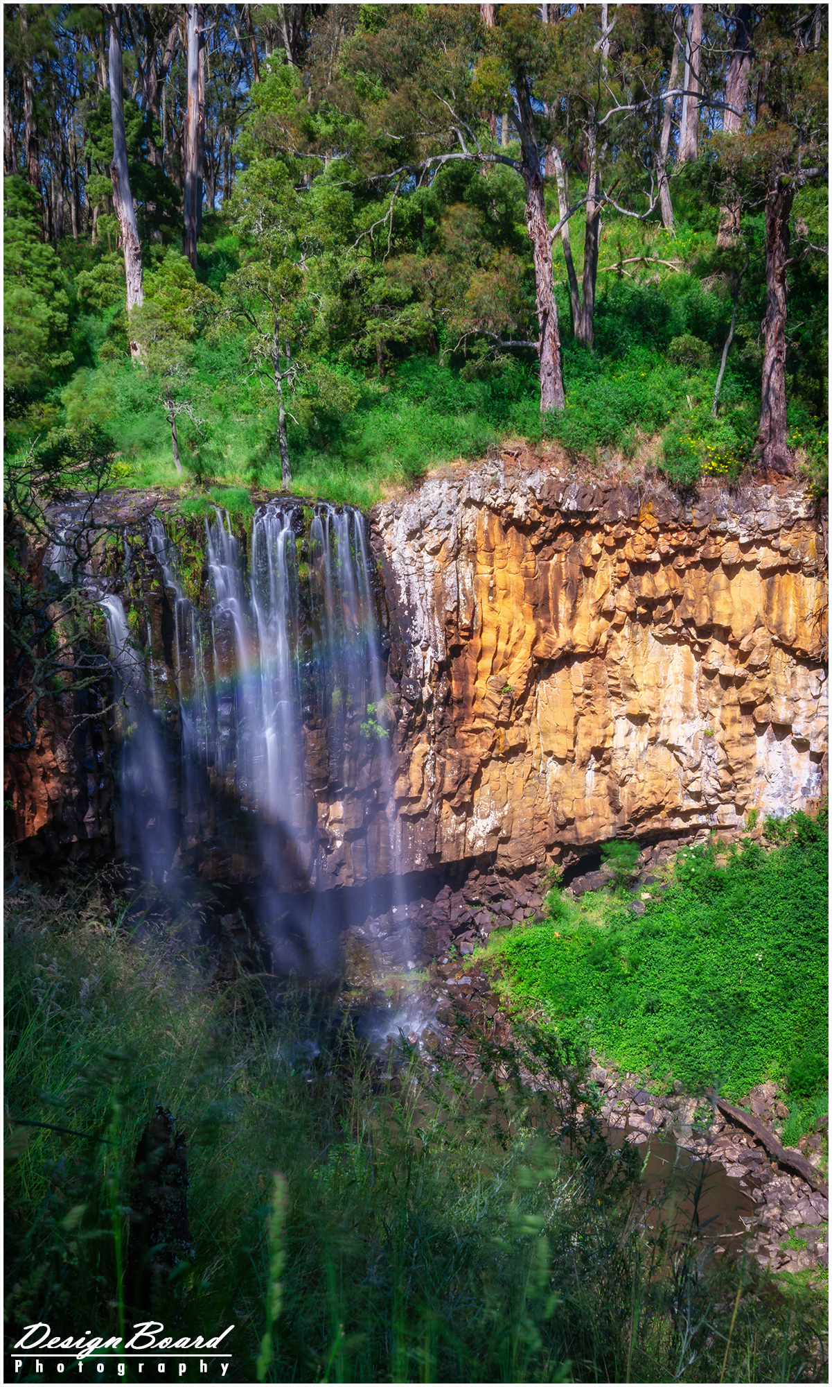
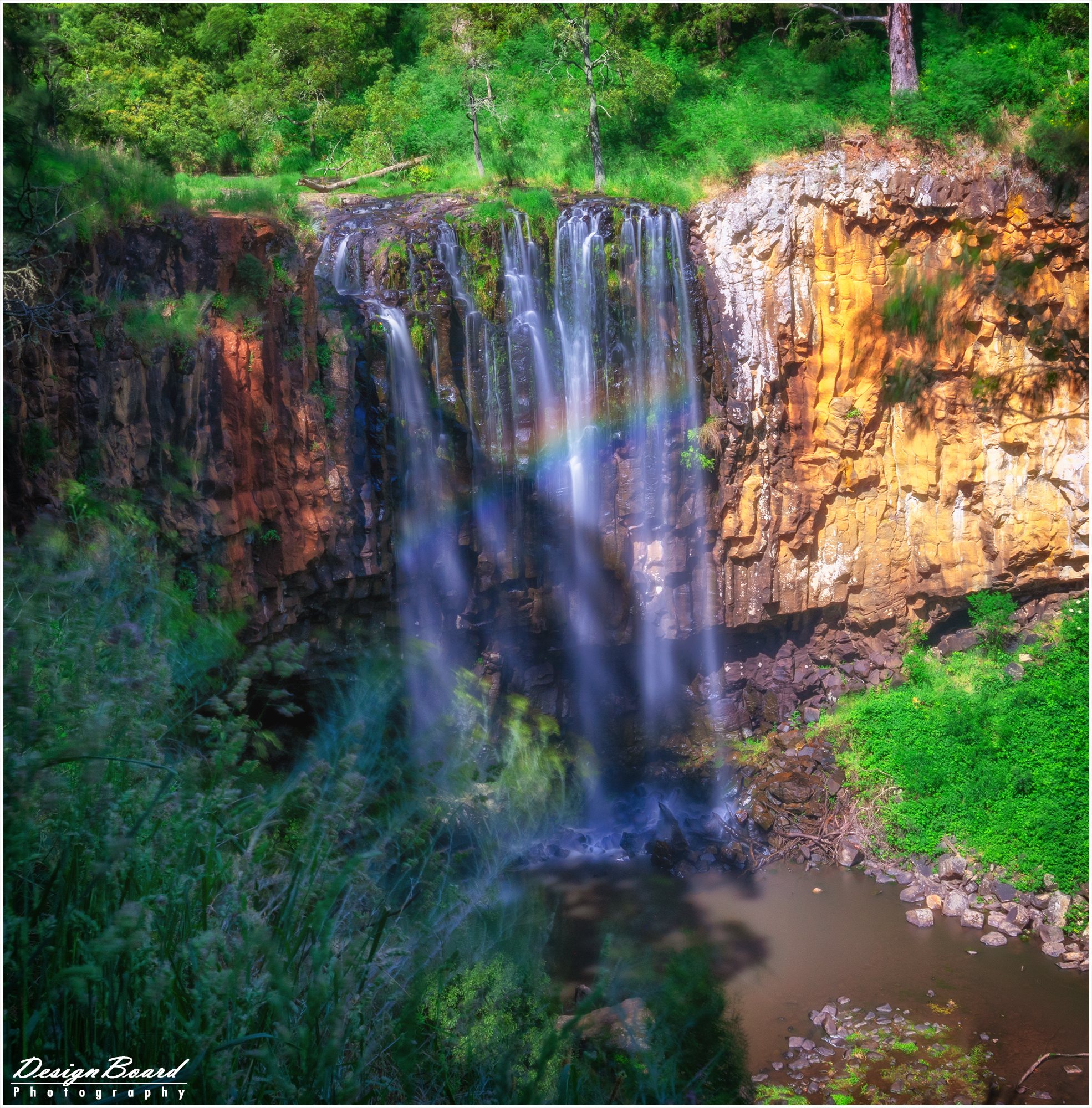
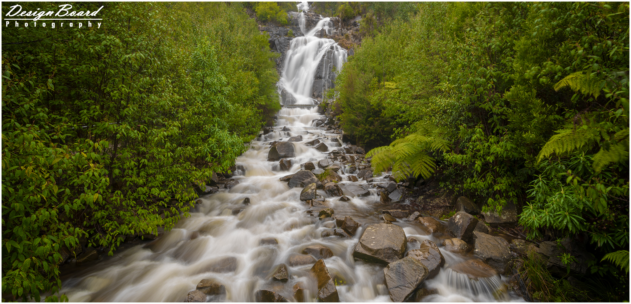
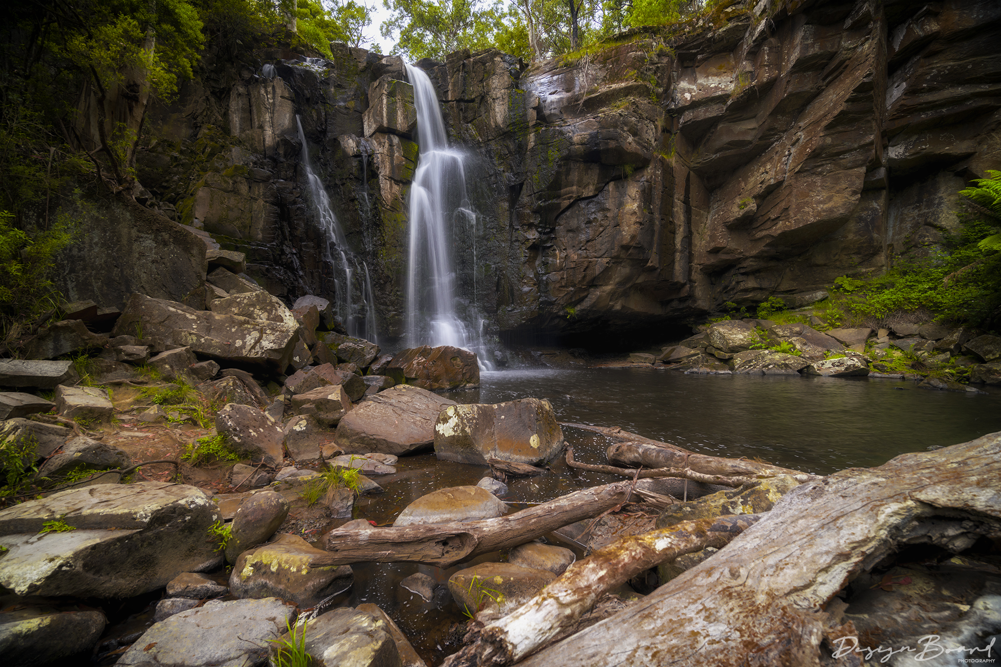
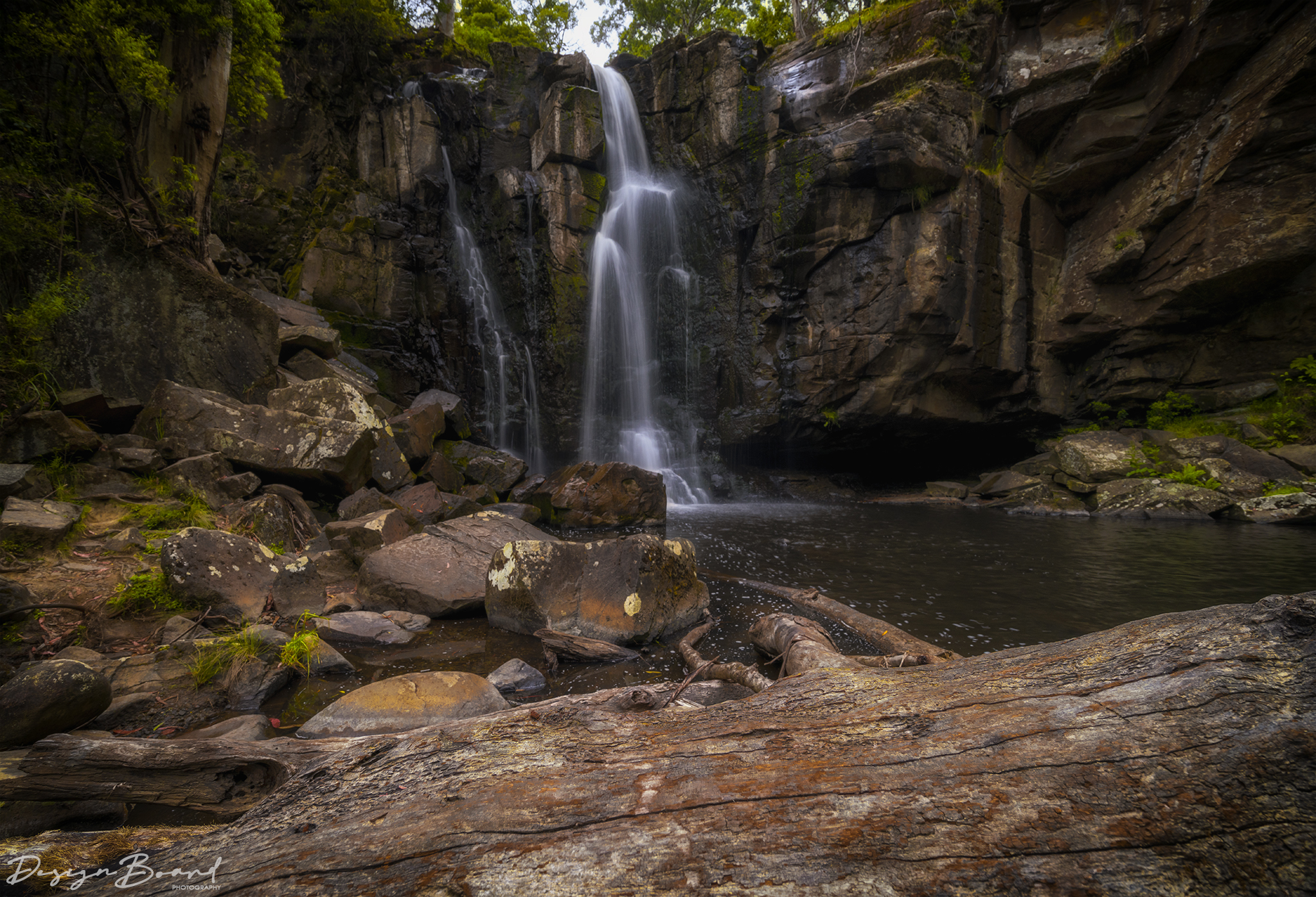
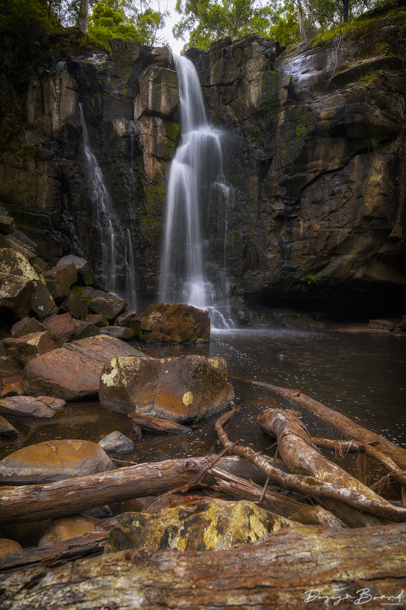
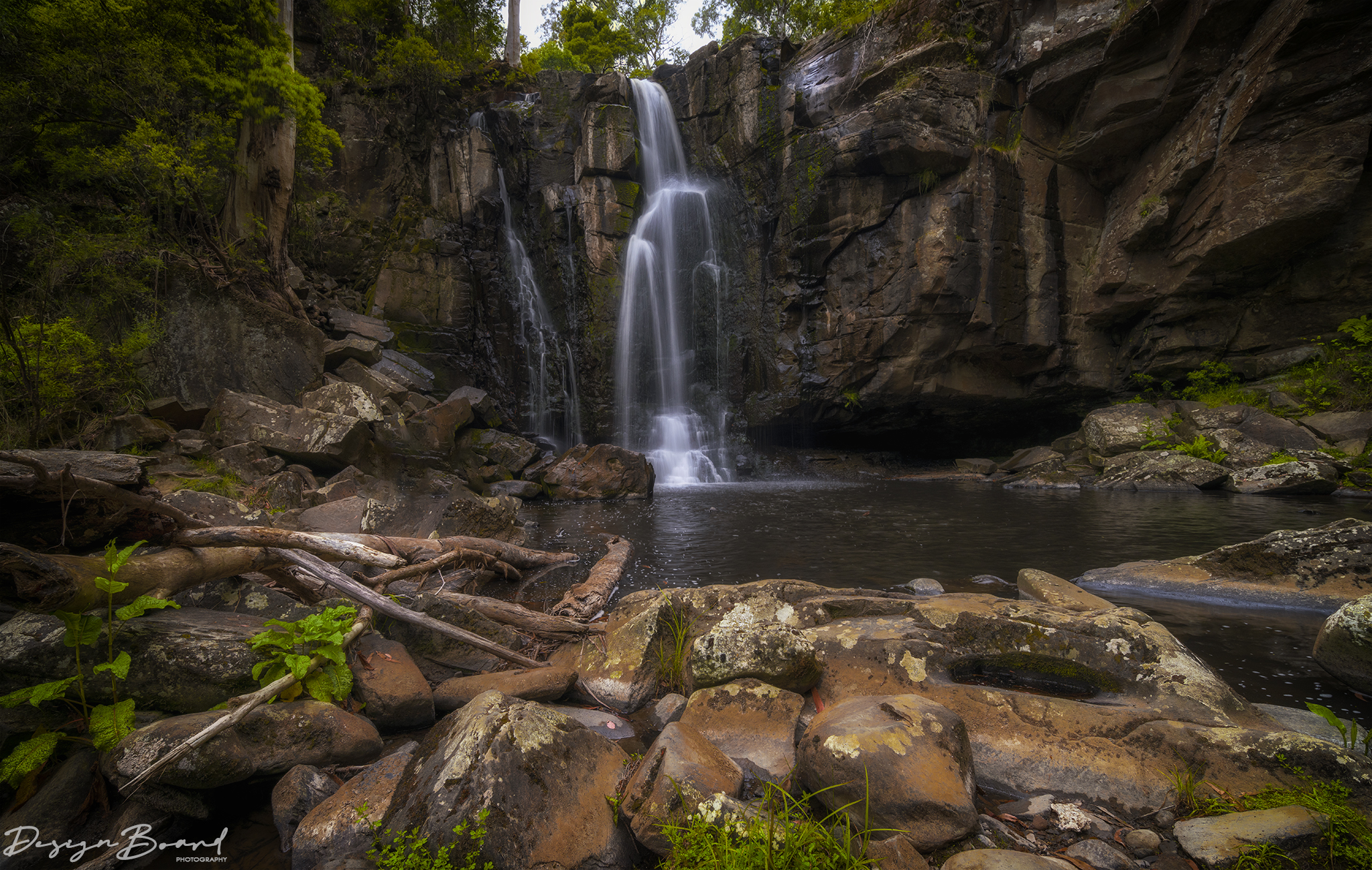
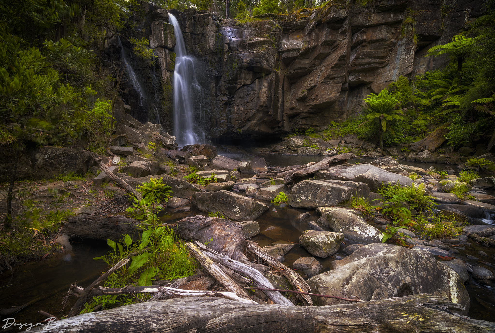
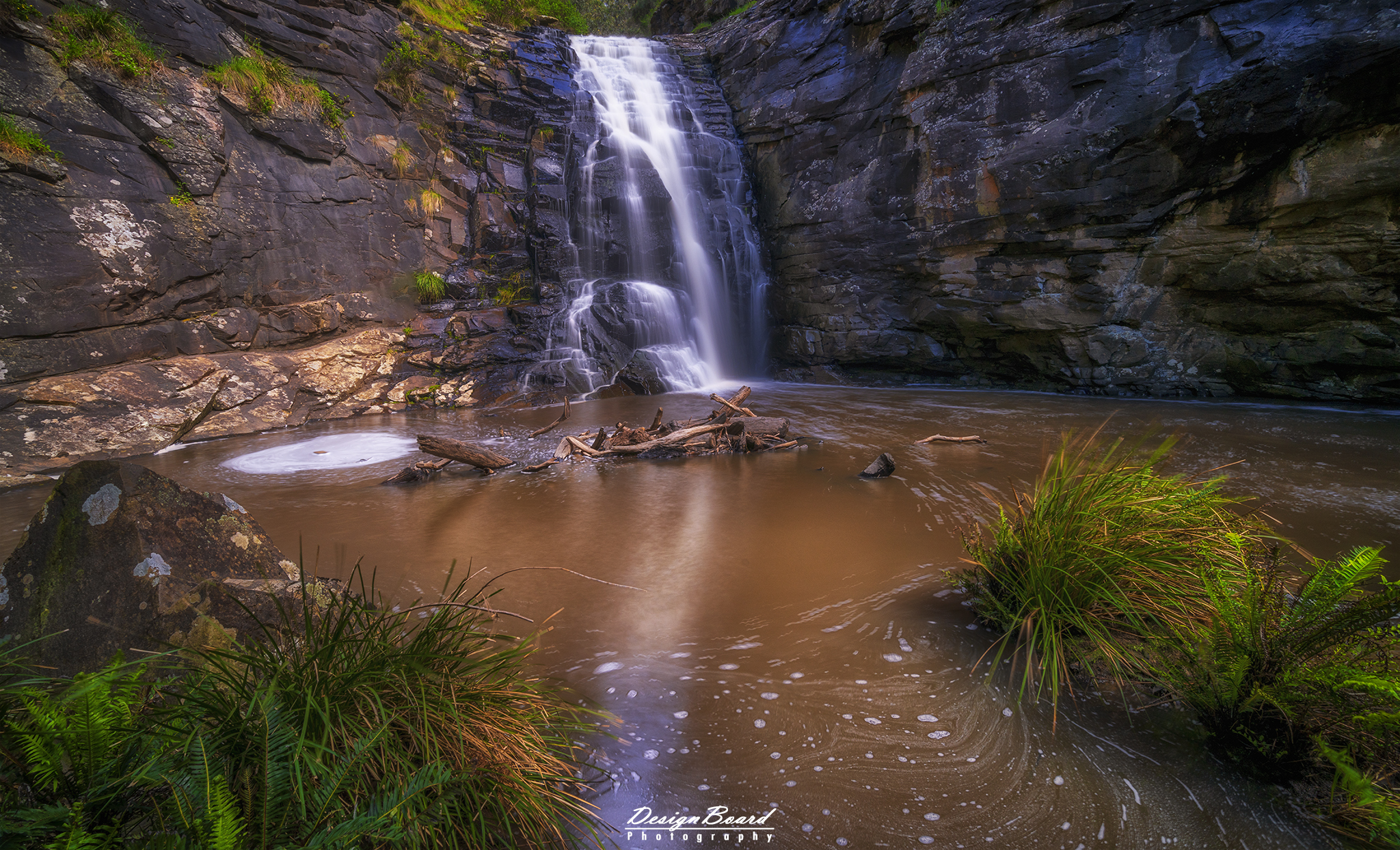
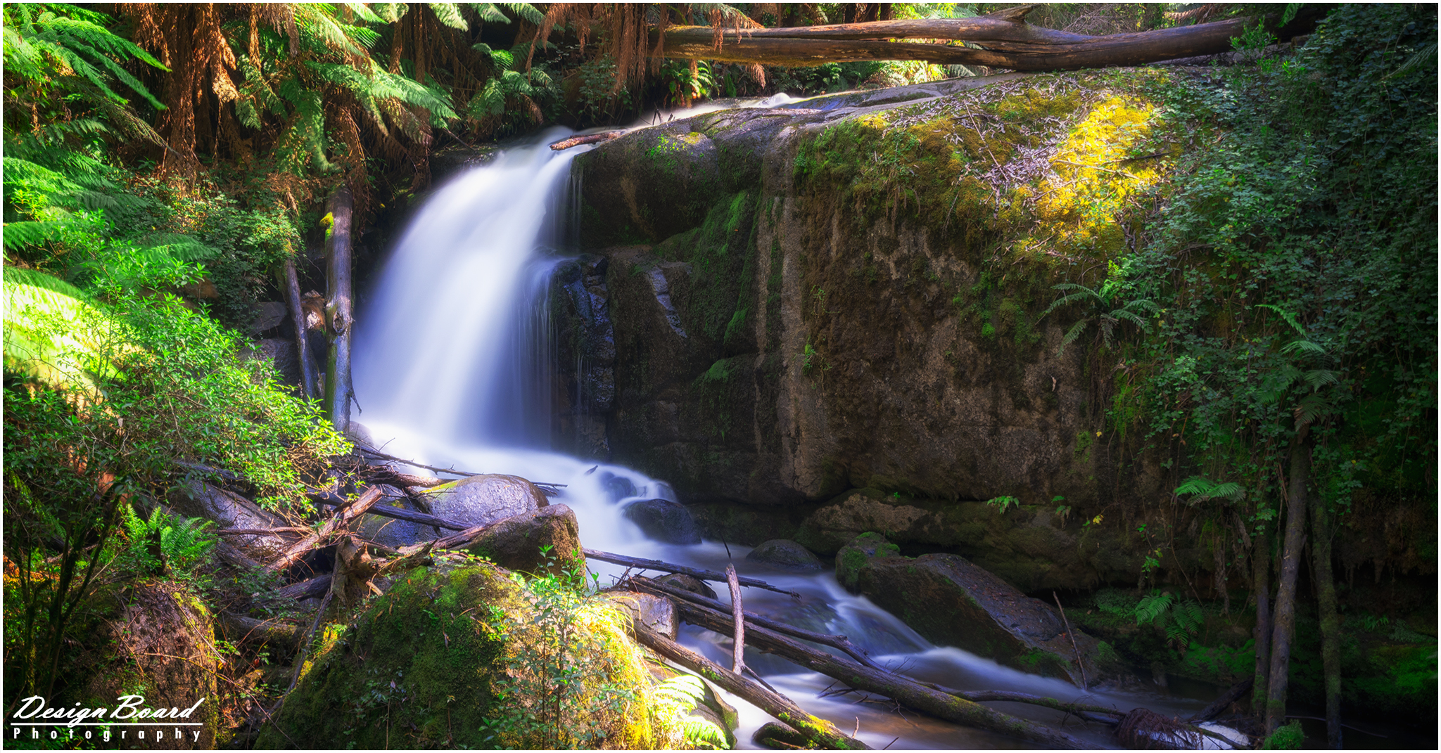
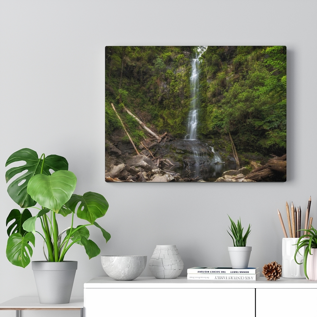
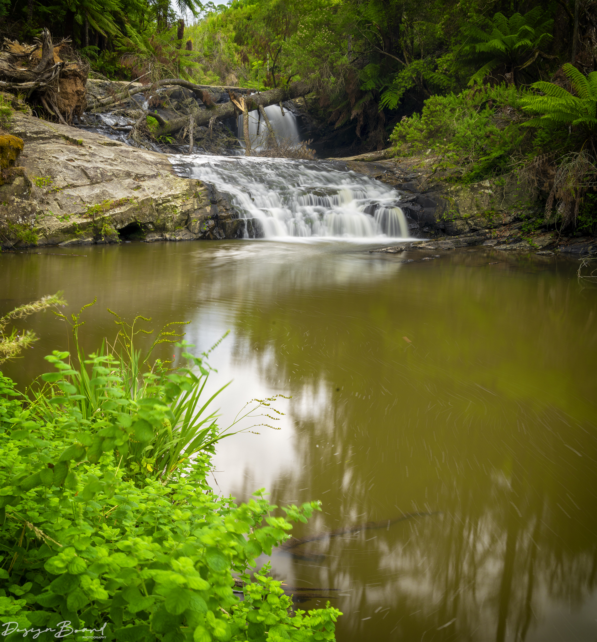
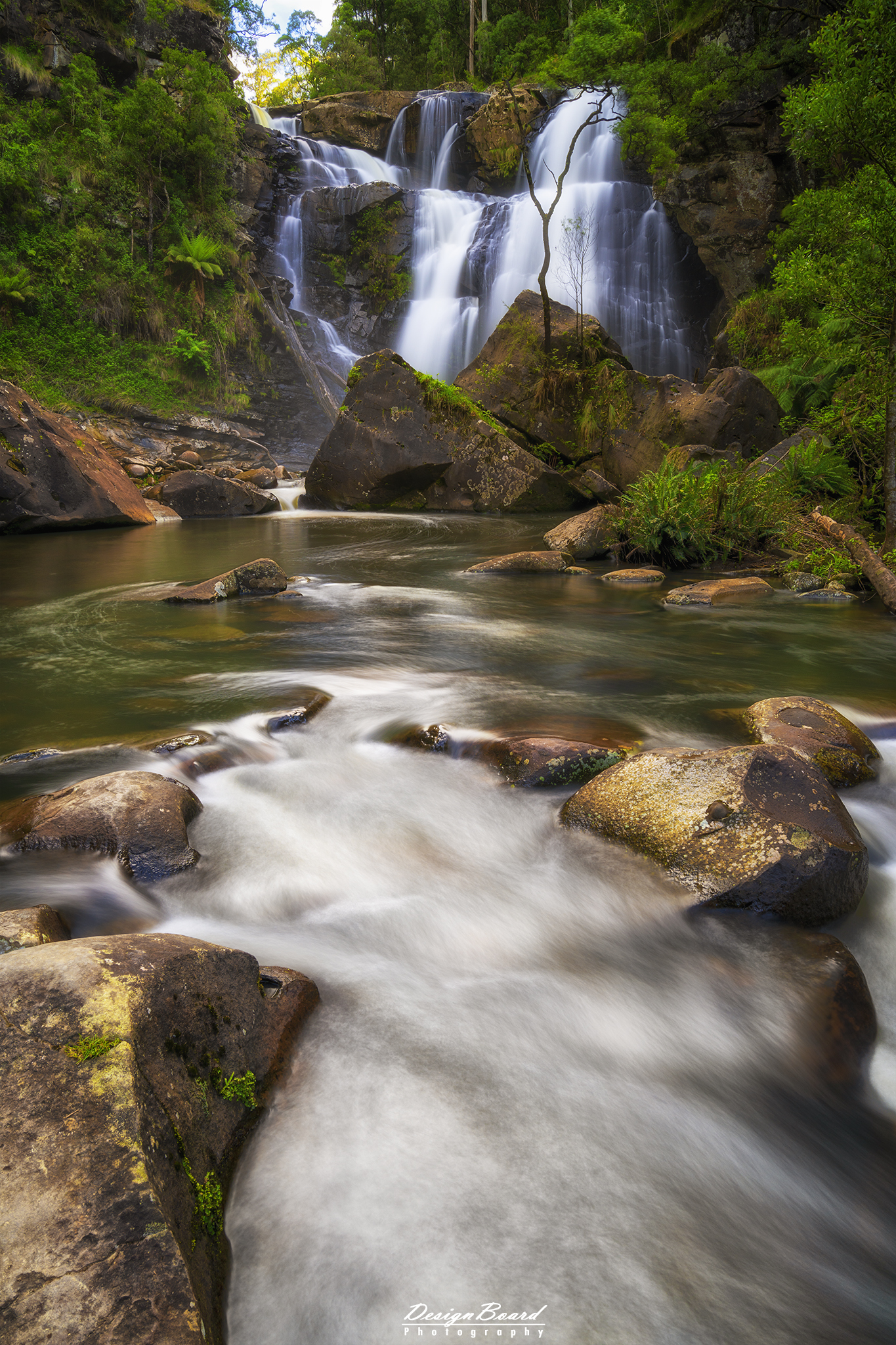
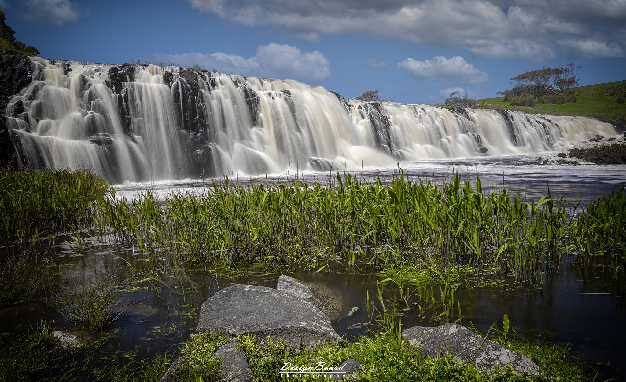
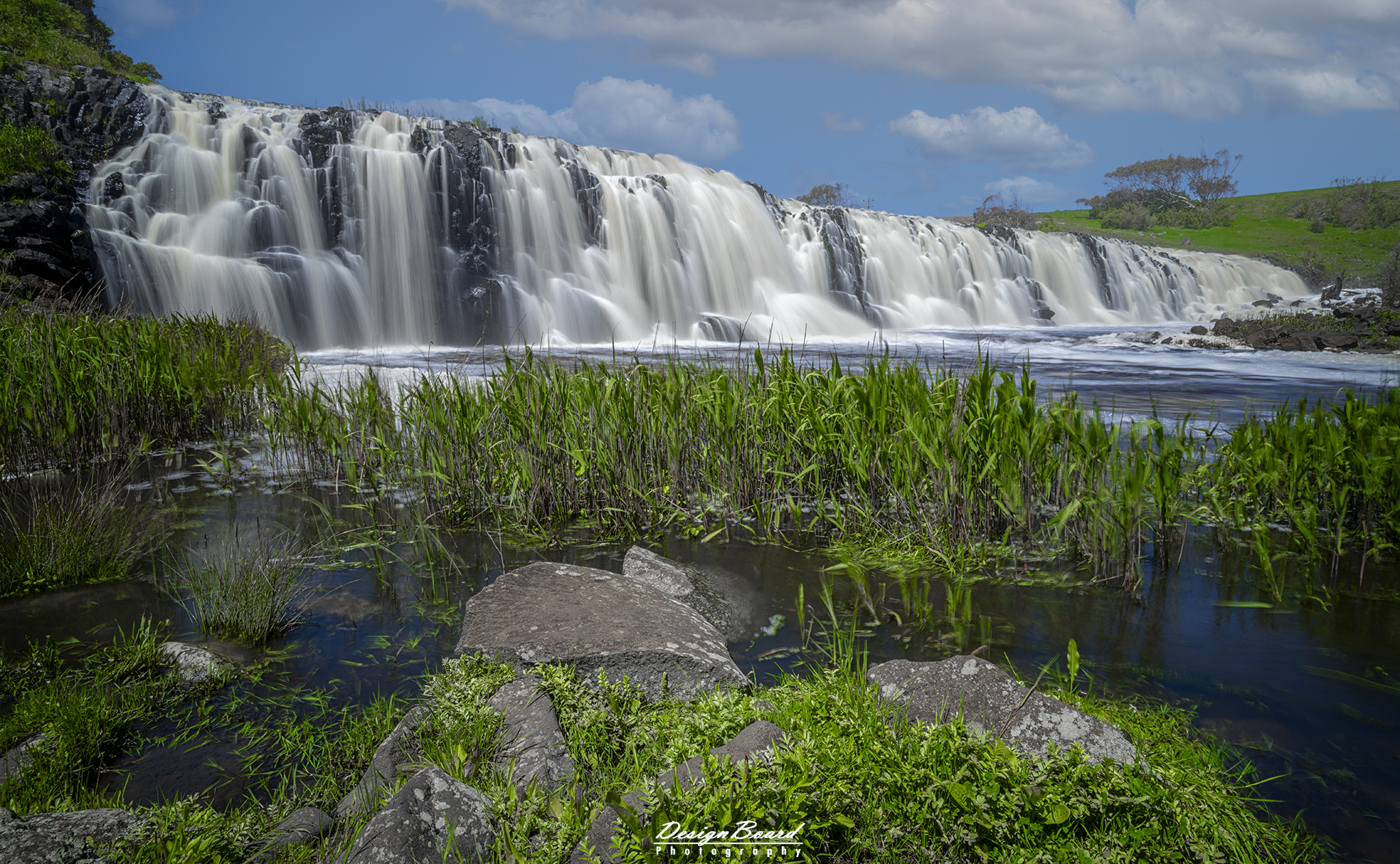
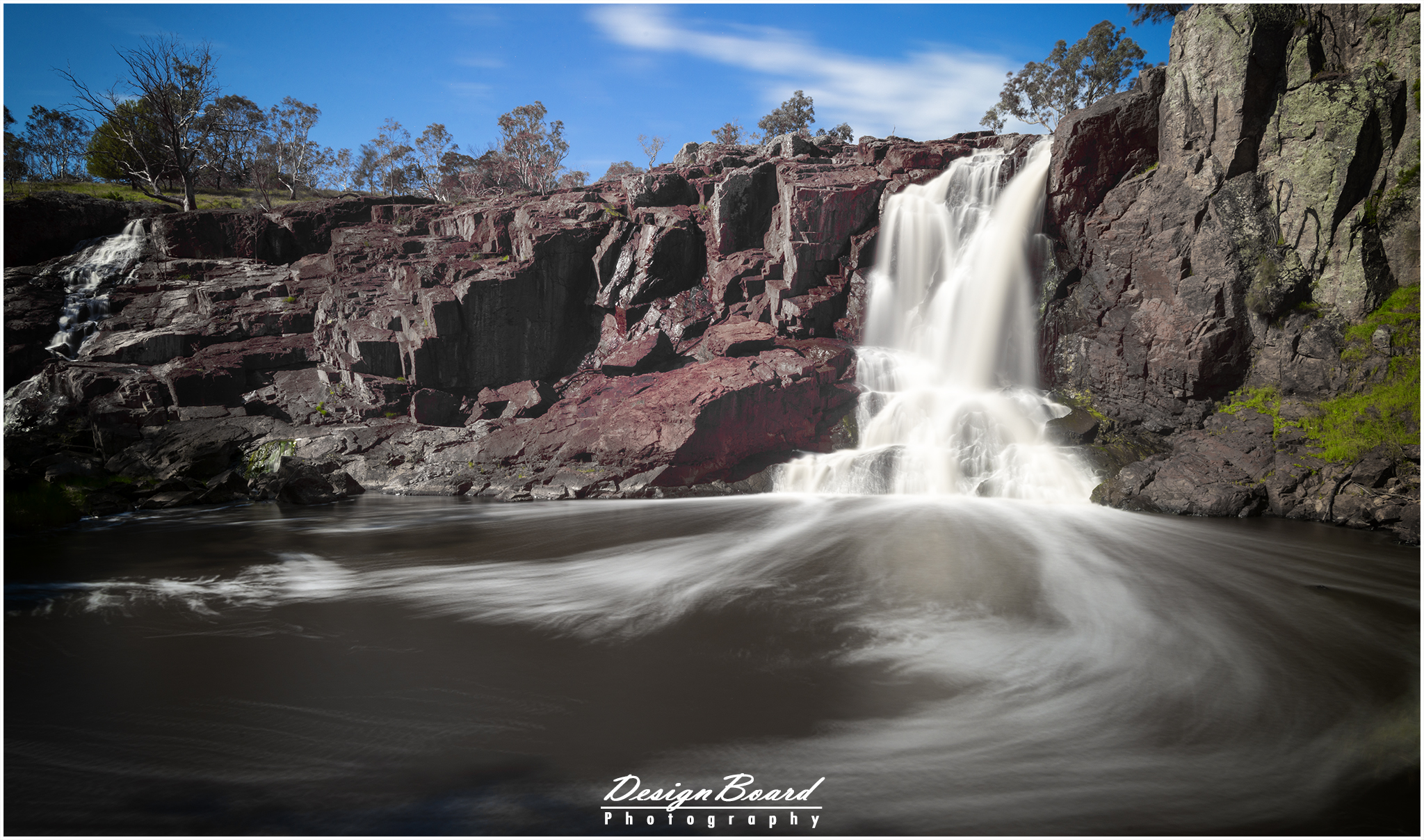
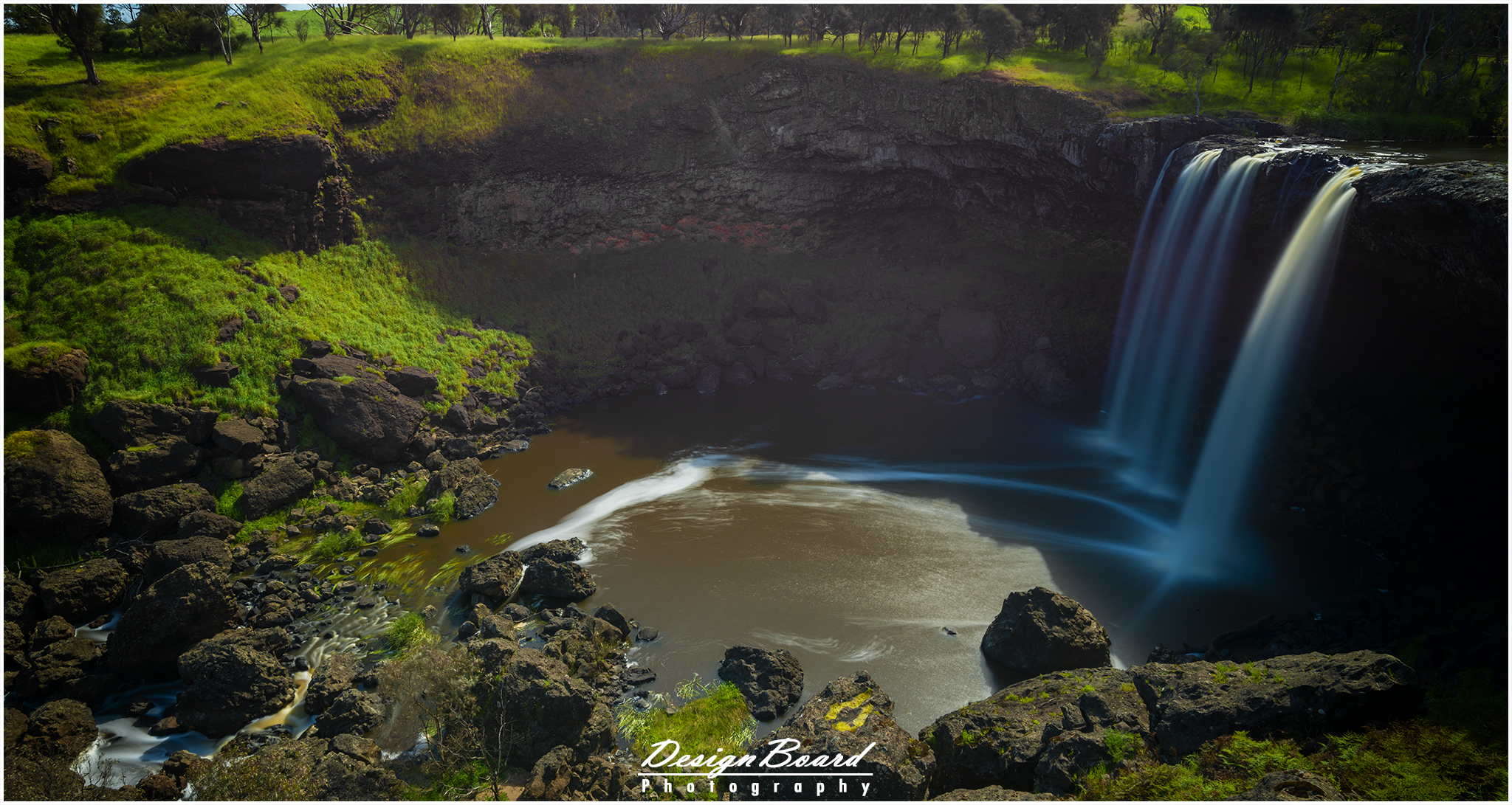
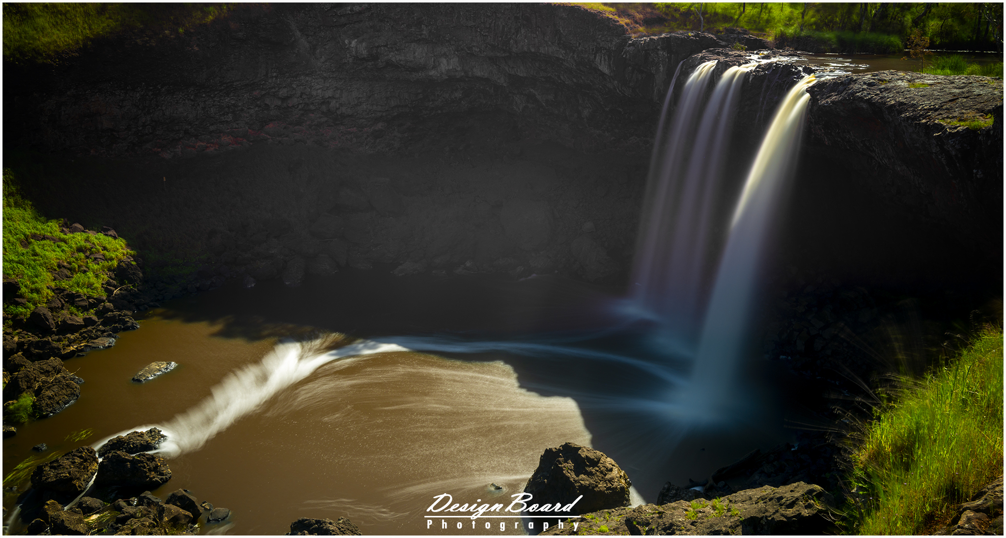
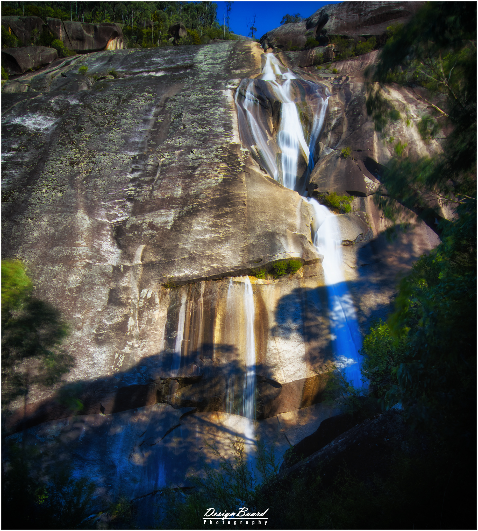
Second up on the list is Turpins falls, at just over a 100 kms. The last few kilometers of the drive is over unsealed gravel road, but should not be an issue for a car. The walk down to the waterfall is a bit tricky as the path is not in the best condition. You’d need good walking shoes and need to be very careful on your way down and back-up to make sure you don’t slip. The steps also are a bit steep, calling for that extra bit of caution.
I would also recommend to check the latest reviews/updates on this one before heading this way, just to make sure that it hasn’t been closed off and is still safe to use the trail.
Click here for Google Maps directions.
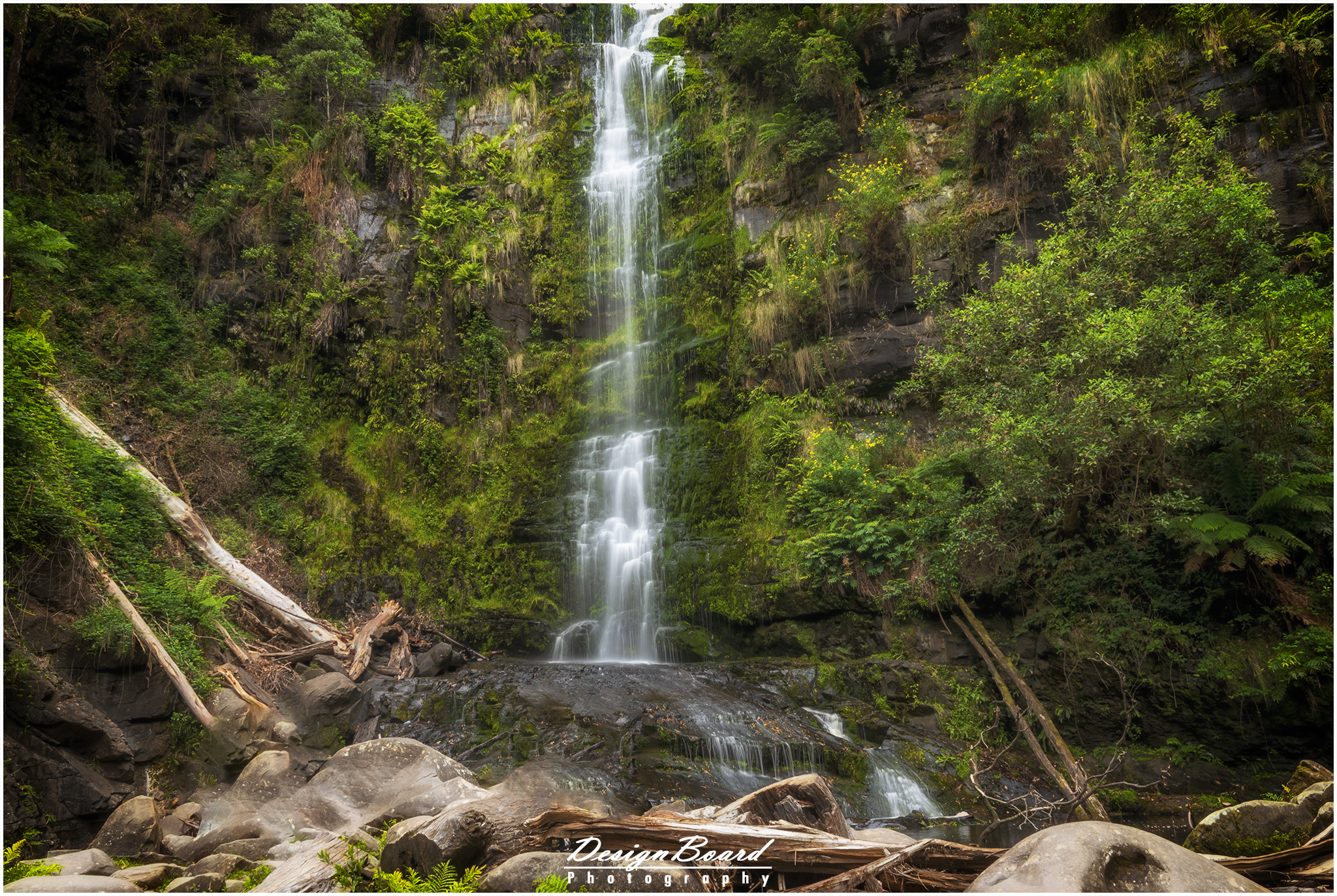
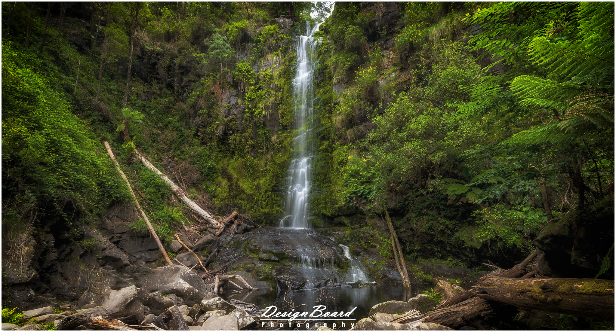
Turpins Falls, Victoria, Australia – DesignBoard Photography
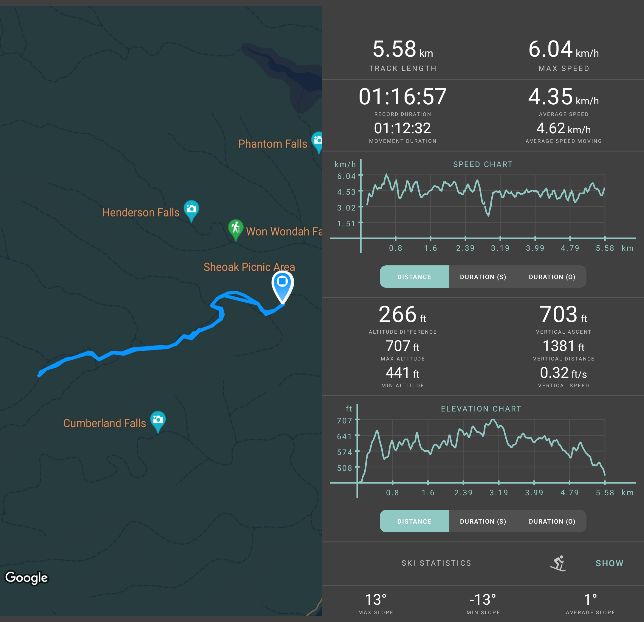
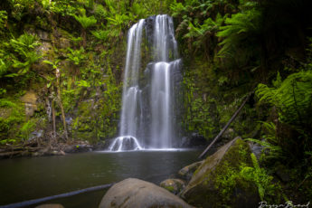
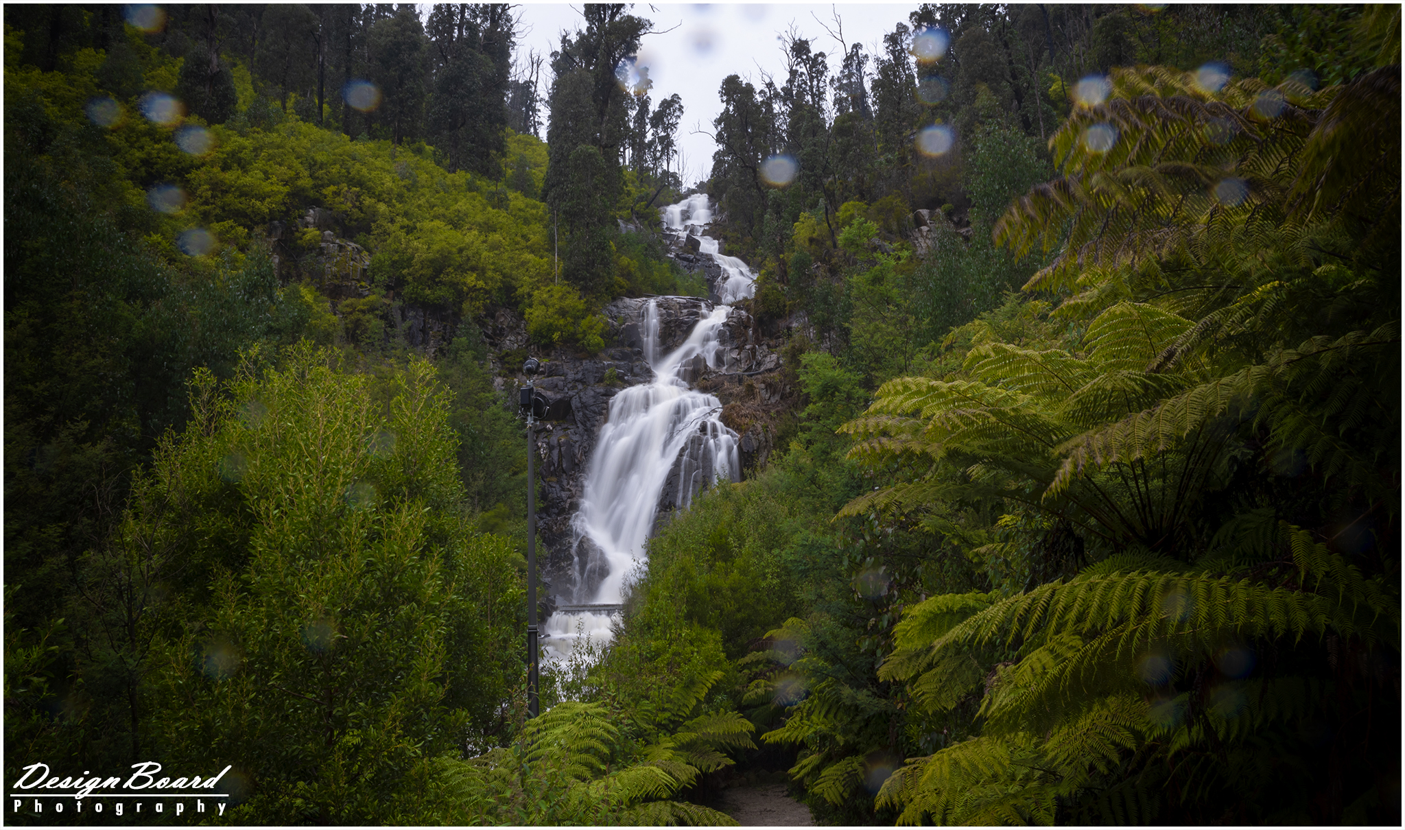
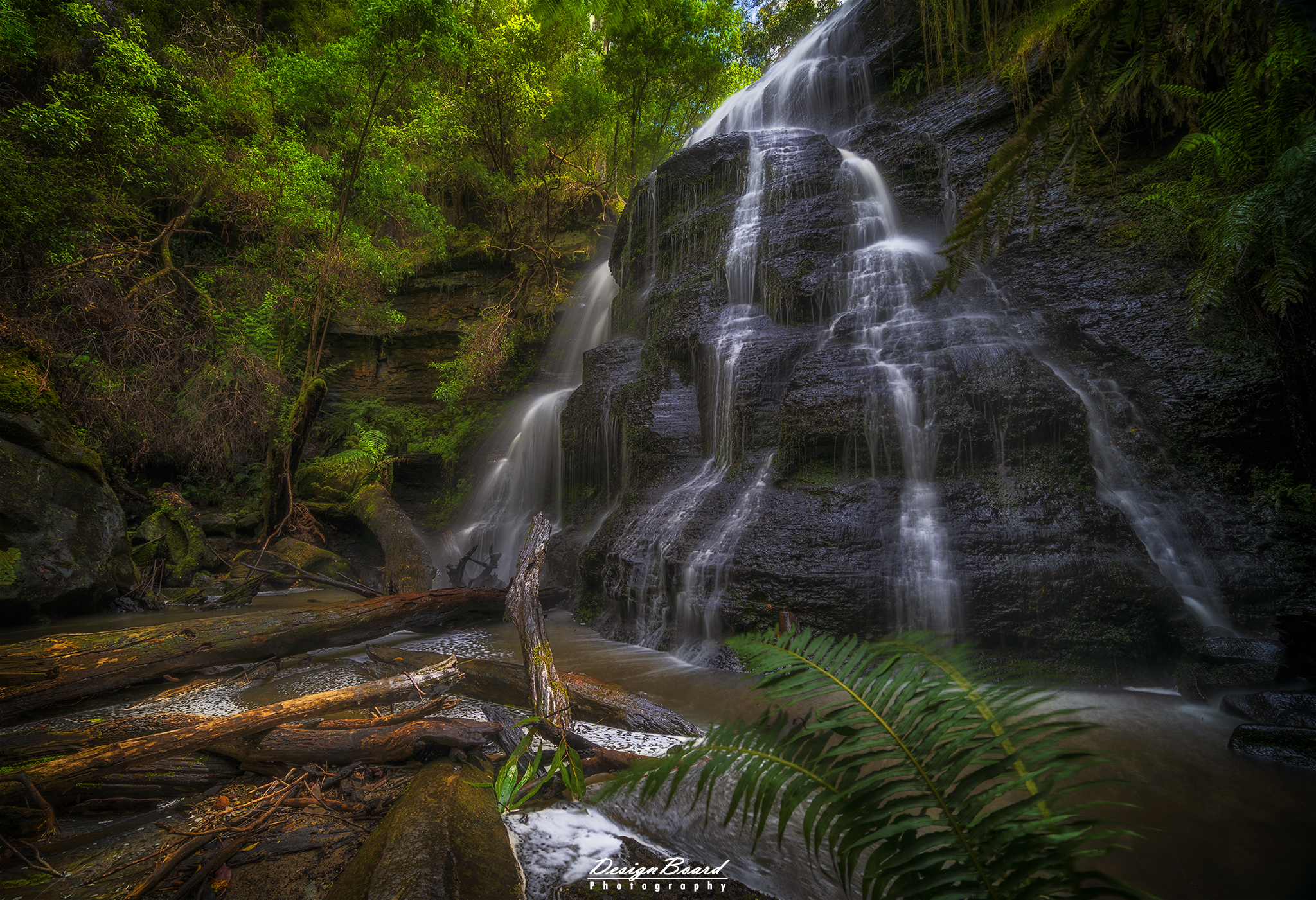
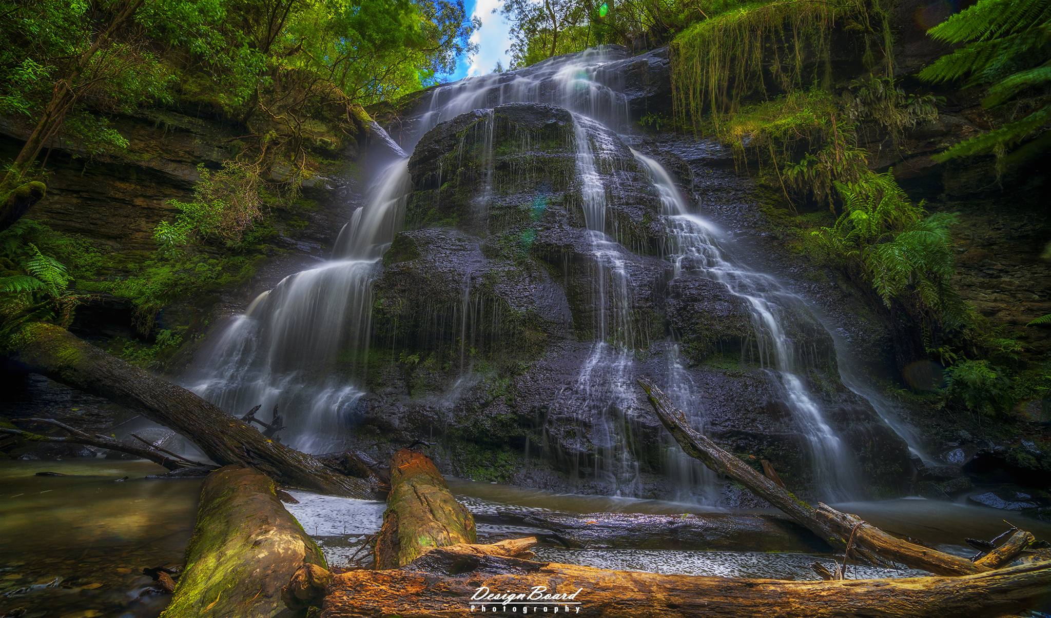
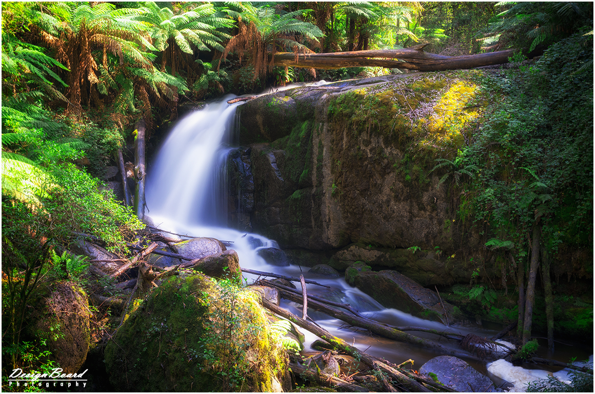
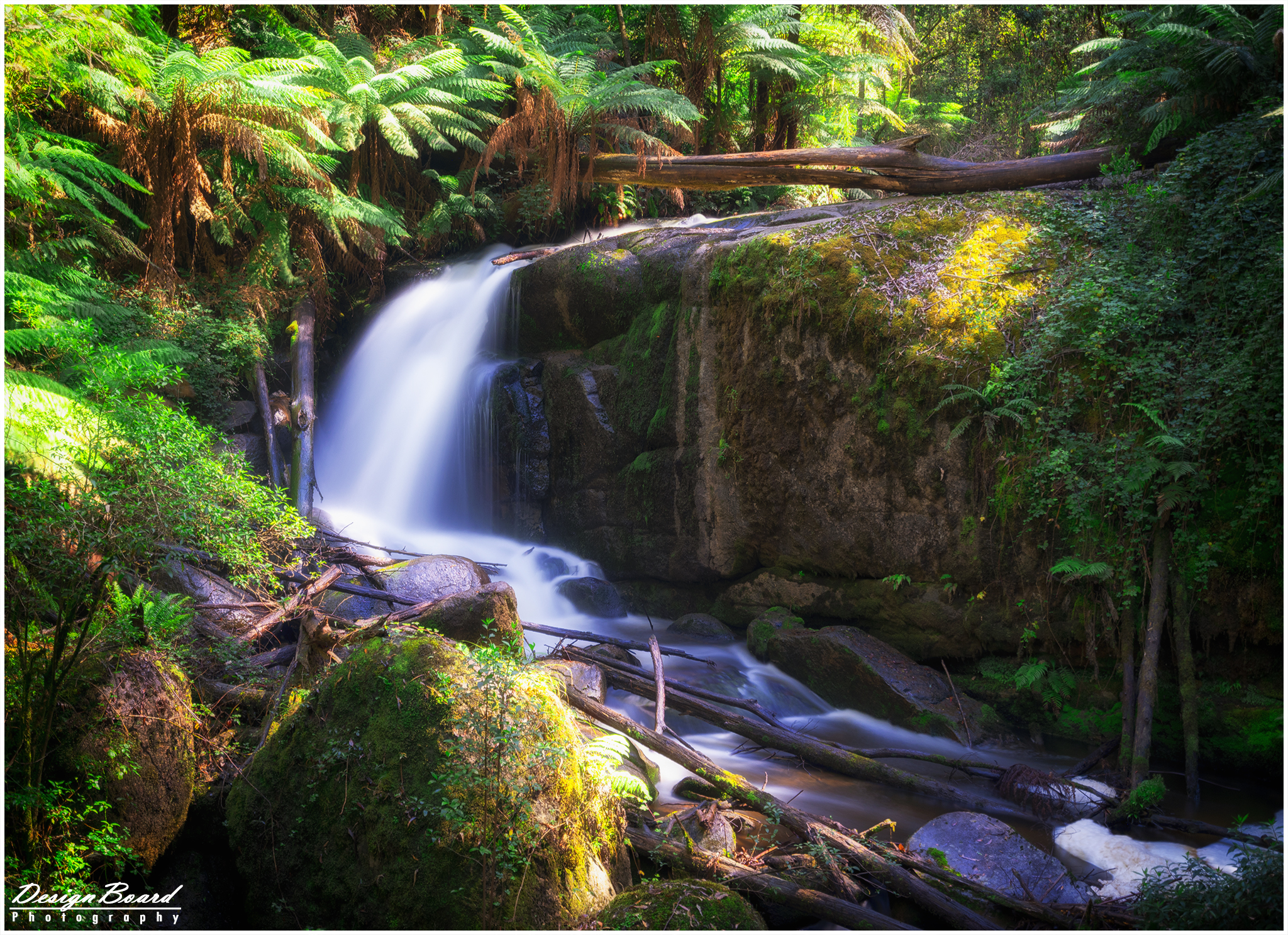
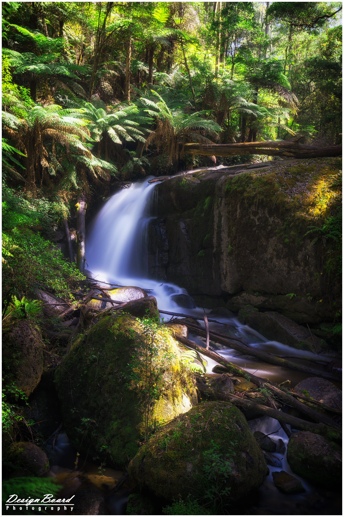
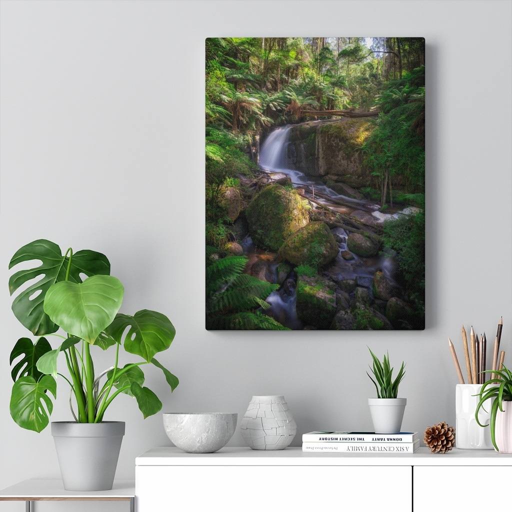
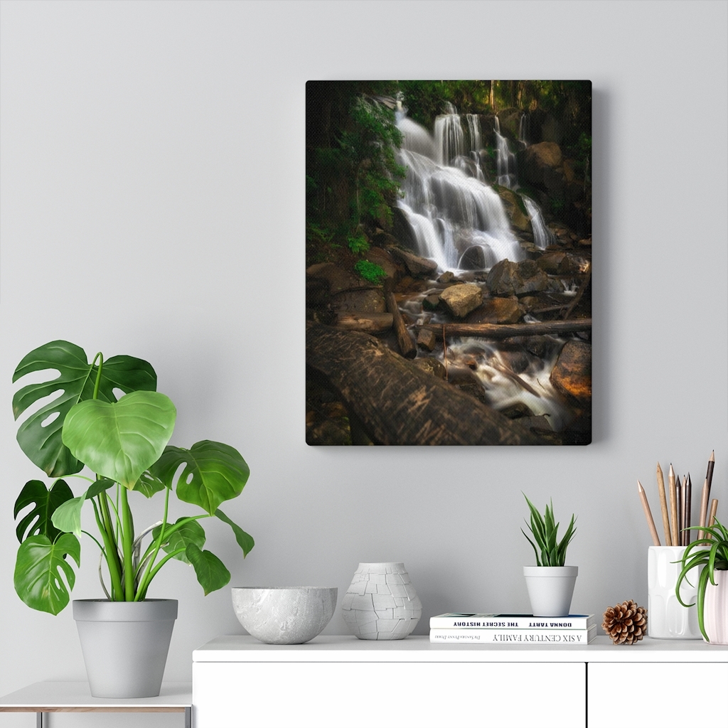
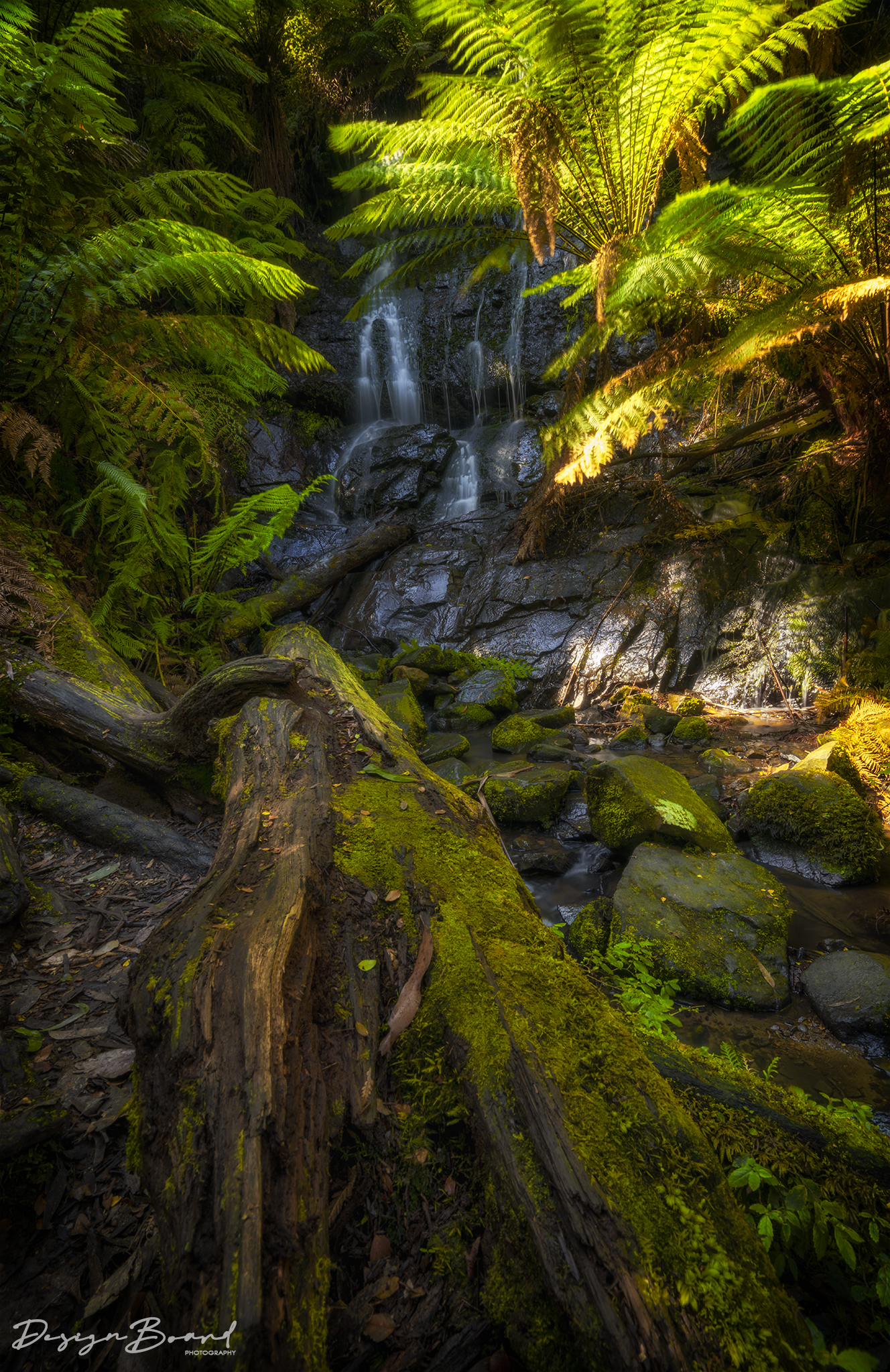
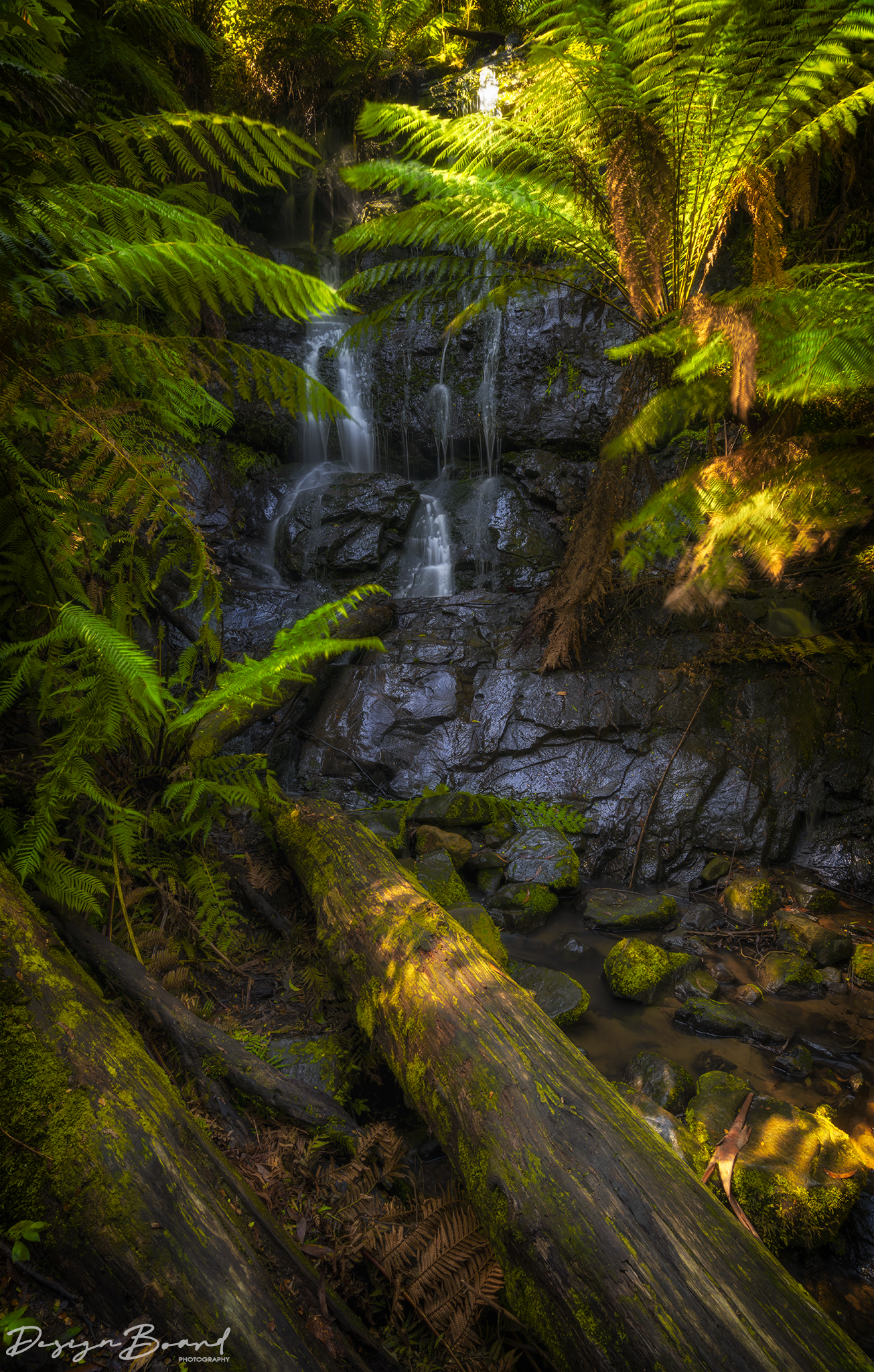
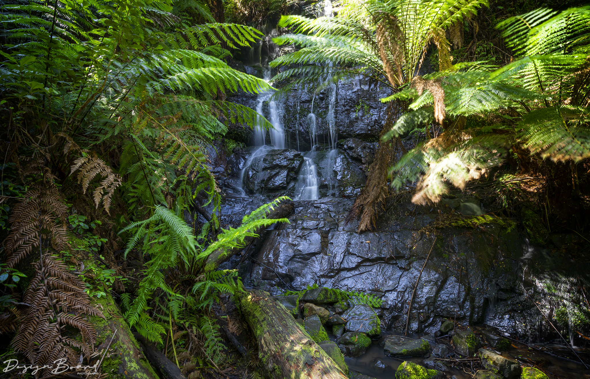
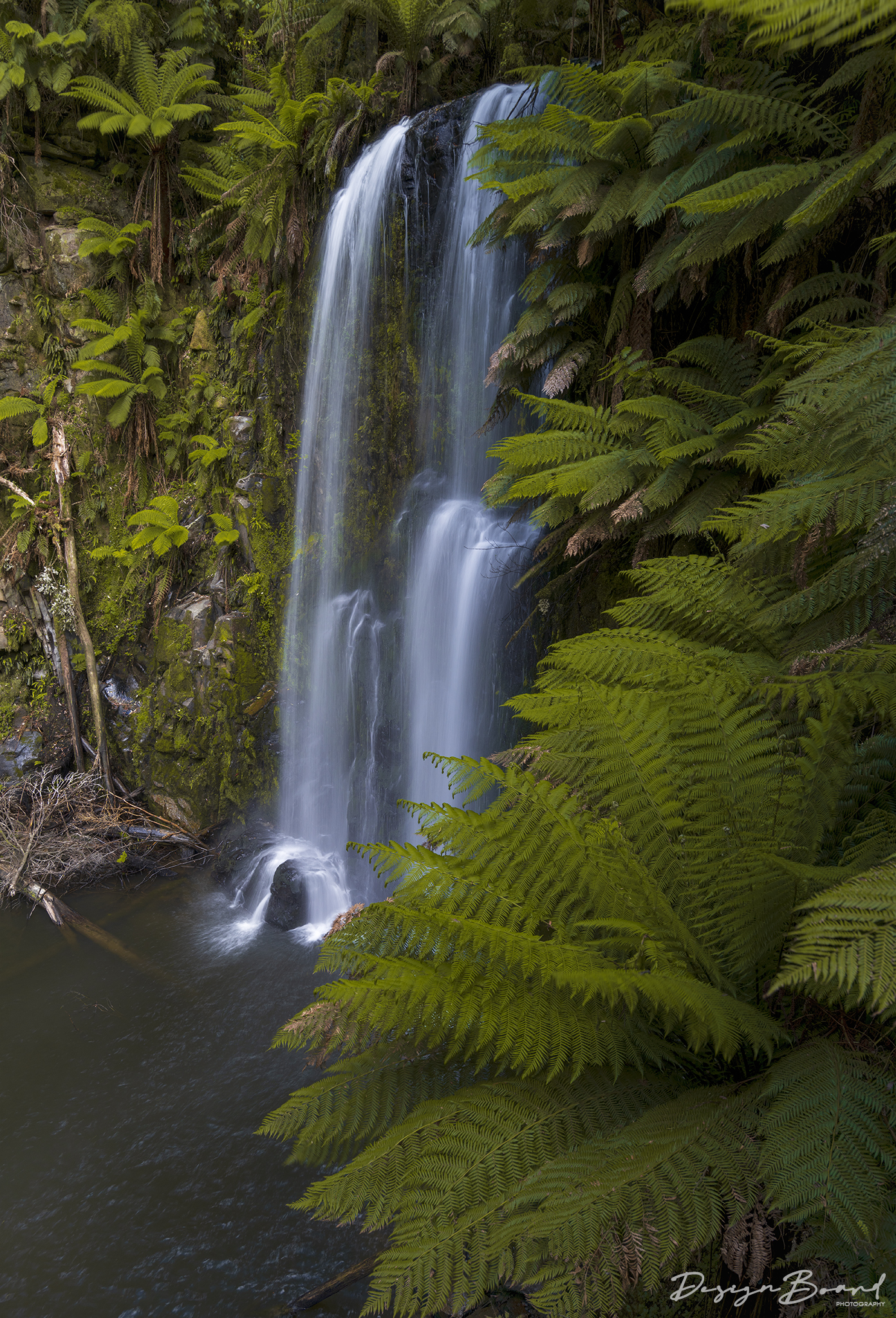
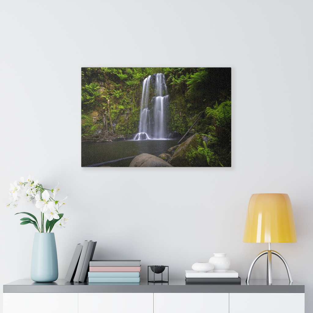
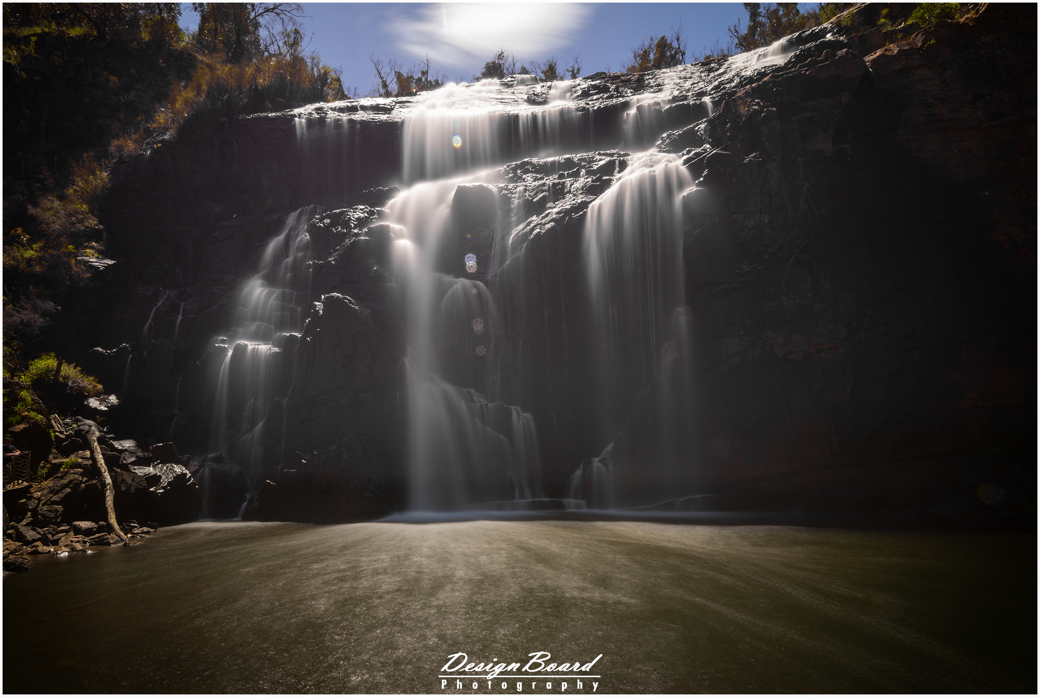
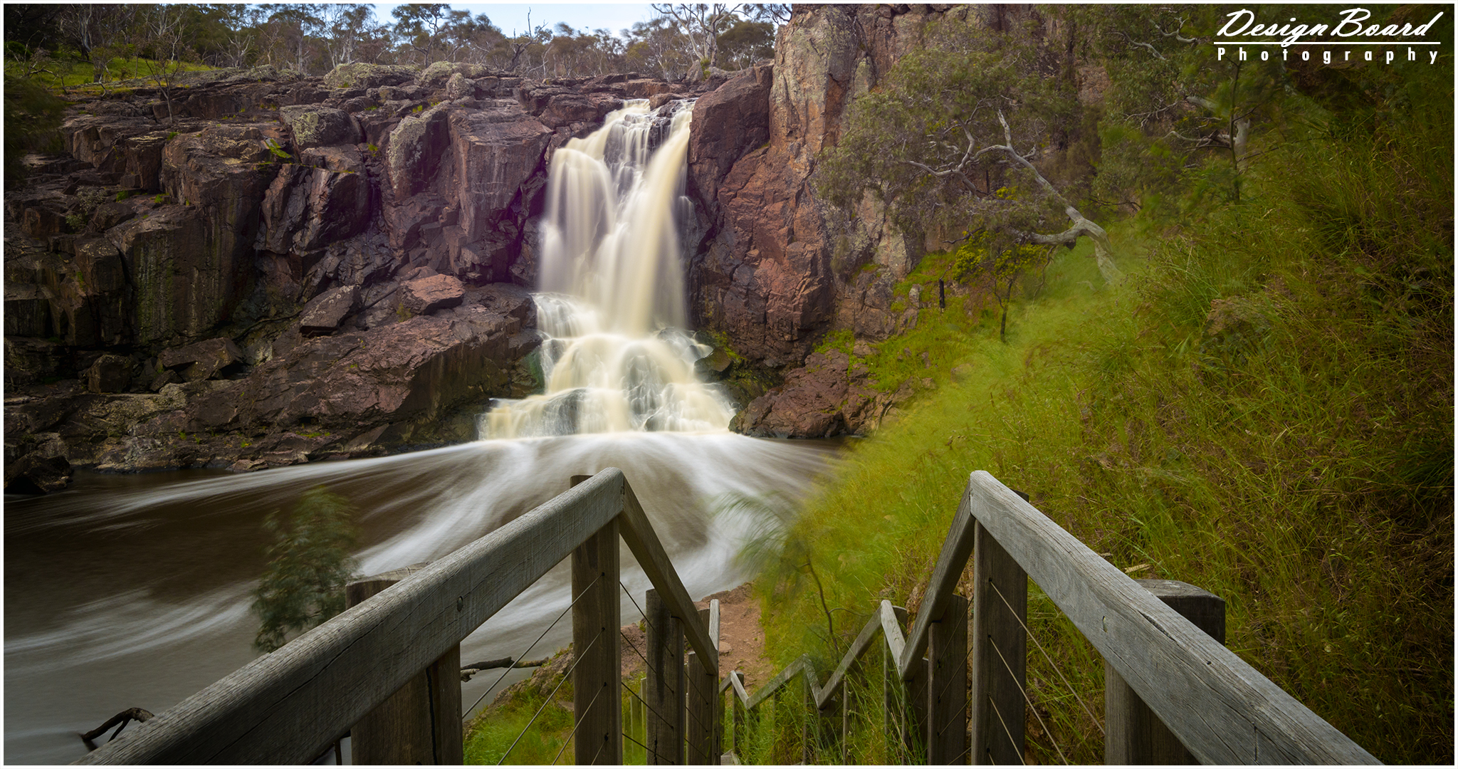
One of the many beautiful waterfalls in the Great Otway National Park, and the first in my list, Phantom Falls is a 3.9 km return walk from the Allenvale Road car park on Allenvale Road. The full walk is along a well defined gravel path. The first part of the path winds it way through a private property and the St. George River. There are clear directions and the path is easy to find and follow. While most of the path is fairly steep in places, there is one spot that is very steep. The path at this spot is also covered in loose gravel, so, be extra careful when you’re going up and coming back down. On your way to the falls, when you’re the top of this especially steep spot, you can see a waterfall in the distance on your right (unfortunately, I’m not sure what the name of this one is). Keep walking! This is not your final destination 🙂 As the path would get quite muddy with rain, a good pair of hiking boots is definitely recommended. Overall, I would say the walk is a moderately difficult one.
The end of the walk will bring you to the viewing platform at the top of the falls. You really can’t see much from here. There is a little to the right of the viewing platform that’ll take to the base of the falls. There are a few steep steps, so, be careful. With rain, the steps would get quire slippery, so, those hiking boots would come in handy here too.
Click here for Google Maps directions
Here’s some more details on the (return) walk to the falls.
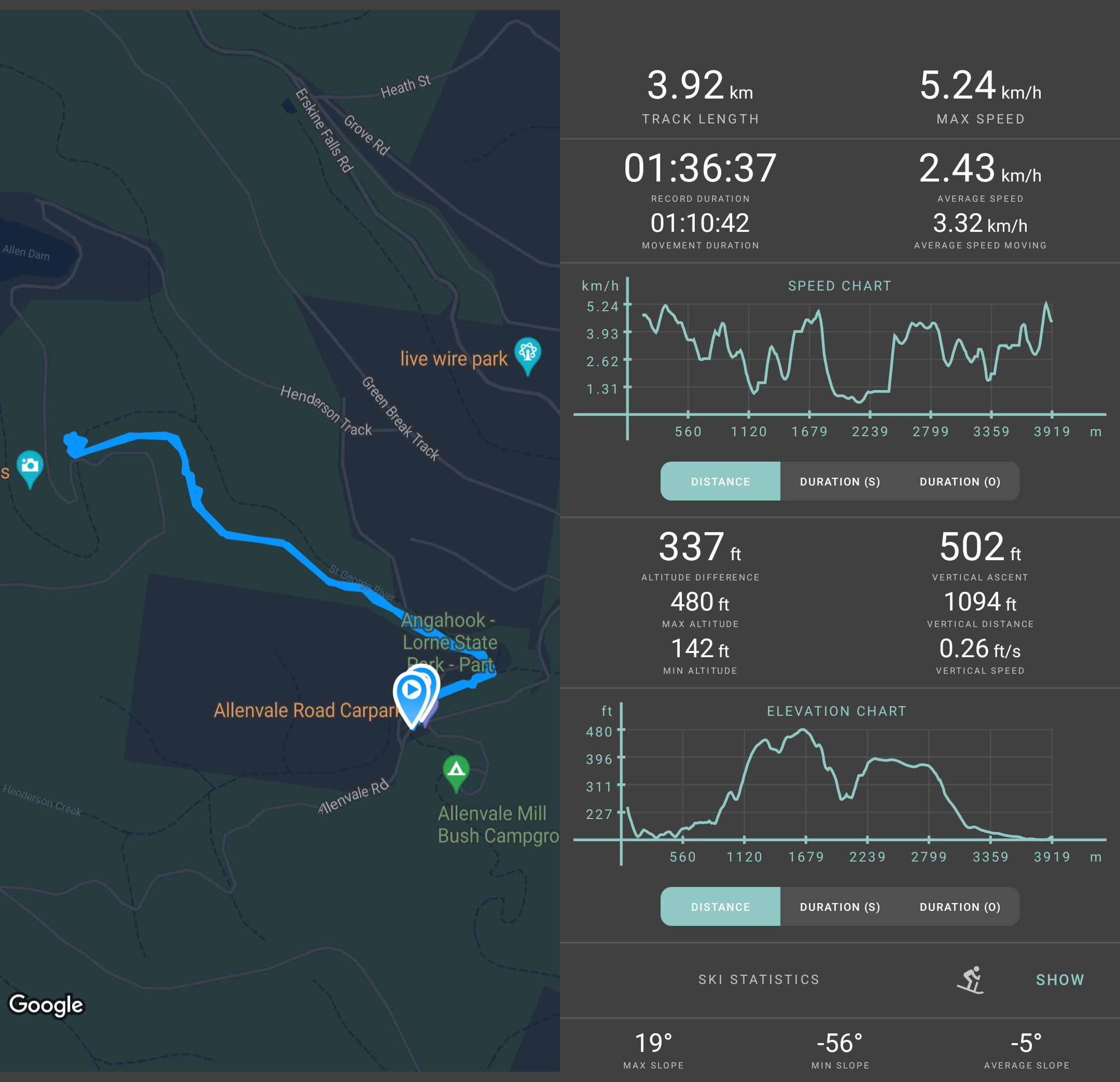
Phantom Falls – Walking Details
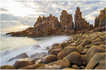
There are a number of places you can checkout on your way like the Noojee Trestle Bridge and the Noojee Heritage Centre. If you’re willing to drive a little bit further, you can also checkout the Thomson Dam and Mount Baw Baw Village. If you’re traveling during the ski season, be mindful that you’d need to buy a resort pass to enter the village and might need to snow chains as well
Here’s a quick glimpse of the Noojee Heritage Centre and the Noojee Trestle Bridge.
Noojee Heritage Centre, Victoria, Australia – DesignBoard Photography
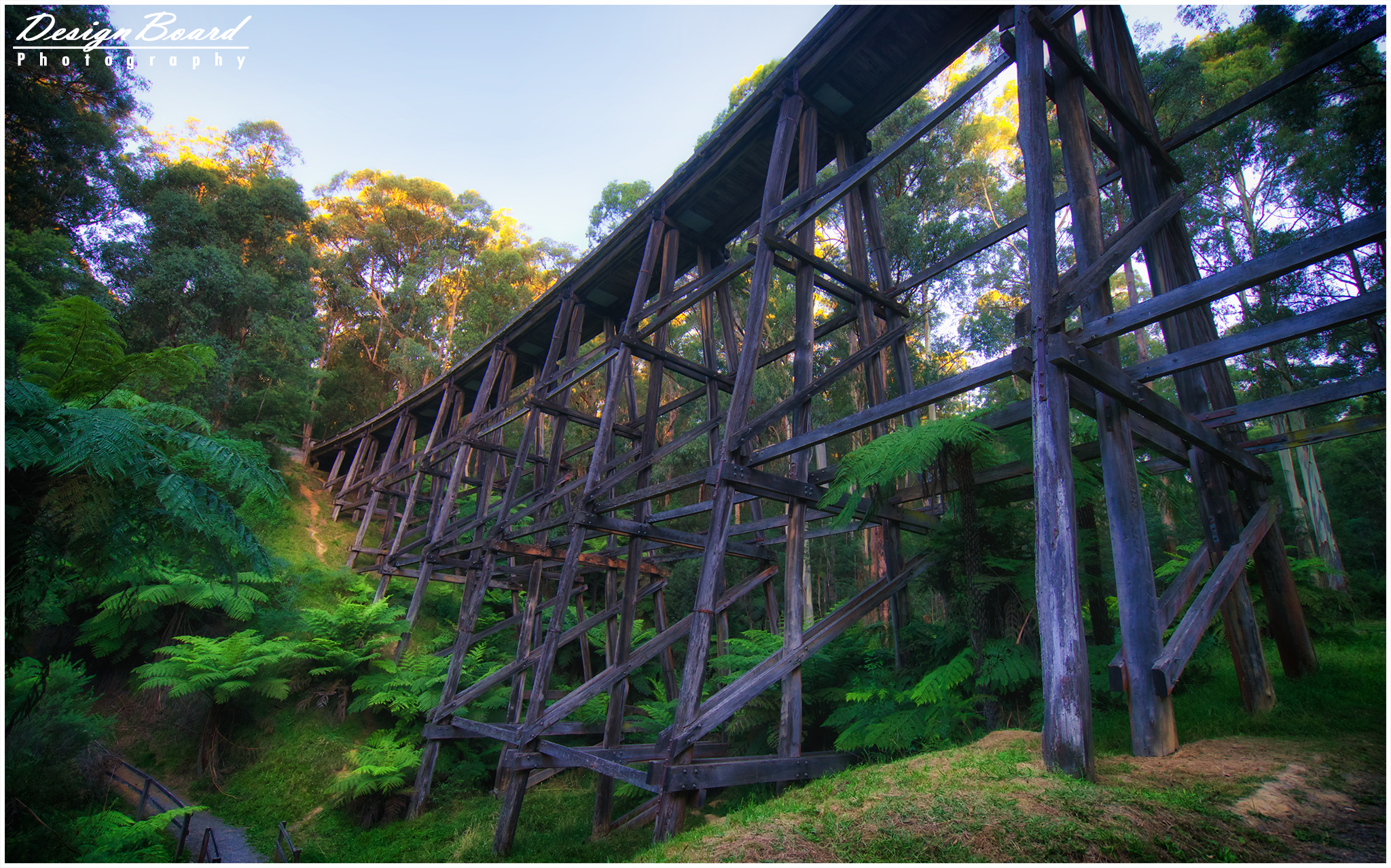
Noojee Trestle Bridge
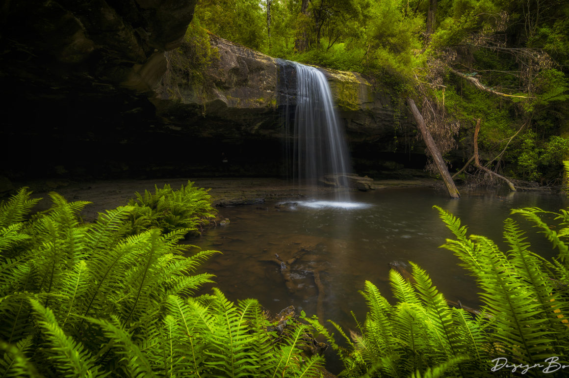
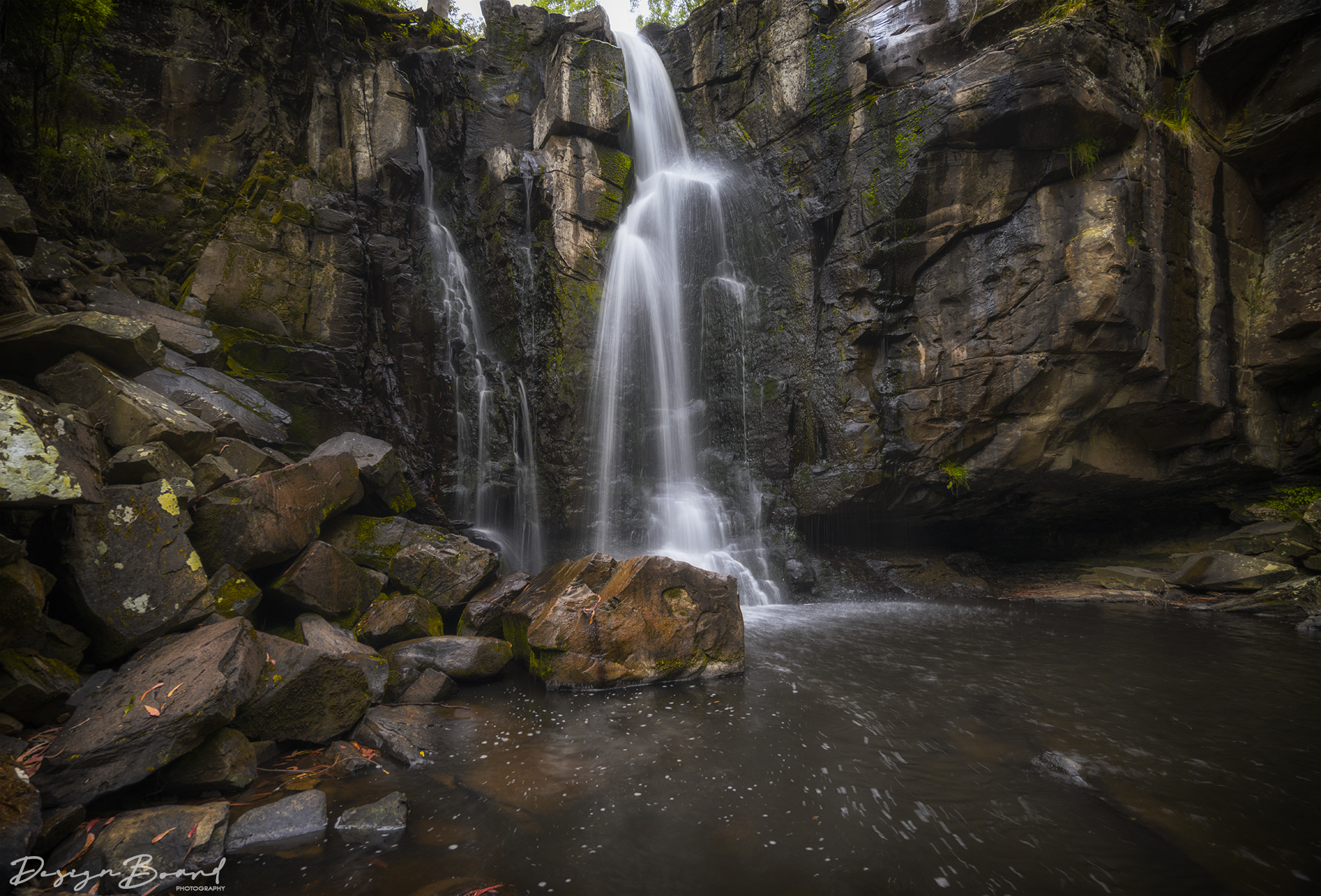
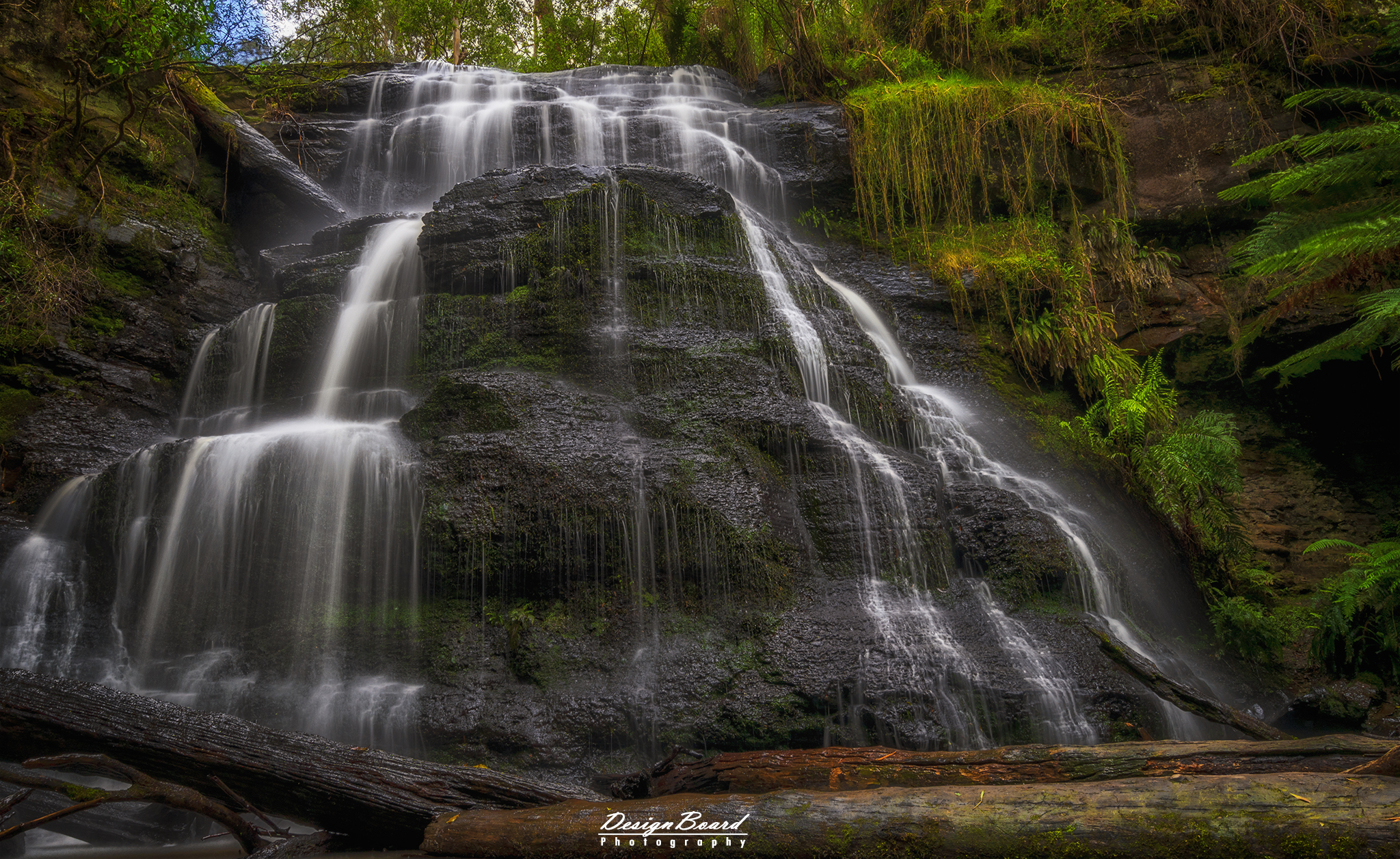
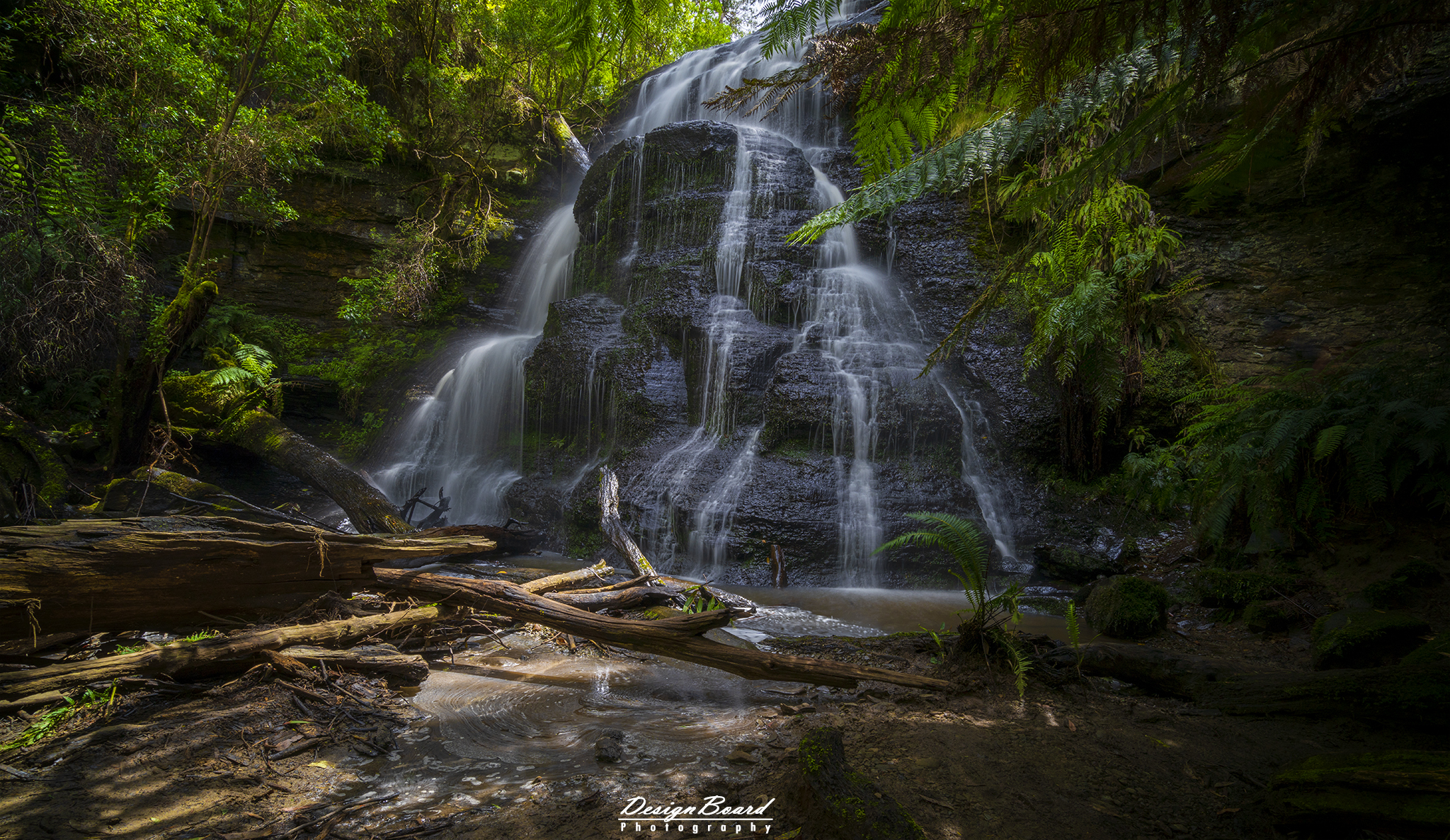
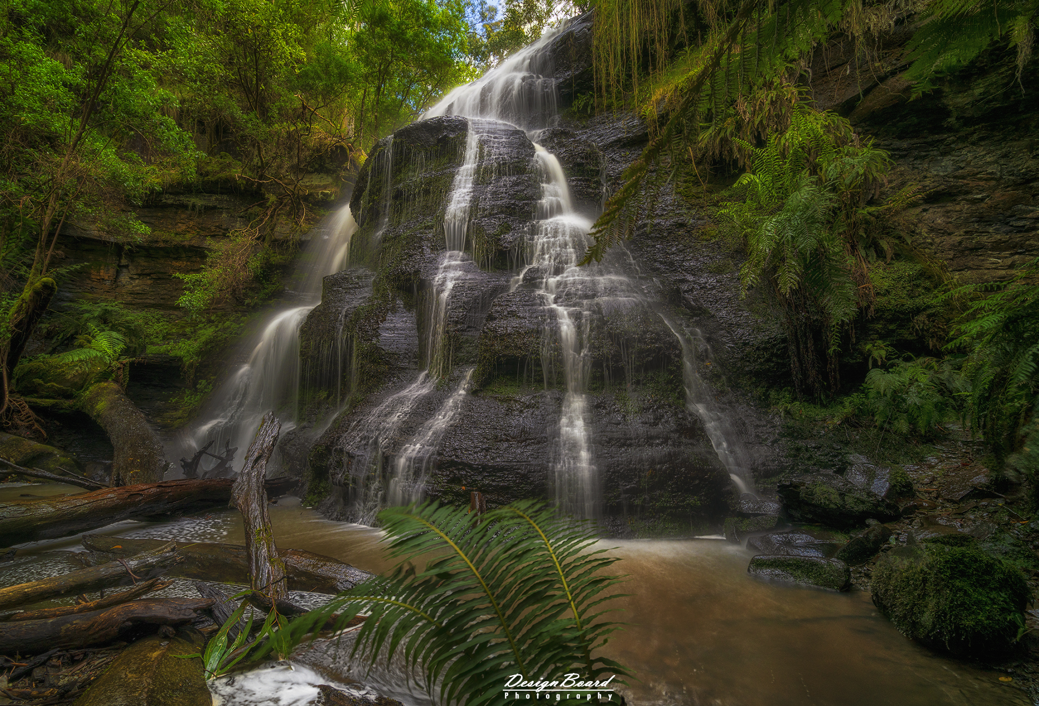
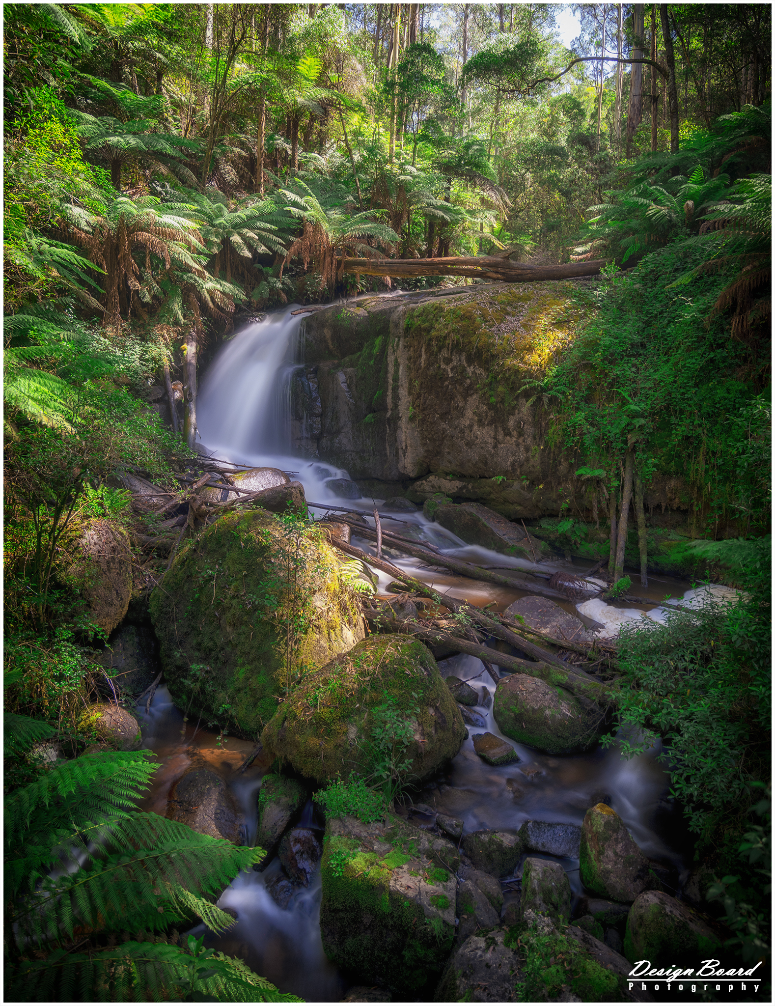
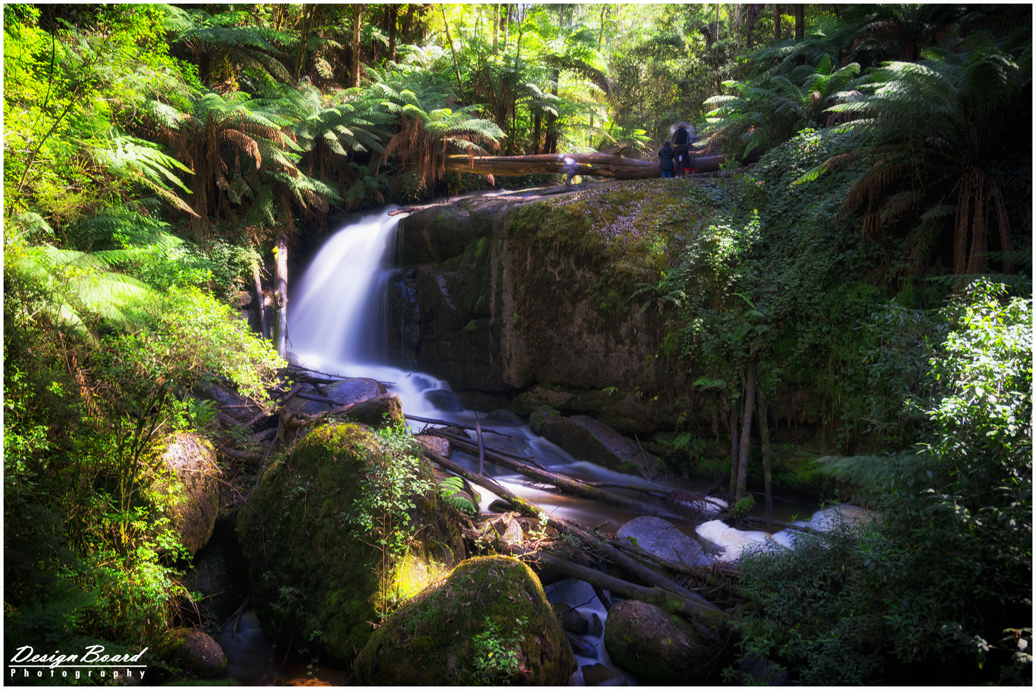
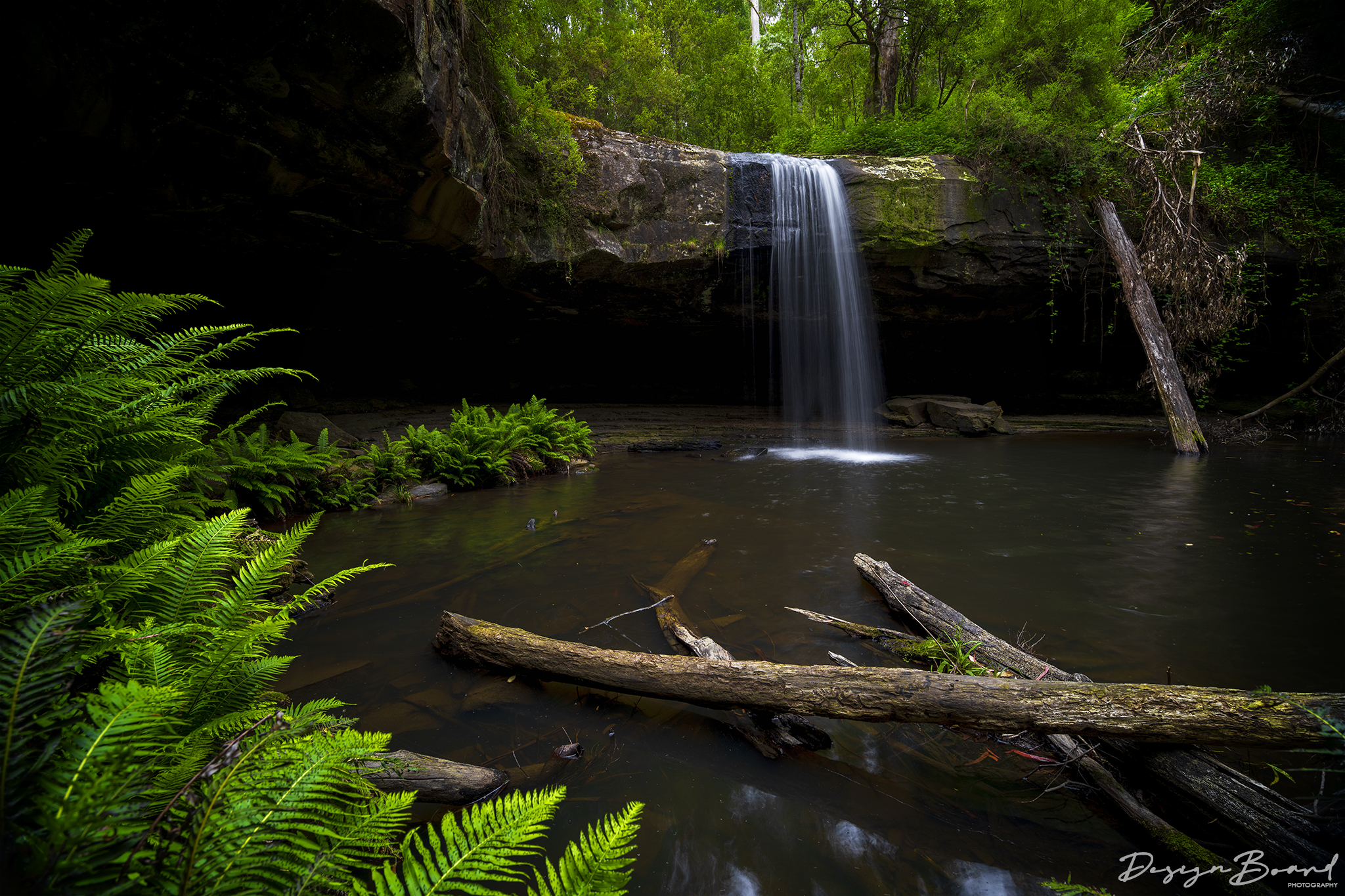
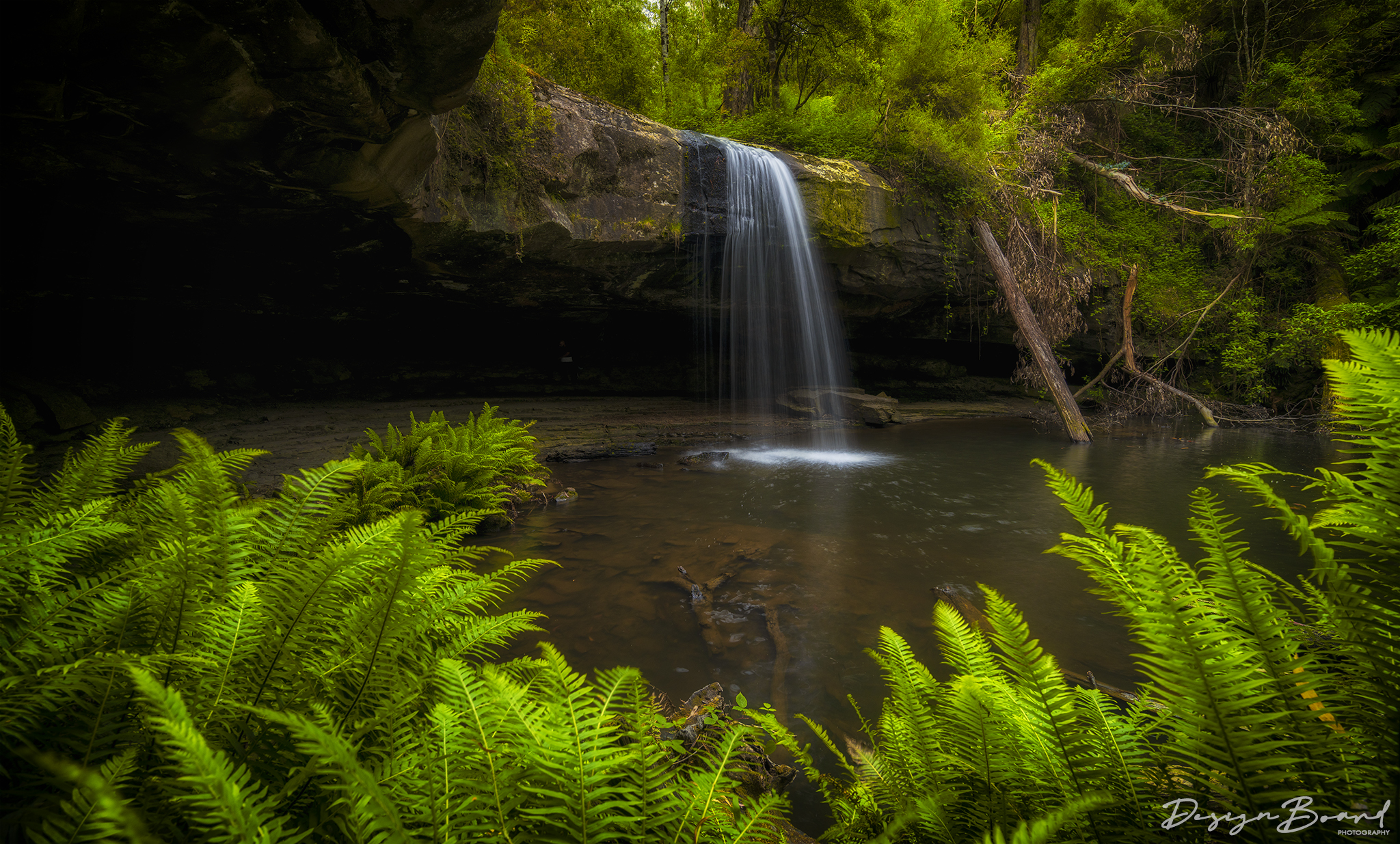
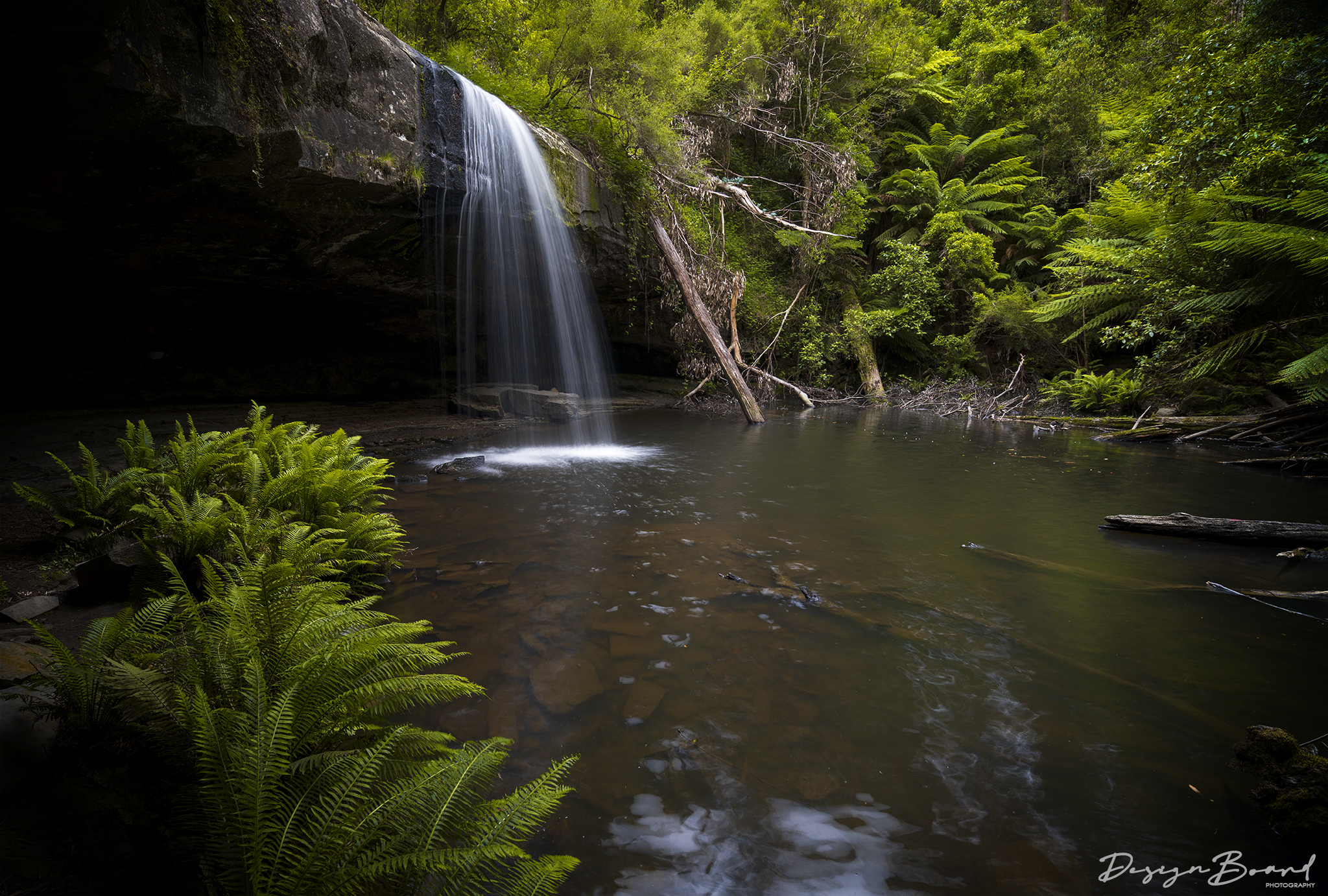
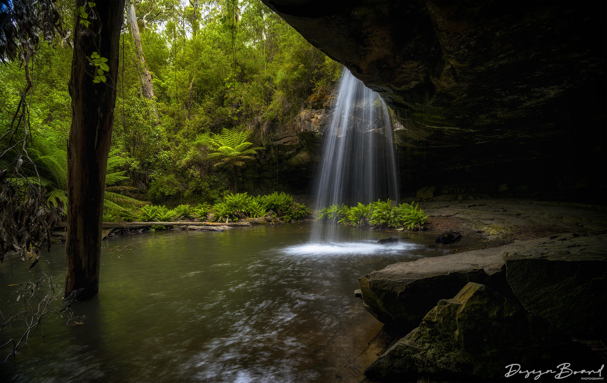
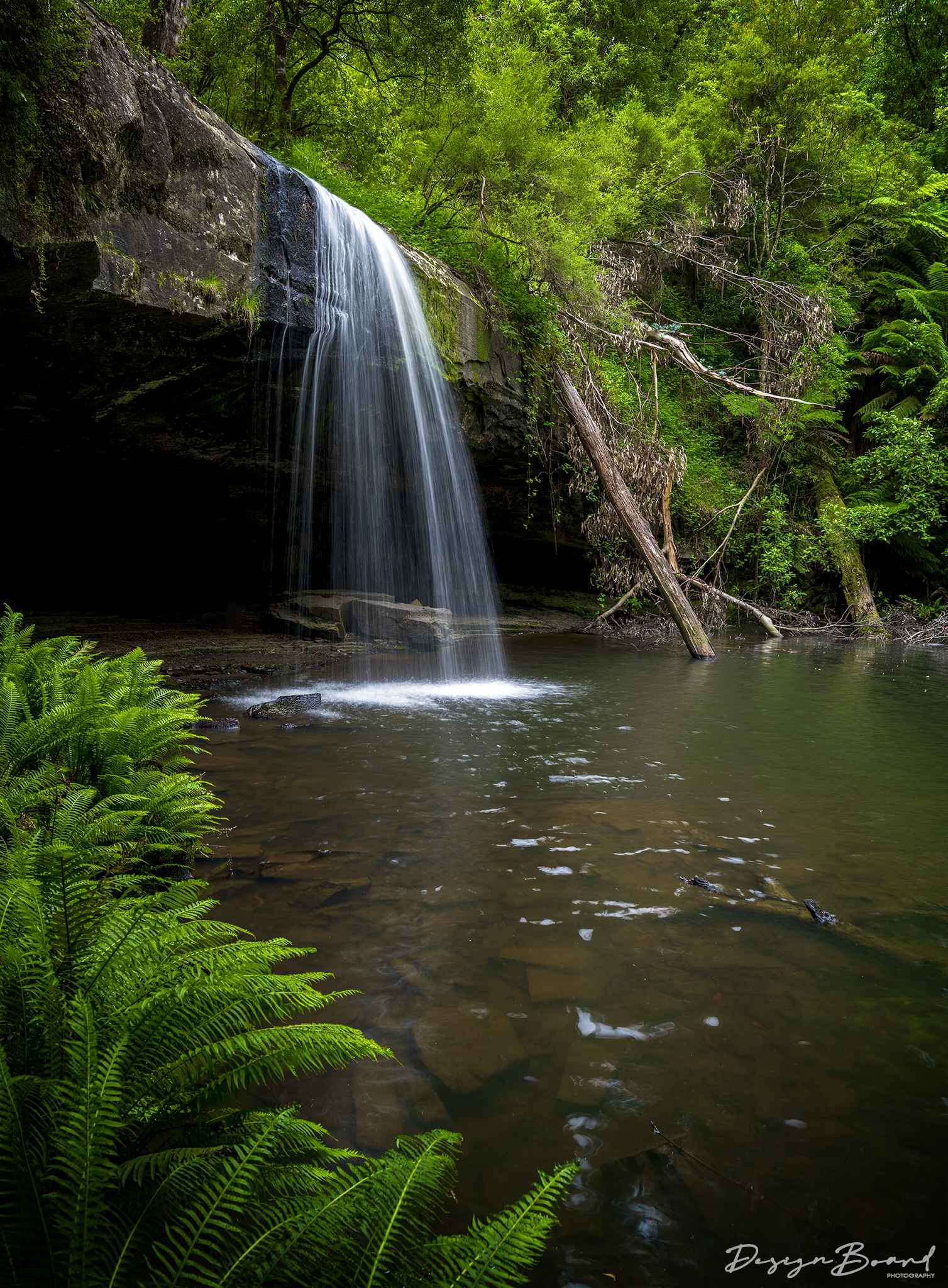
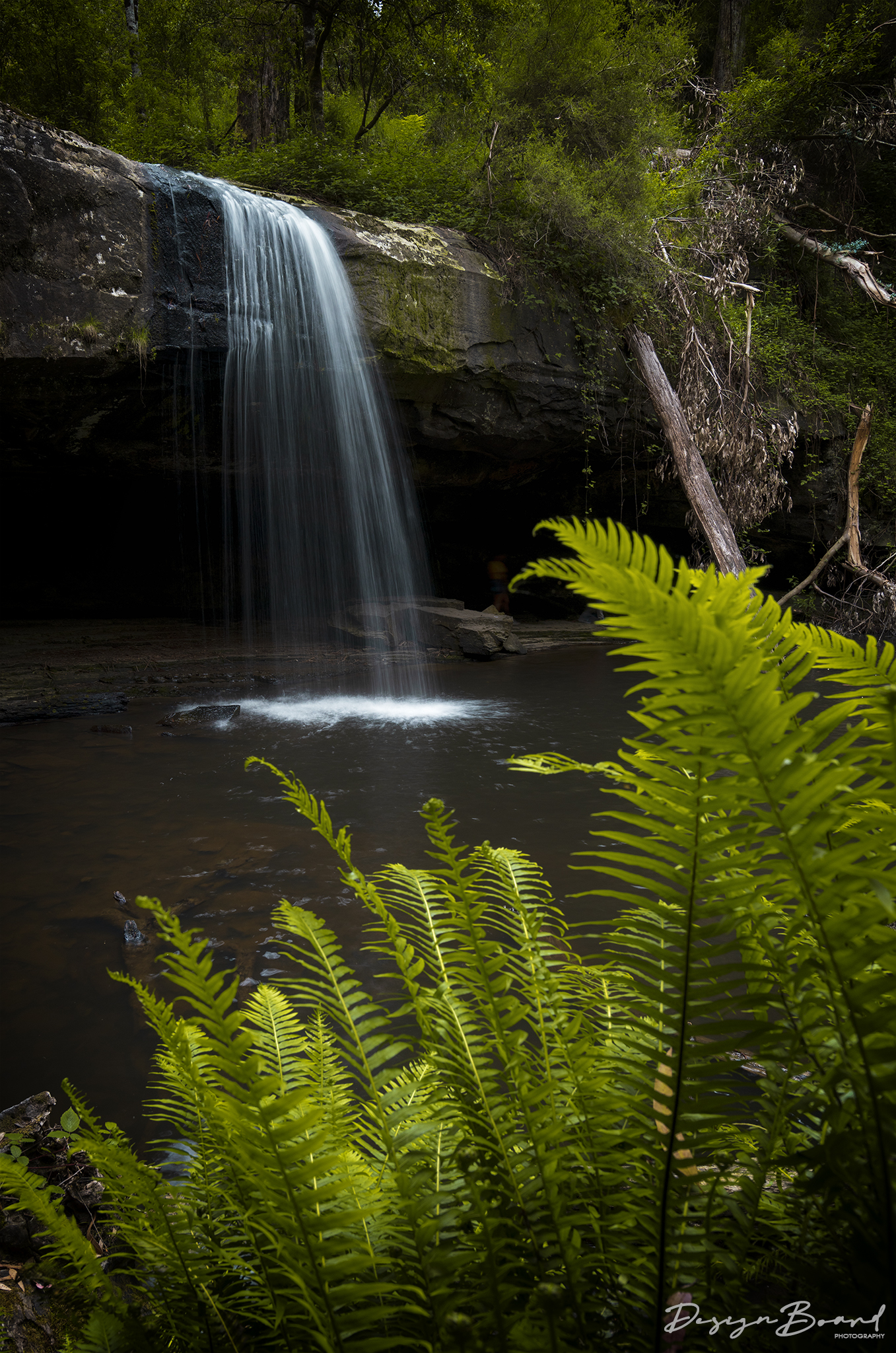
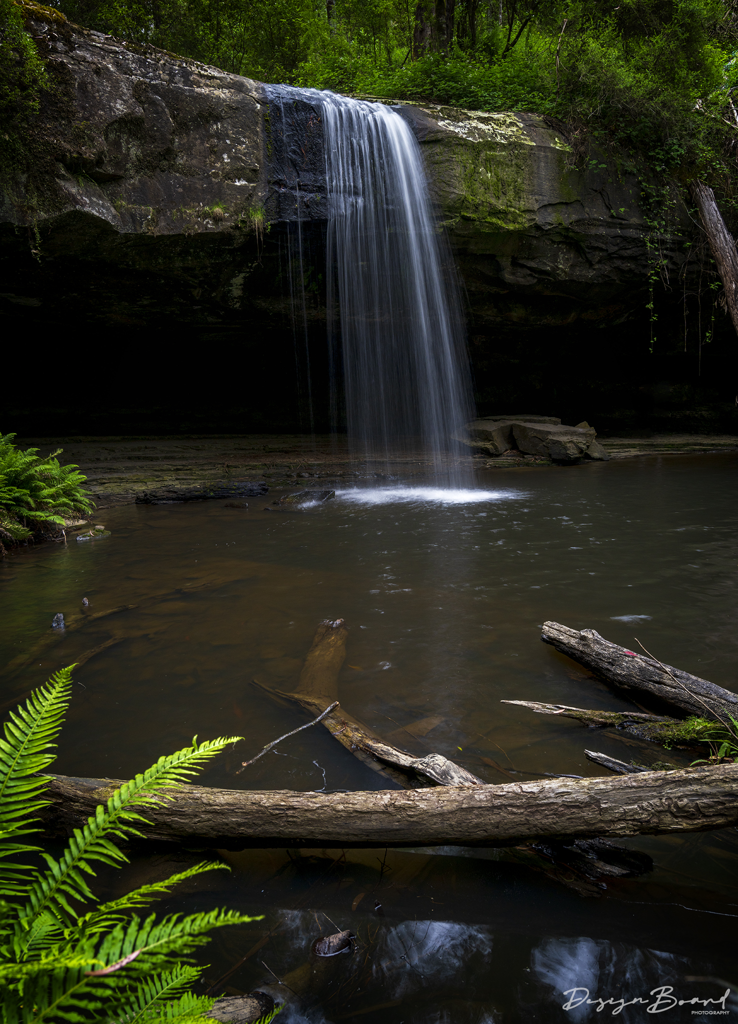
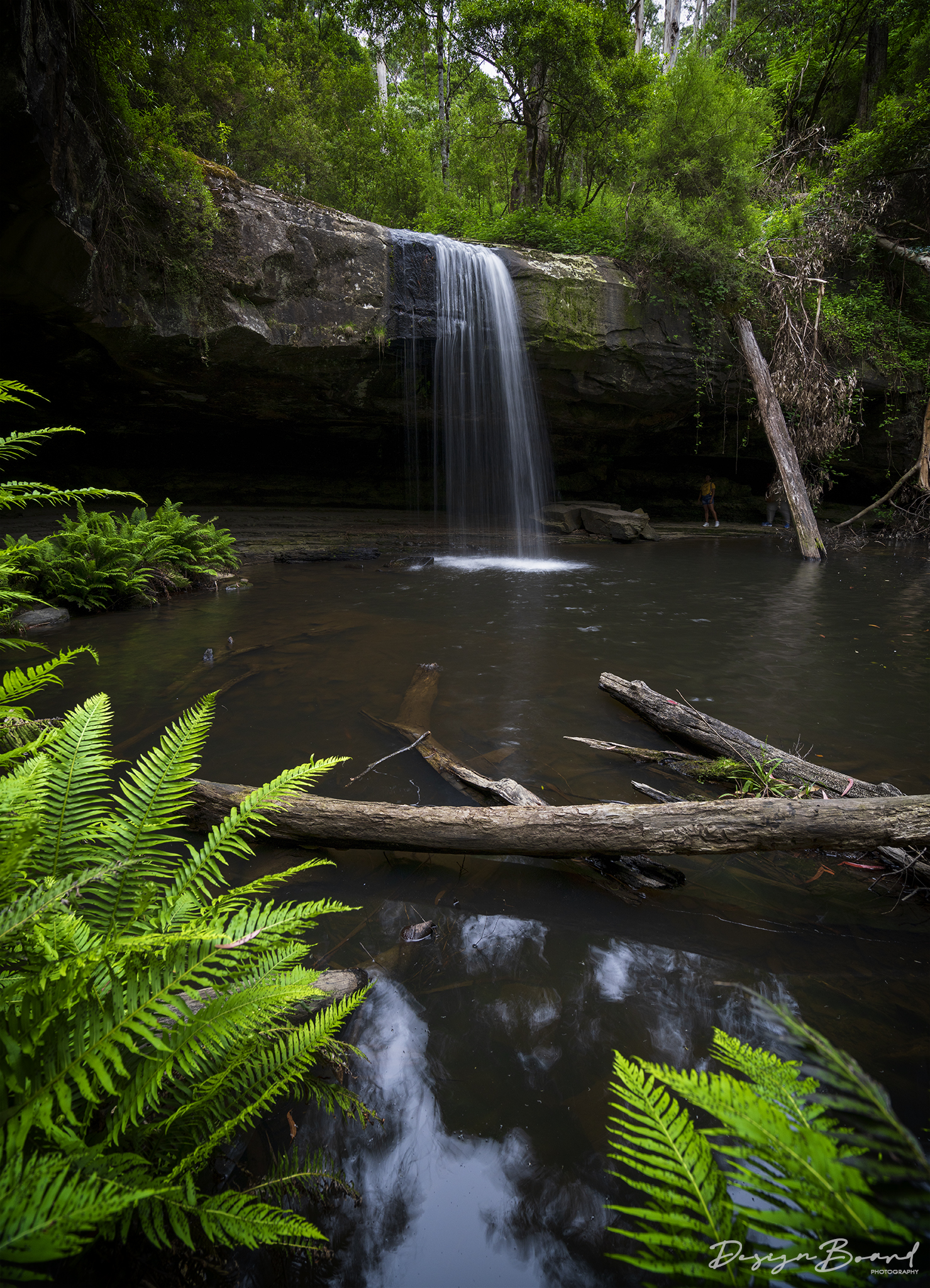
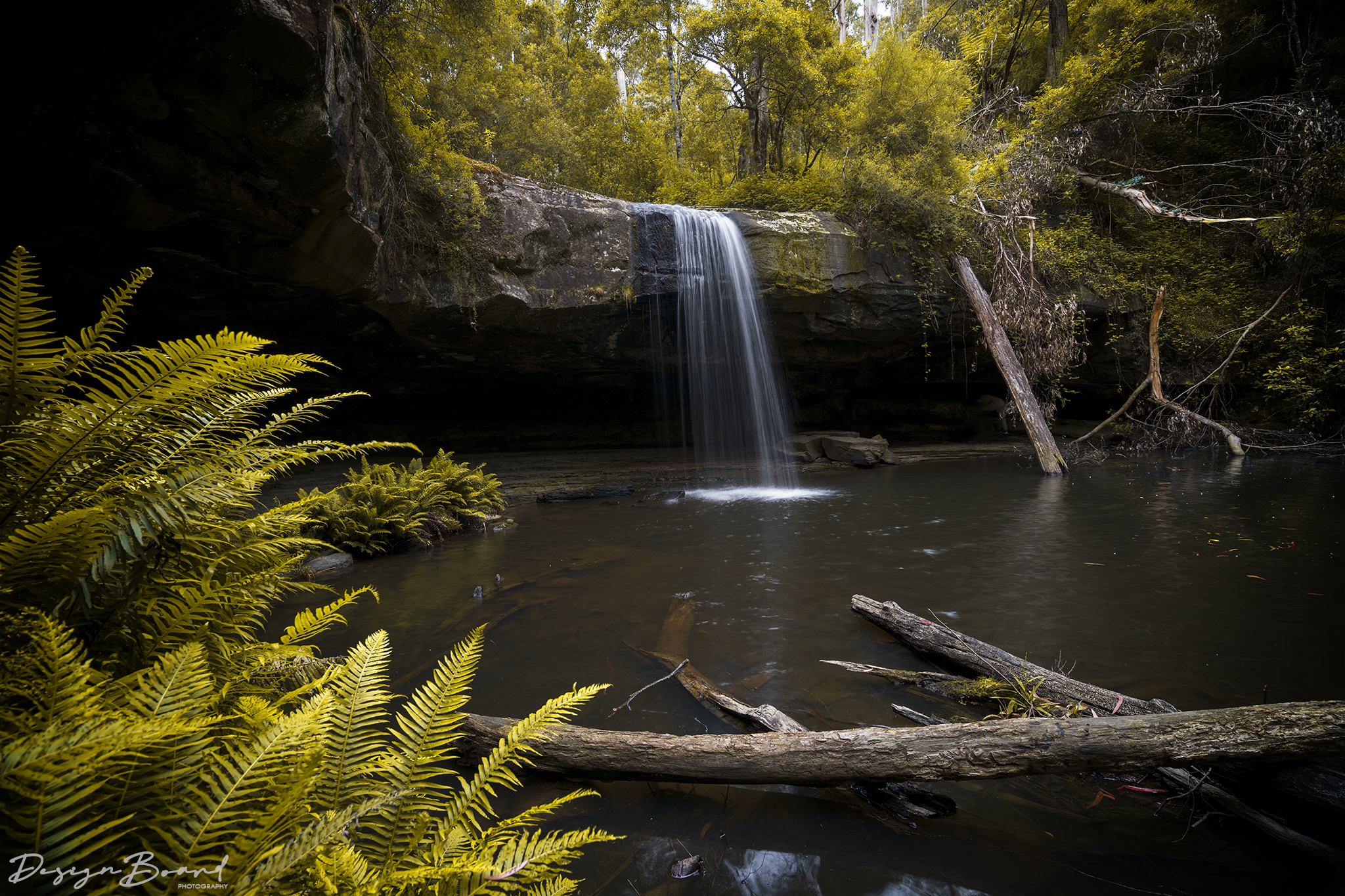
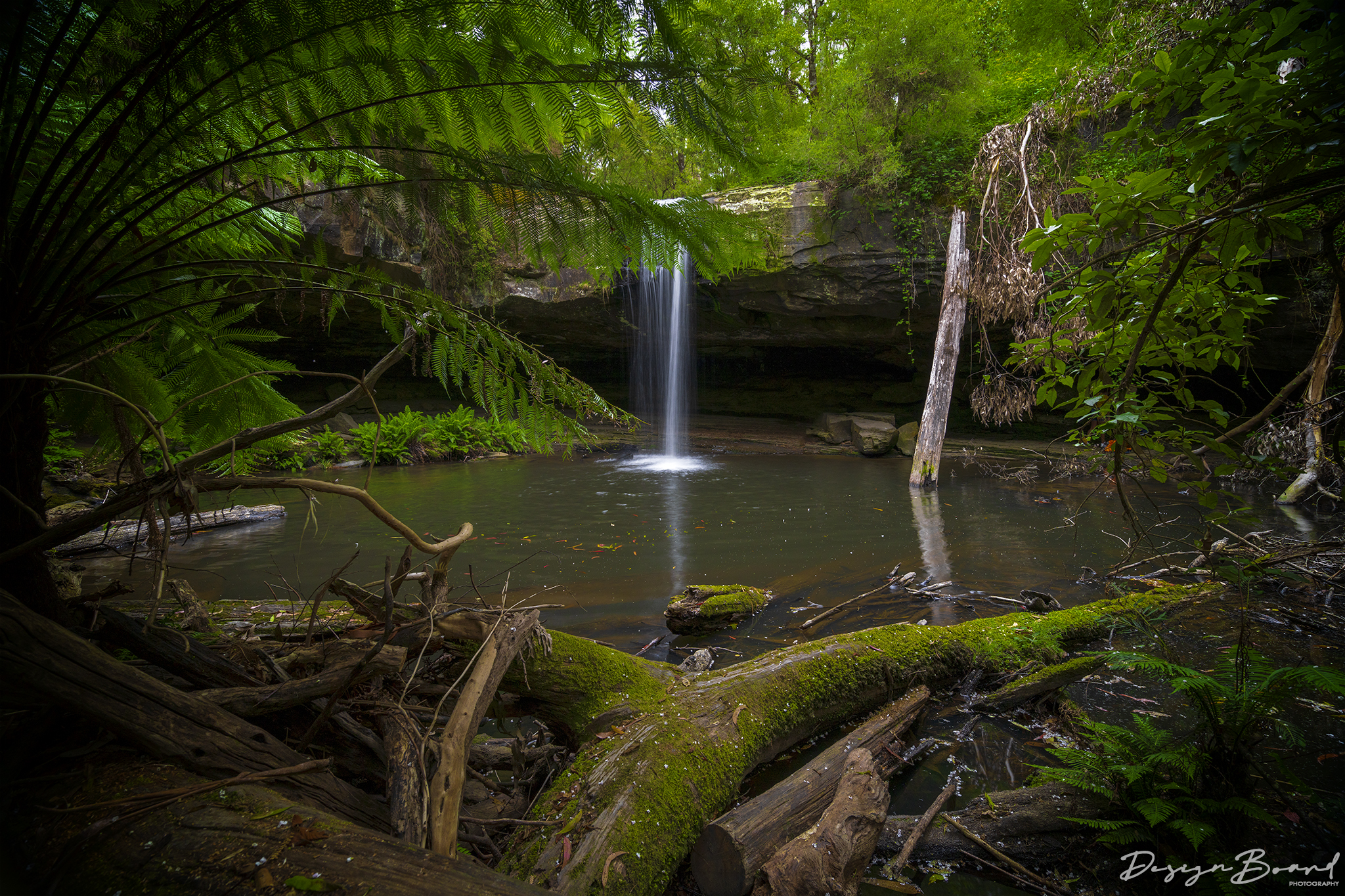
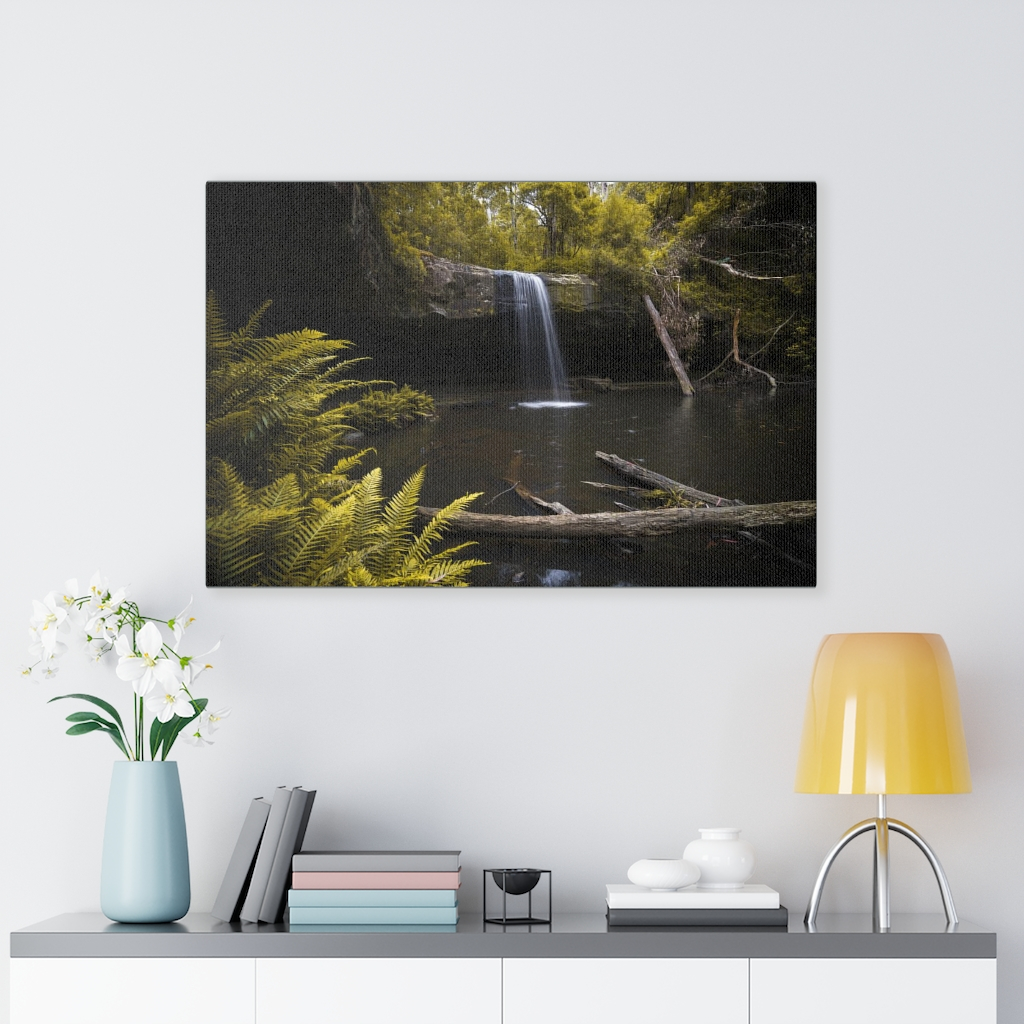
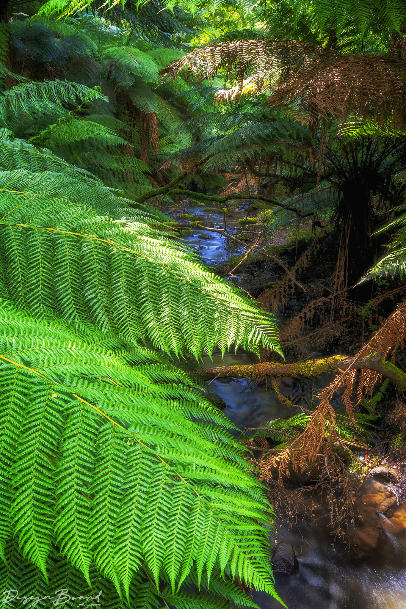
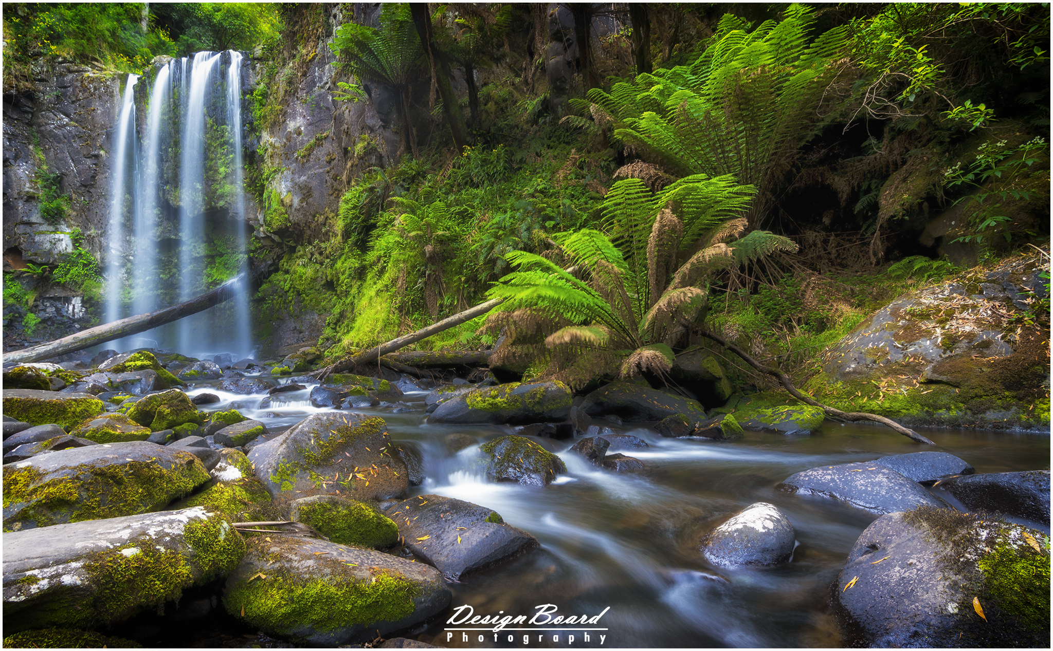
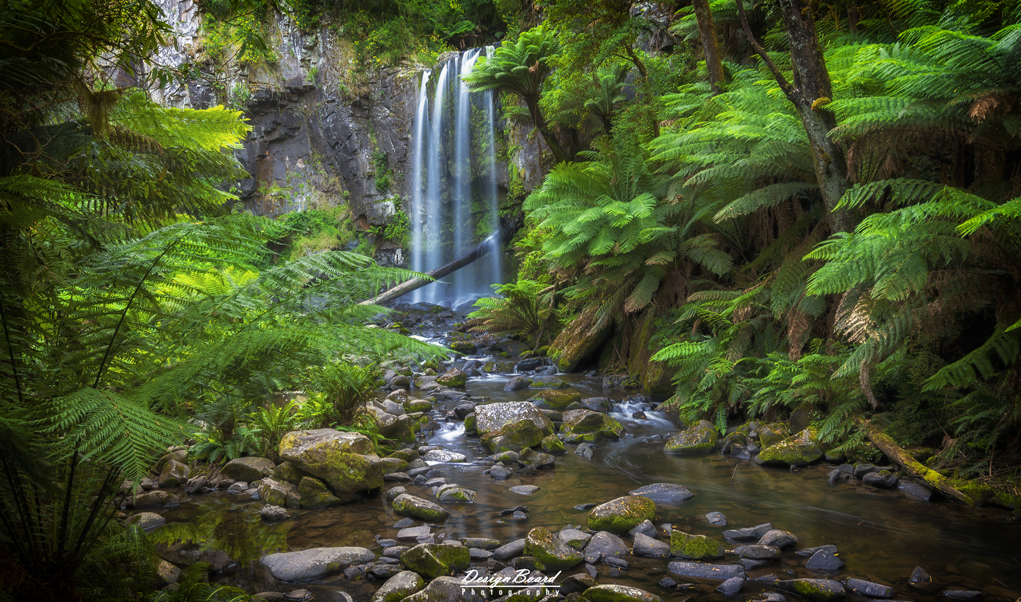
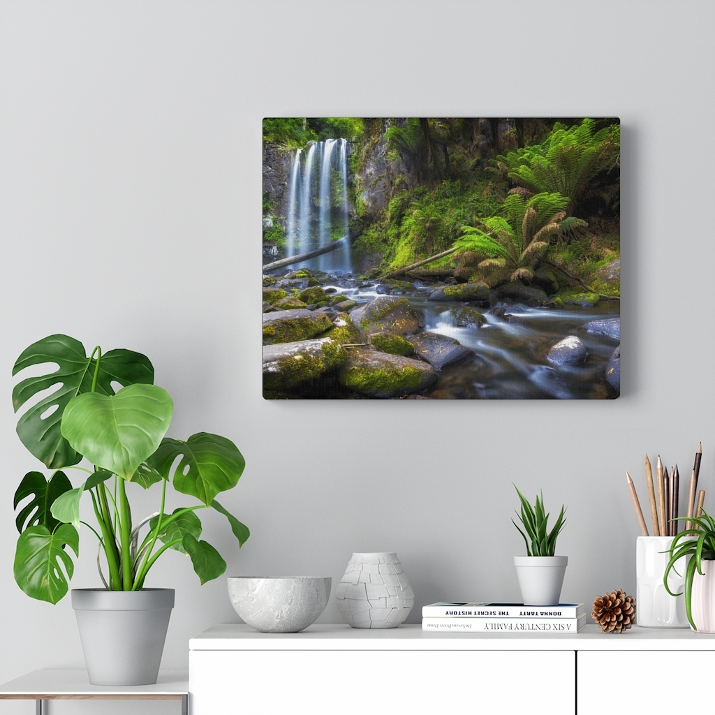
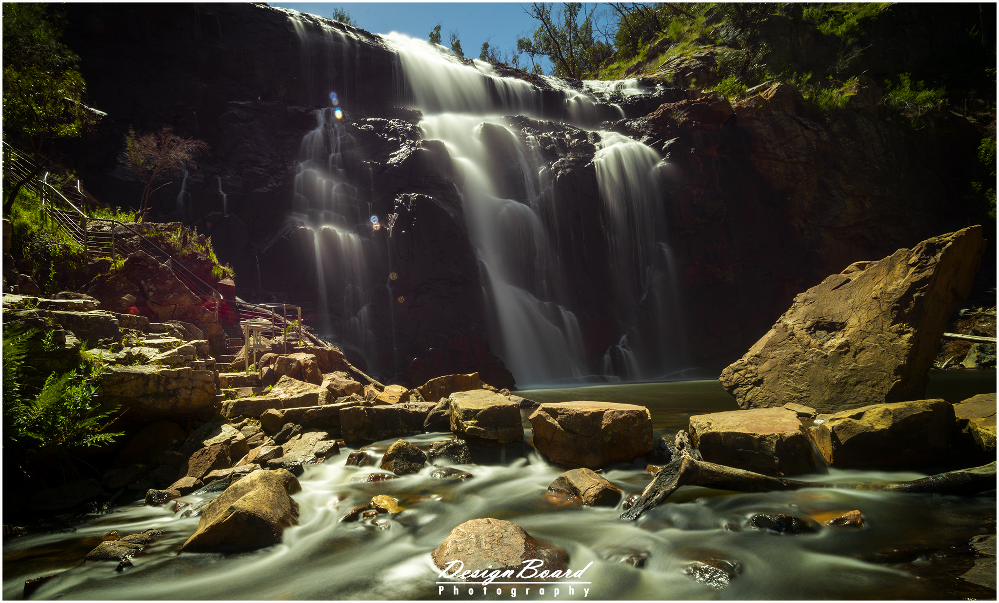
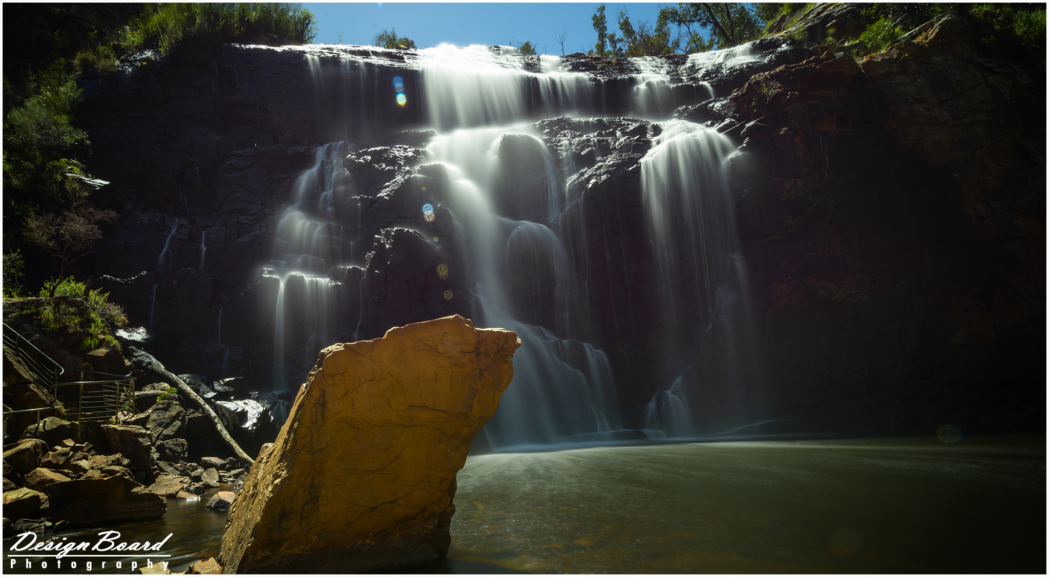
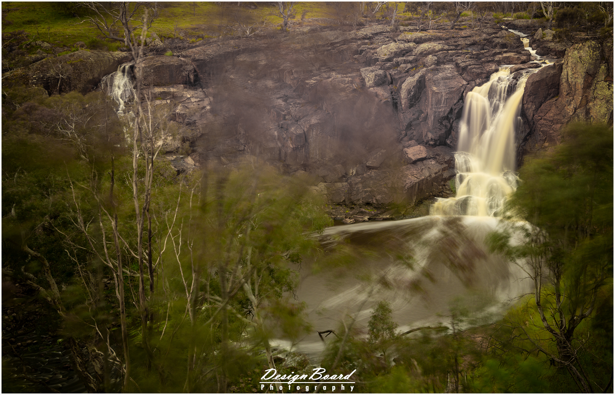
Another gem in within the Great Otway National Park, and is a top contender for the title of one of the most beautiful waterfalls in the Great Otway National Park. The 5.5km (return) walk to the Lower Kalimna Falls takes you through a beautiful creek valley filled with tall ferns and giant blue gums. The walk to the lower falls is an easy one. However, with heavy rains, the path will get quite muddy and sometimes you’d have to climb over fallen trees and branches. You can walk past the lower falls all the way to the Upper Kalimna Falls (8.2km return trip). Unfortunately, during my visit, the path to the upper falls was closed off due fallen trees.
What is a bit unique about this waterfall is that you can easily walk behind the waterfall.
To get to the falls, park at the Sheoak picnic area and follow the clearly marked path to the falls.
Click here for Google Maps directions
Here’s some more details on the (return) walk to the falls.
Lower Kalimna Falls by DesignBoard Photography – Walking Details
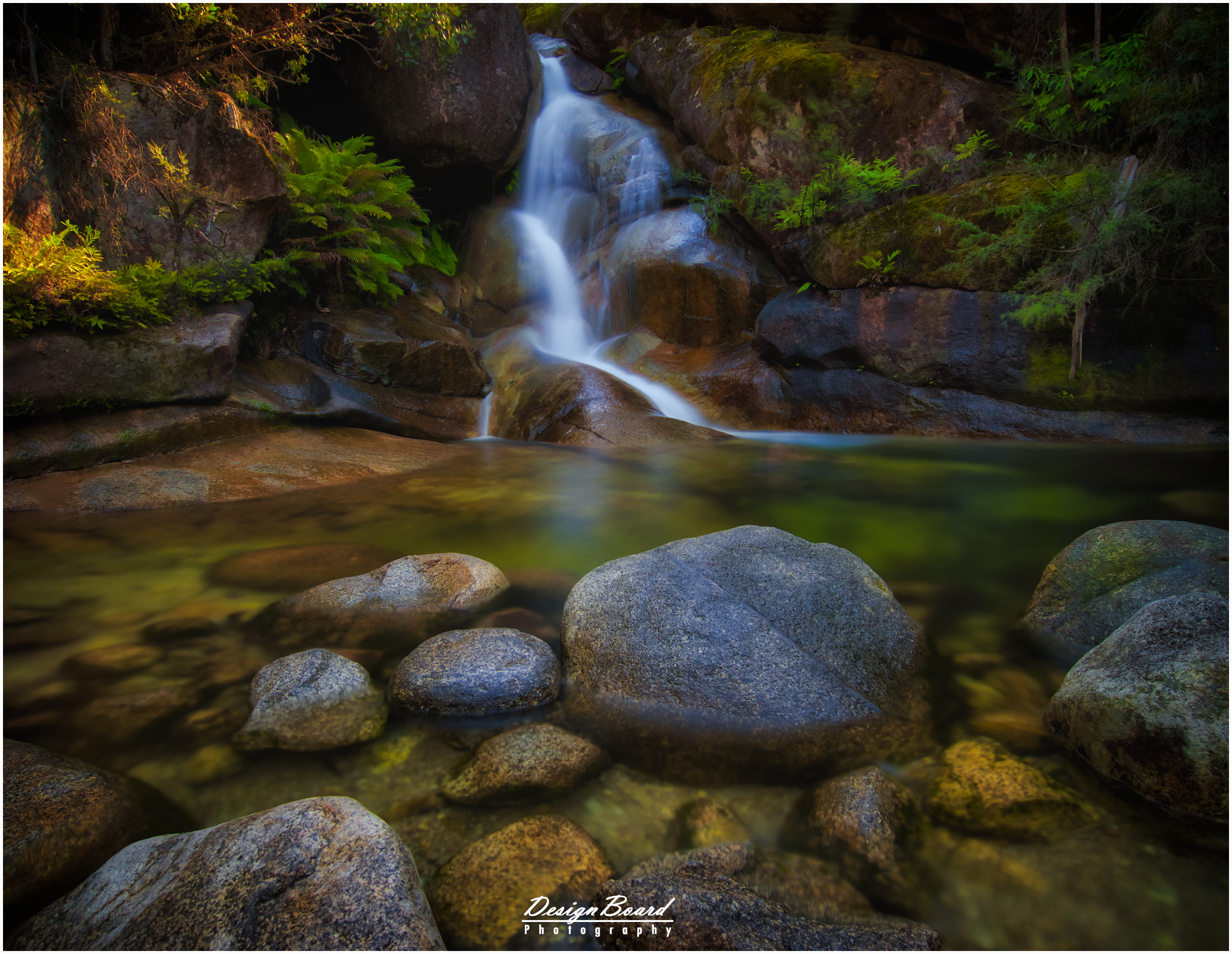
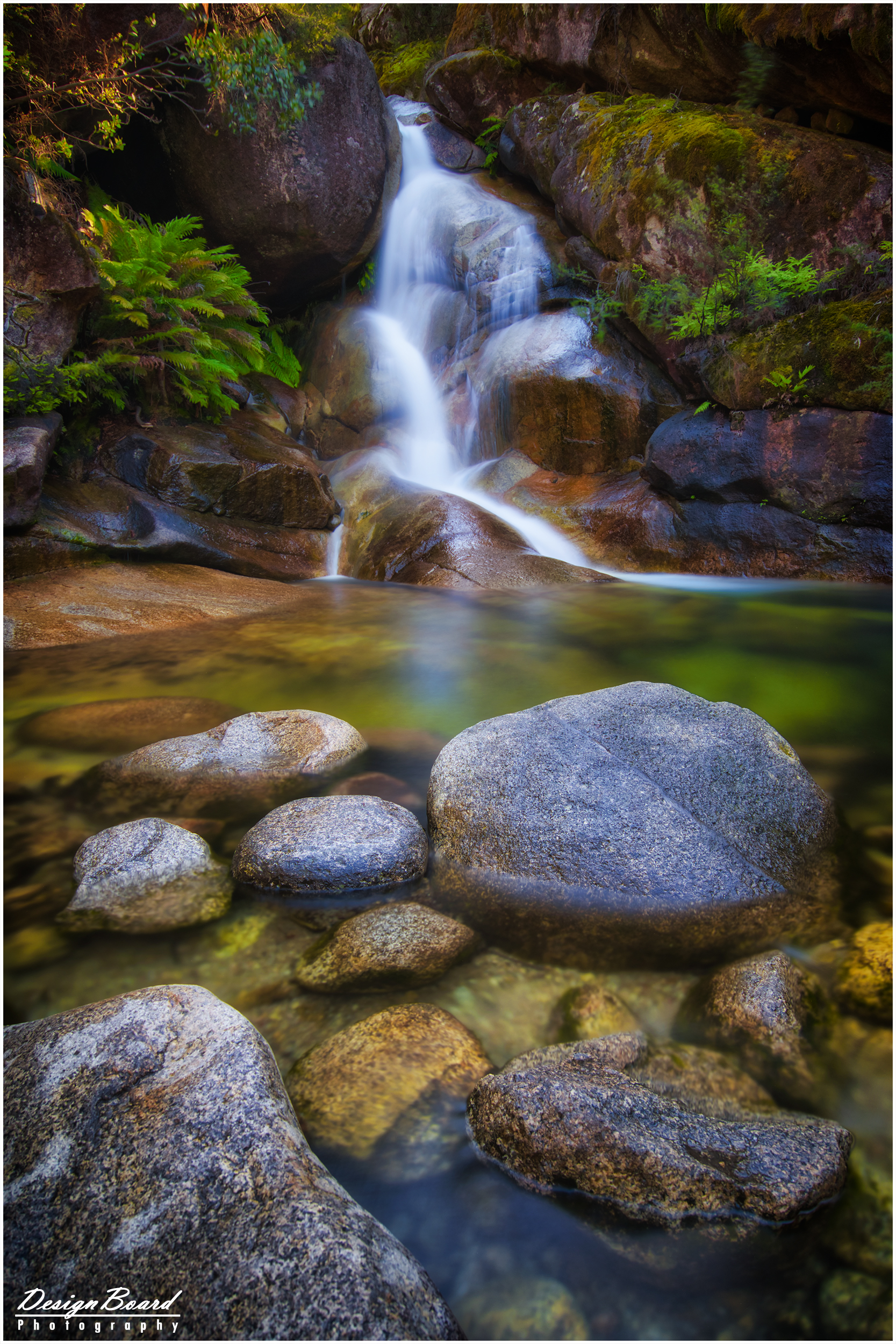
It’s an easy, less than 1km return, walk from the car park. There are picnic tables at the start of the walking path, but these were quite worn out and looked like hadn’t been maintained. The path to the falls is to the right from the picnic tables. The track gets quite narrow and places and could get slippery with rain.
You can get real close to the base of the falls. Elsewhere on the web, there are photos that show a tree with a swing at the base of the tree, which looks really nice. However, neither the tree nor the swing (well, suppose there can’t be a swing without the tree 🙂 are there anymore.
Click here for Google Maps direction
Here’s some more details on the (return) walk to the falls.
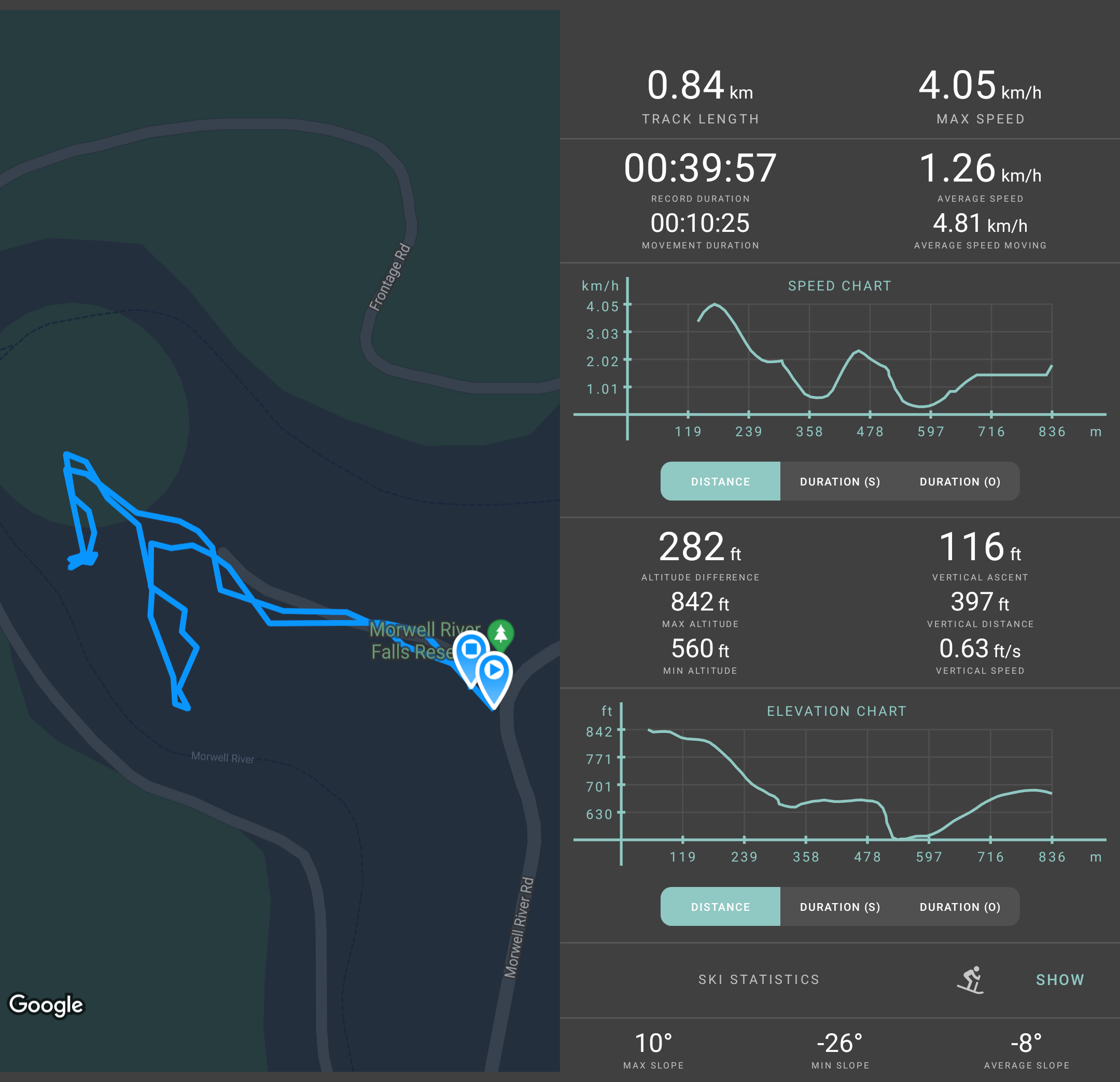
Morwell River Falls – Walking Details
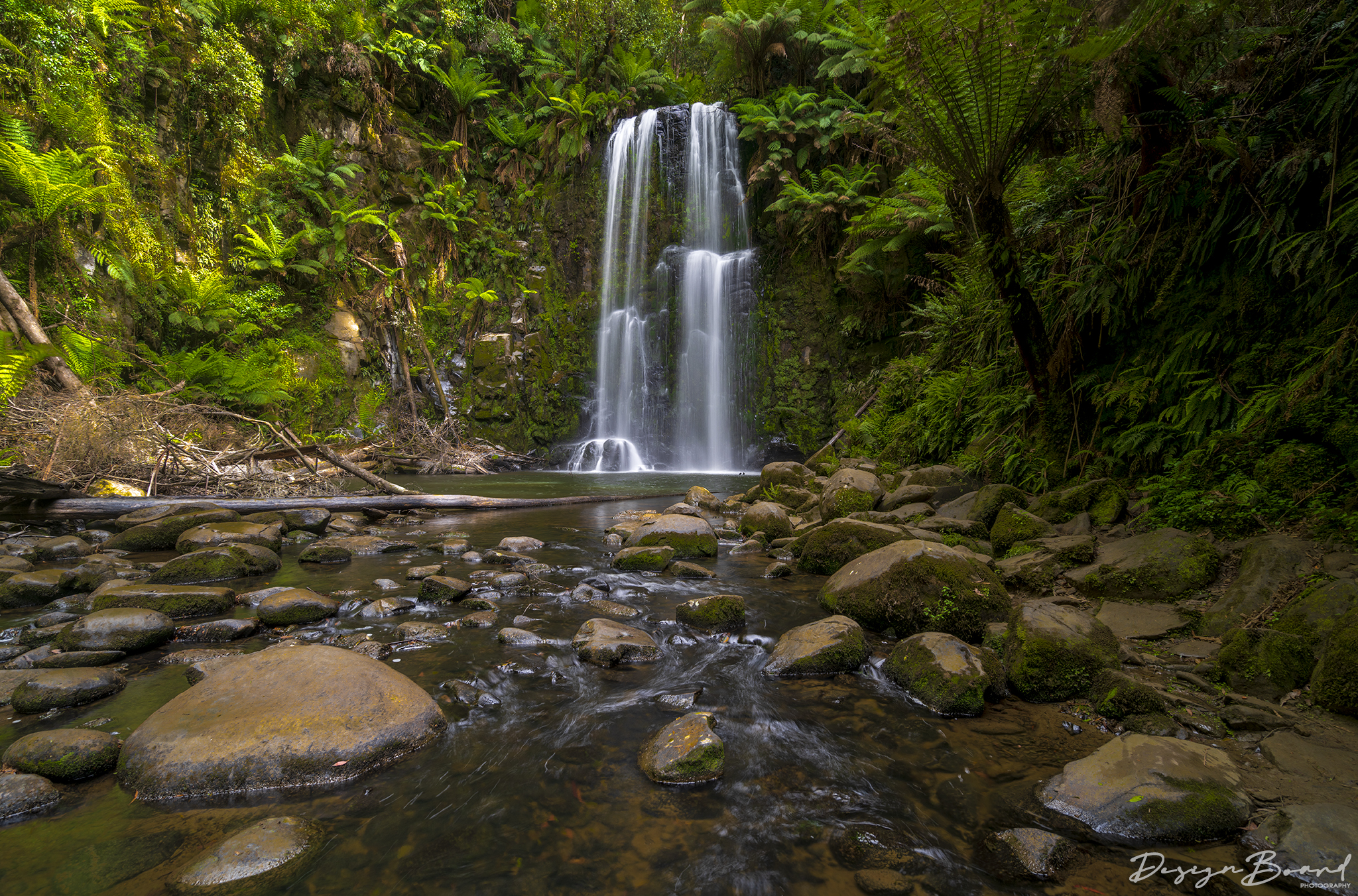
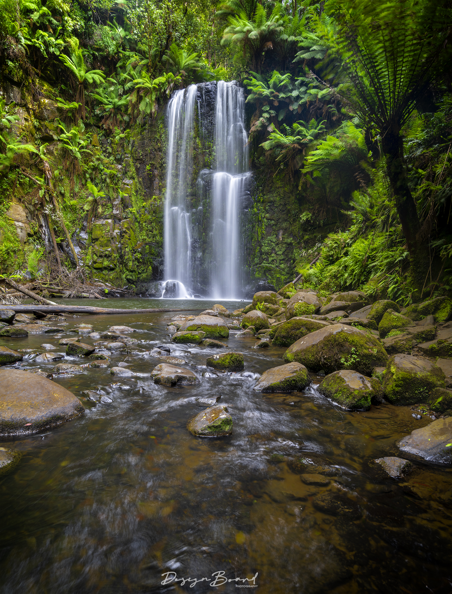
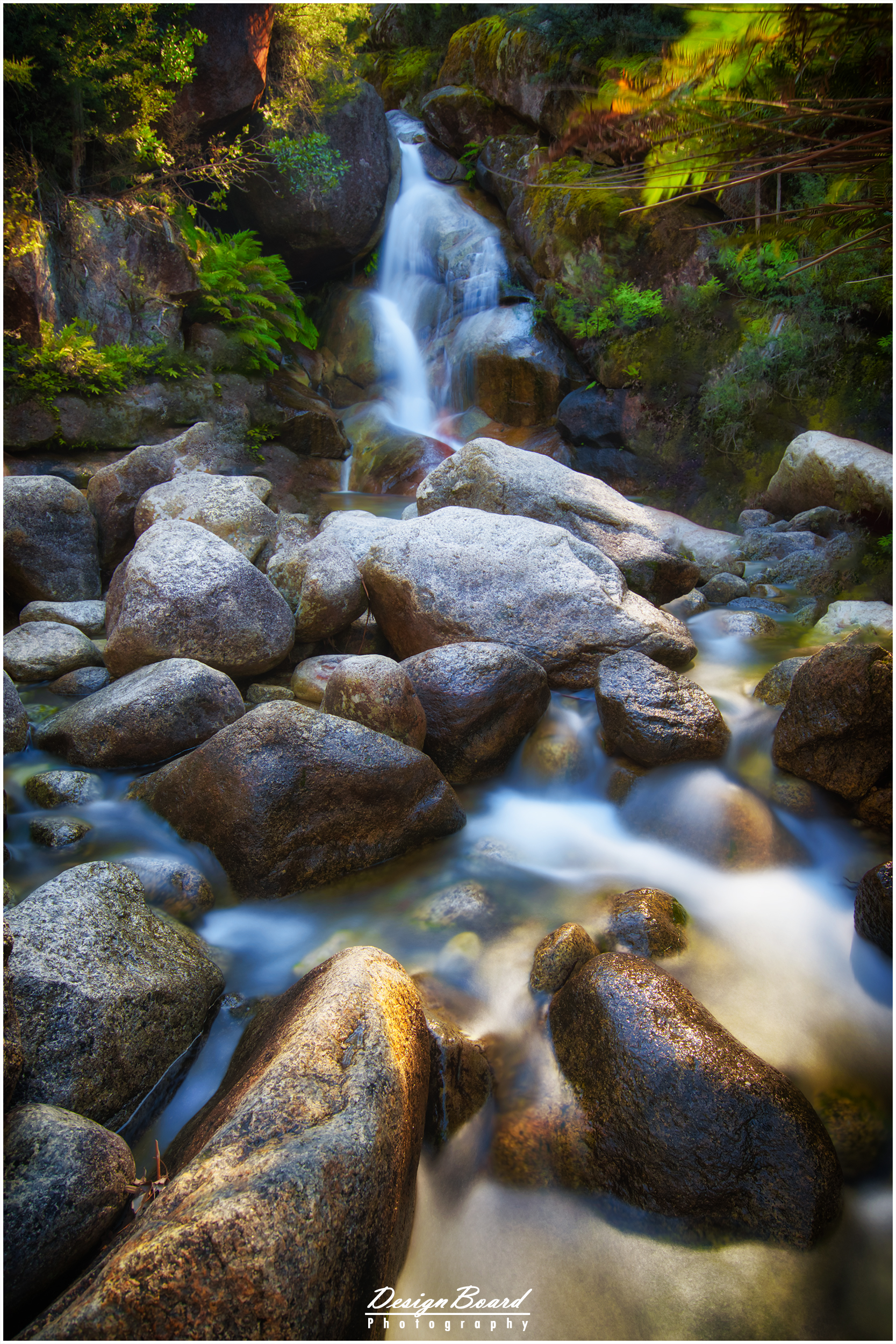
A relatively easy 1.8km return walk from the Tarra Valley Picnic Area through a lush green rain-forest, filled with tall ferns brings you to this waterfall. Early in the walk, you’d come across a fork in the path, marked ‘East Track’ and ‘West Track’. As the path is a loop walk, you can go either way to reach the falls. There are few steps at the end to get to the falls (these could get slippery with rain), but not difficult to tackle.
The falls itself could be a little bit obscured by the ferns. There’s a viewing platform and a bench at the falls.
As the falls are quite small, if you’re planning on visiting, make sure there has been some rain. Otherwise, the falls are likely to run dry quite easily.
Click here for Google Maps directions
Here’s some more details on the (return) walk to the falls.
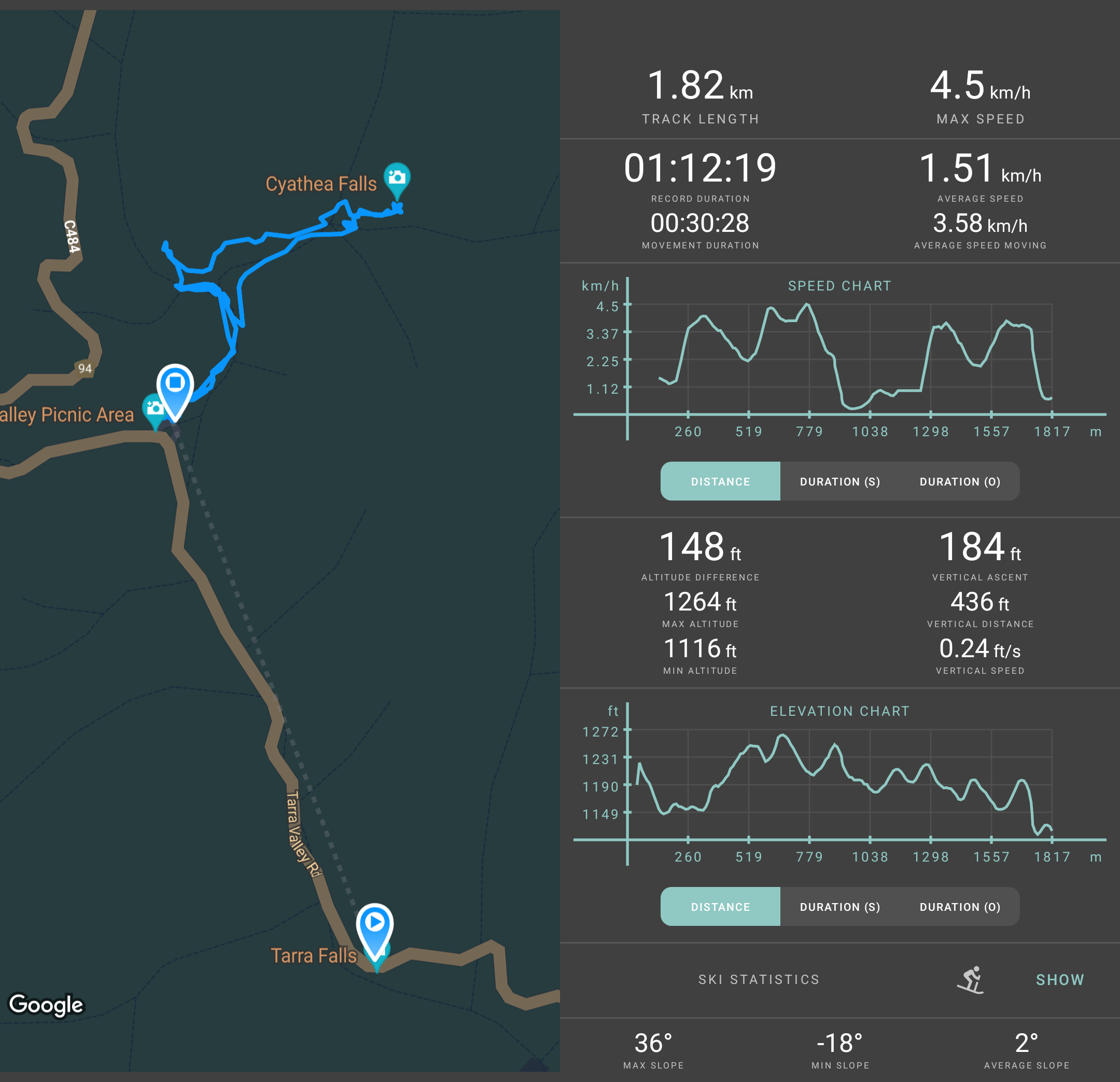
Cyathea Falls – Walking Details
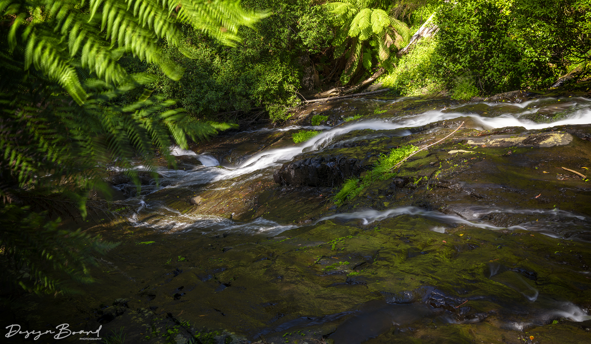
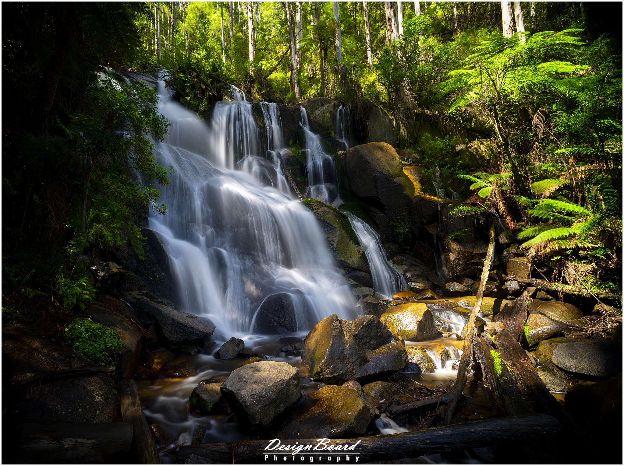
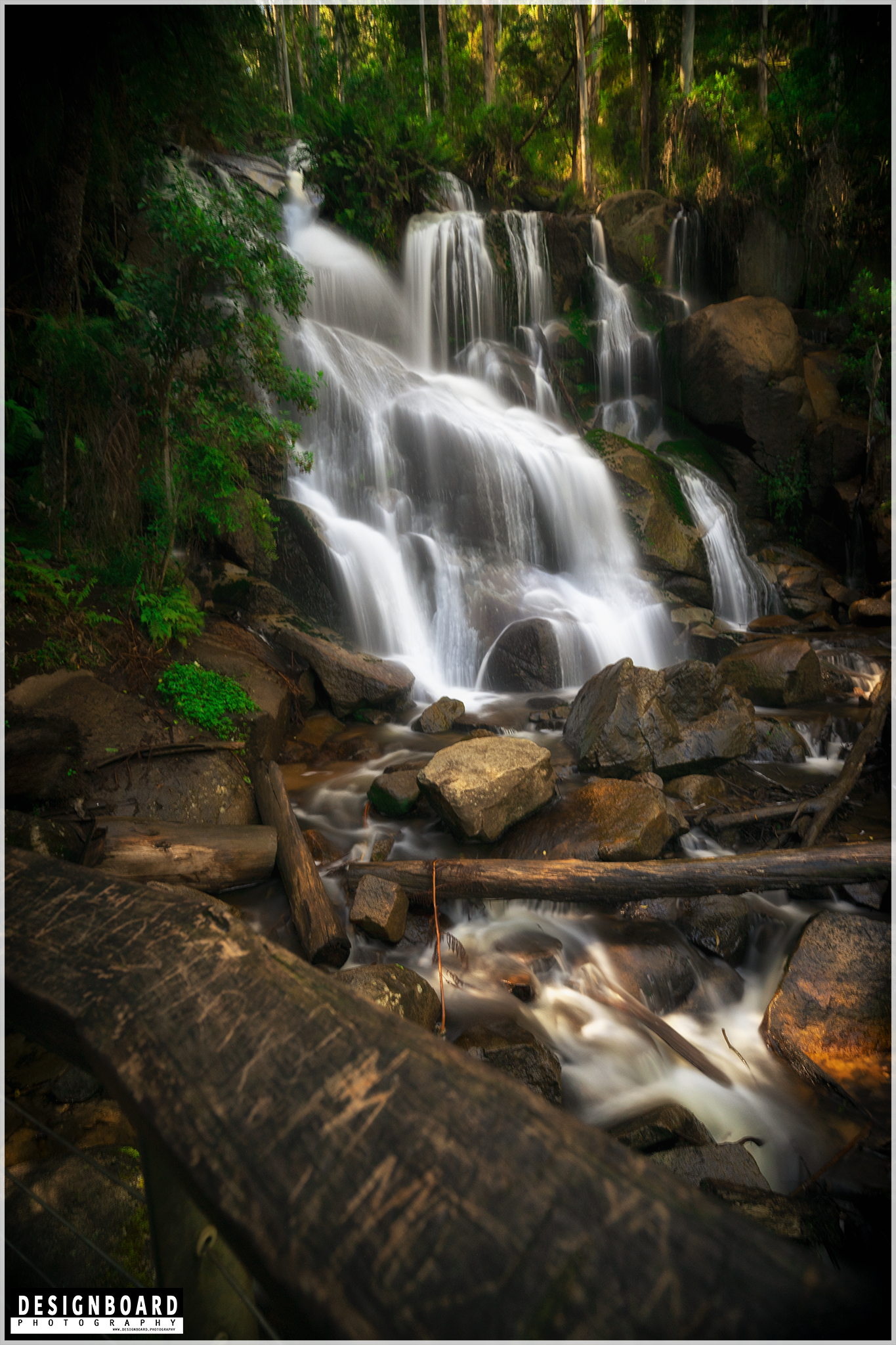
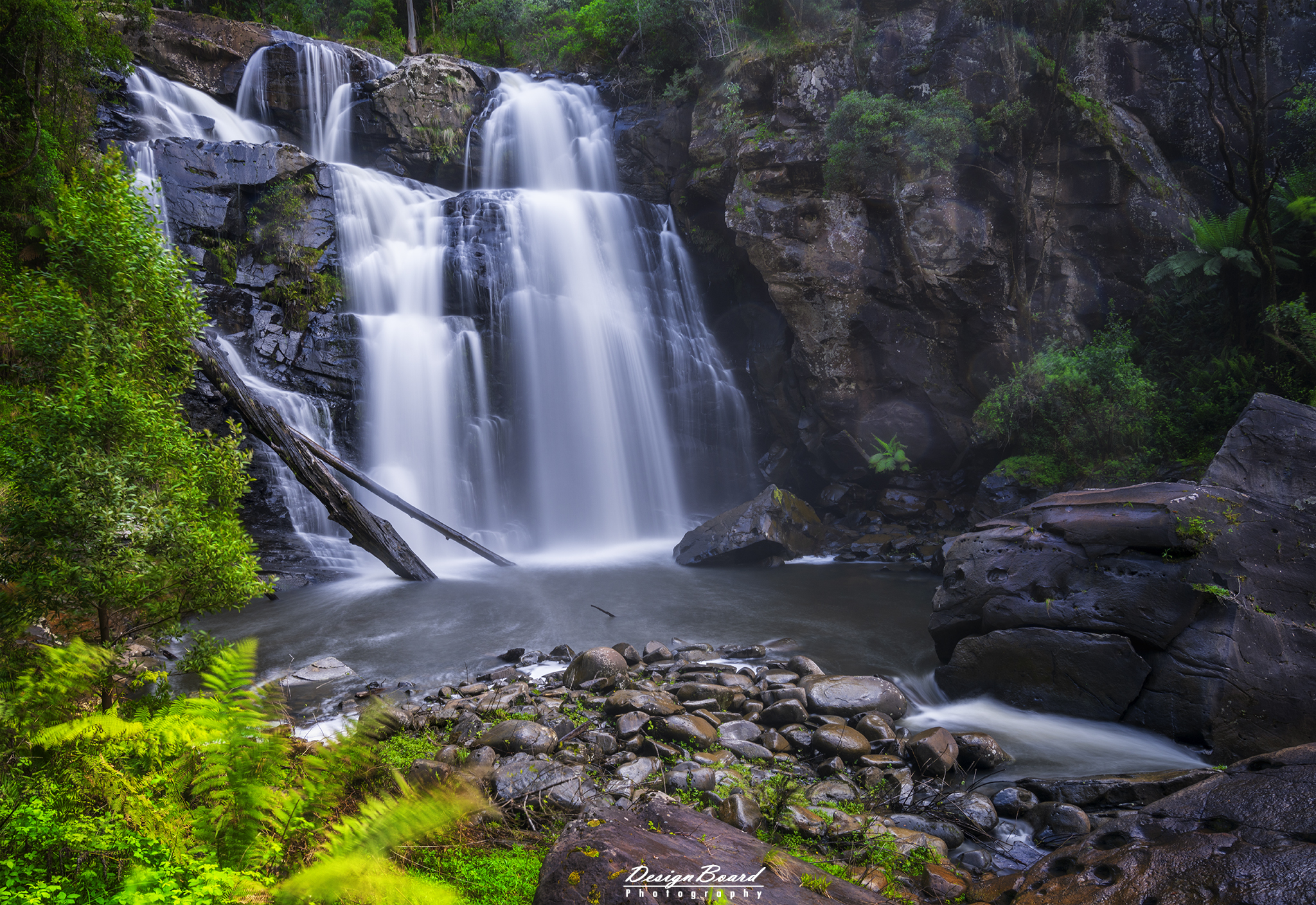
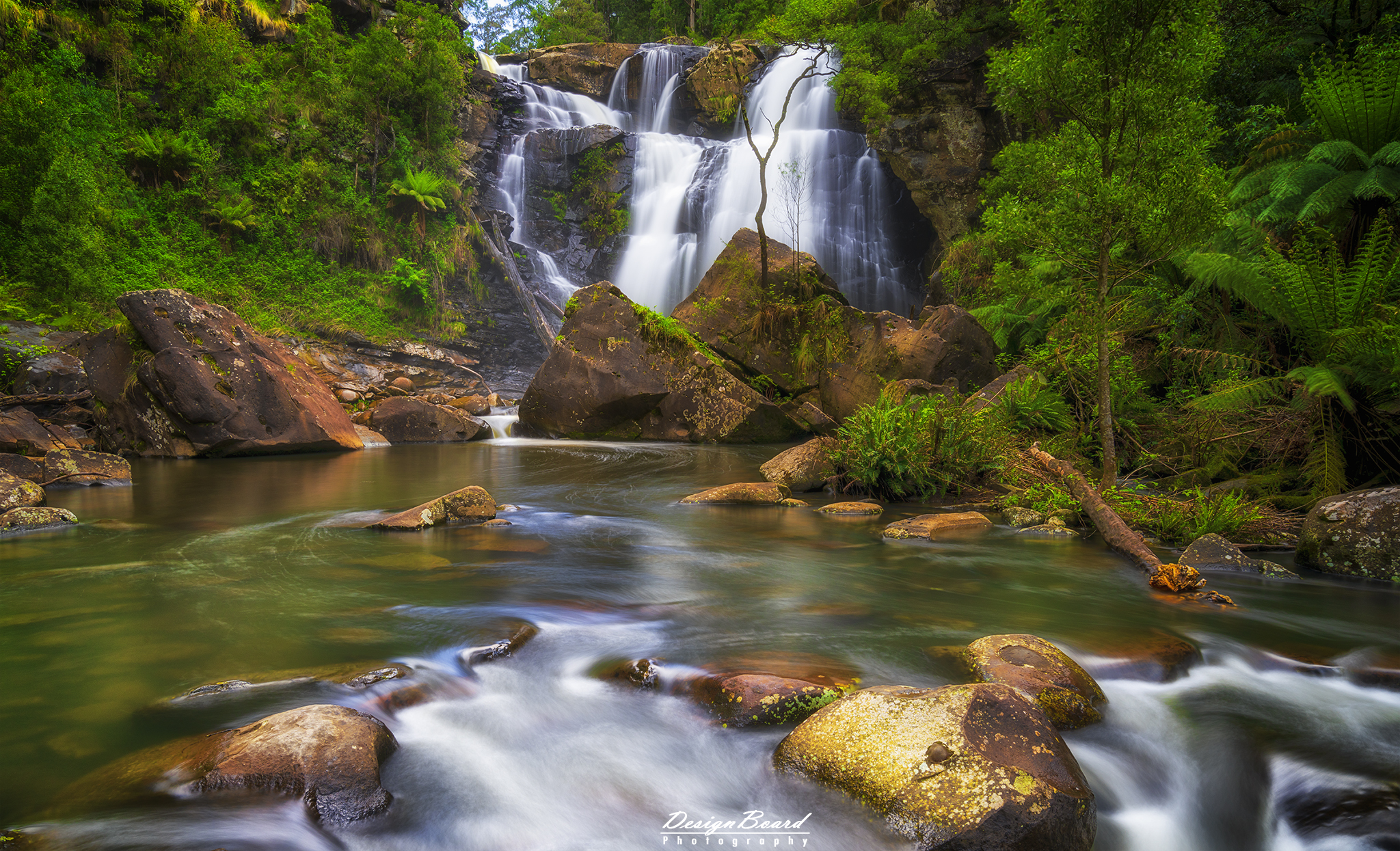
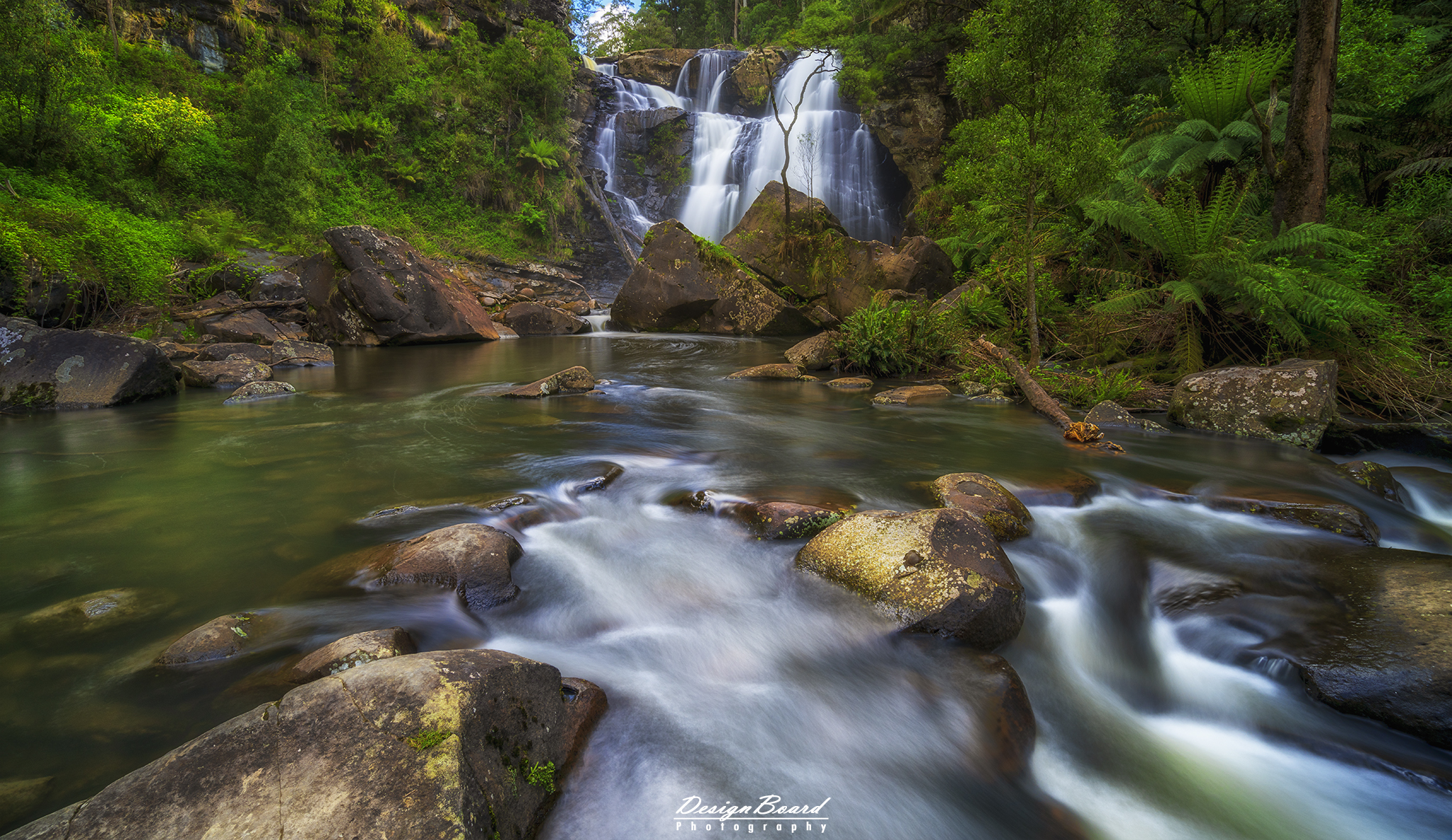
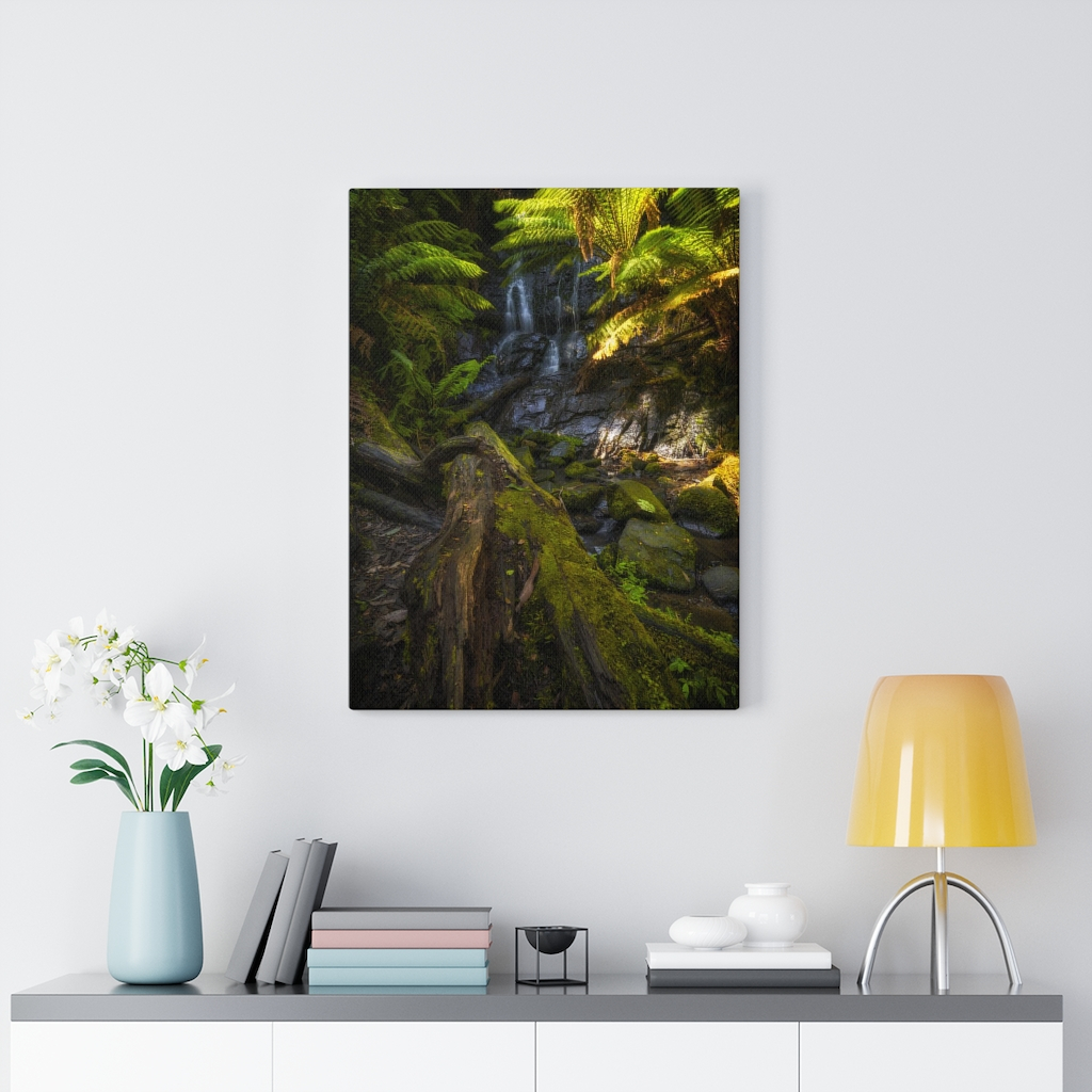
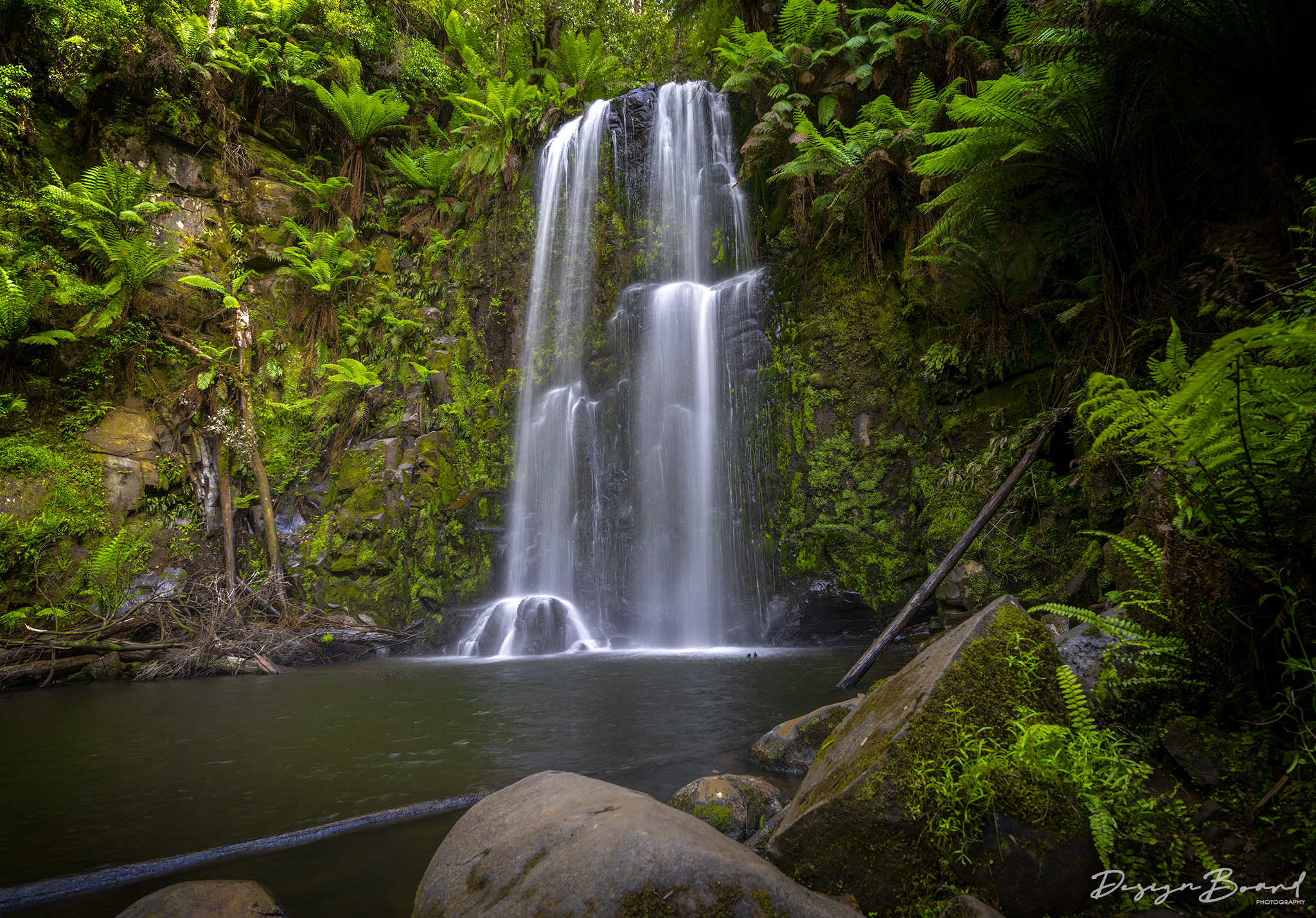
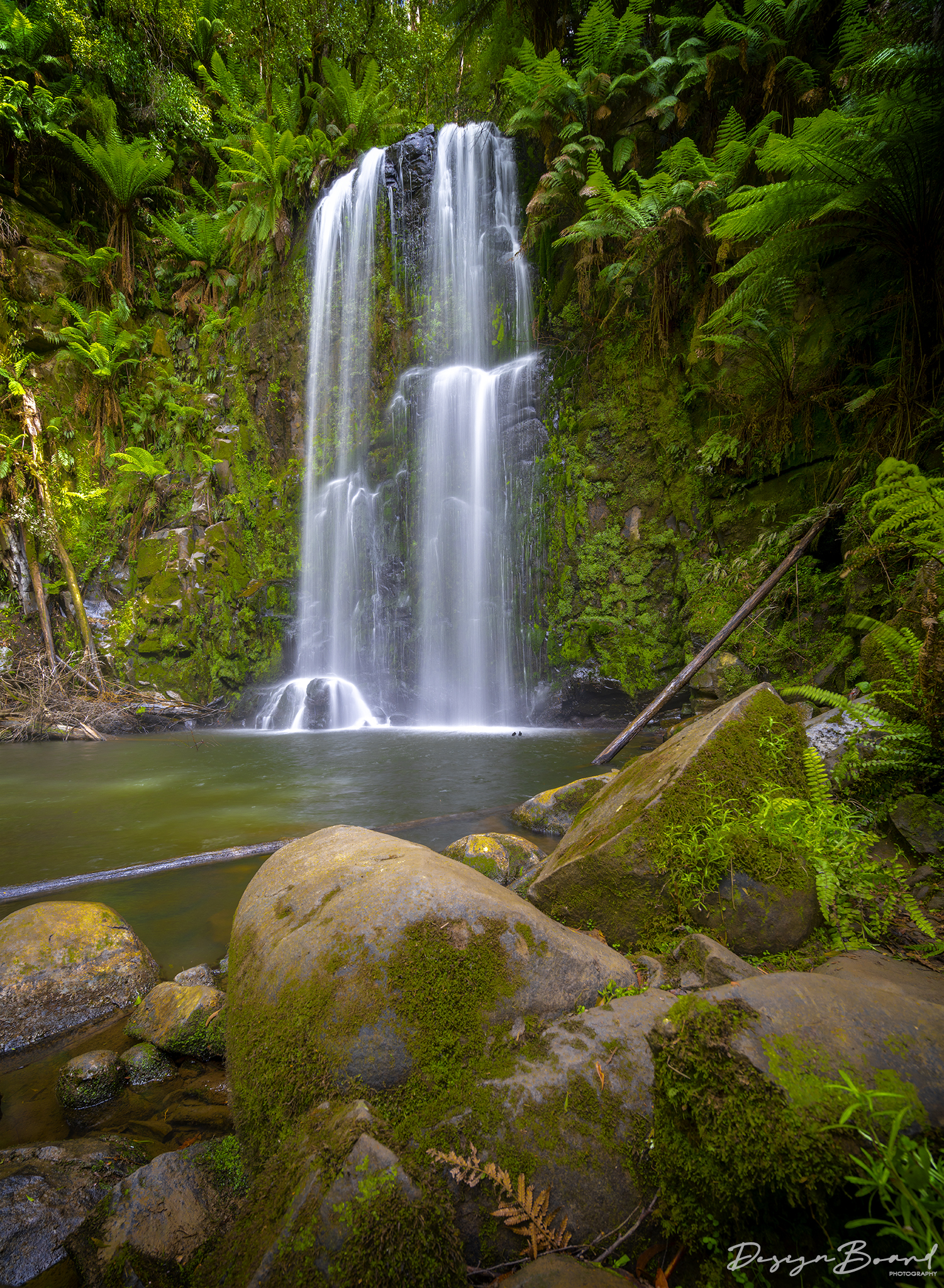
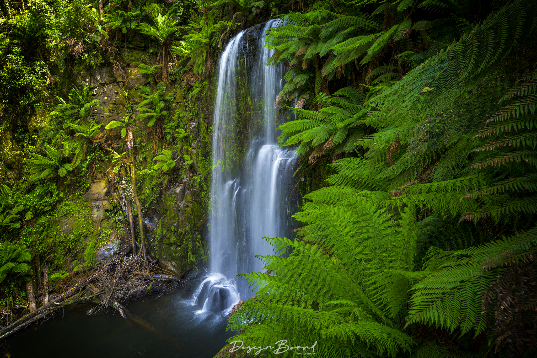
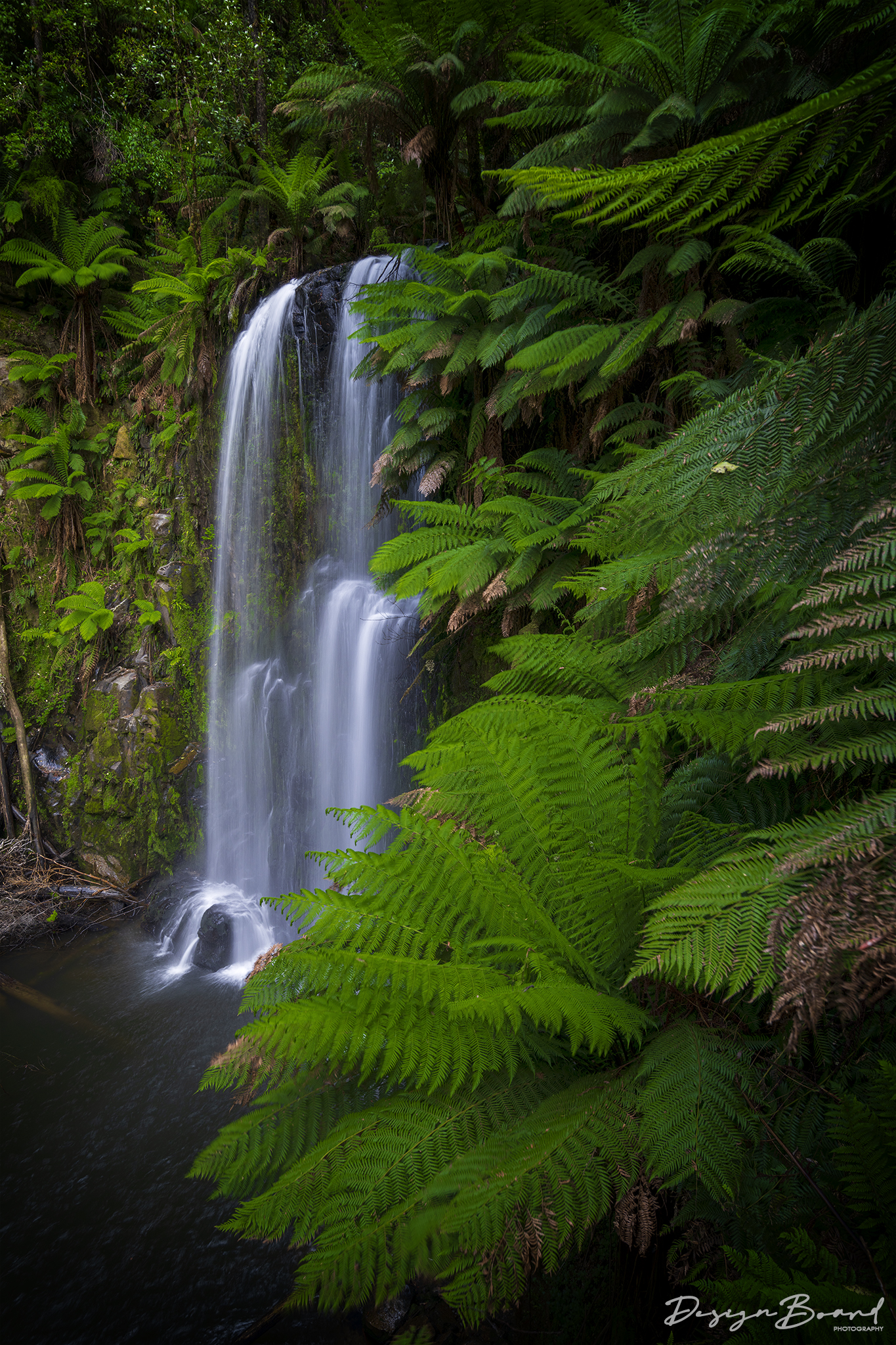
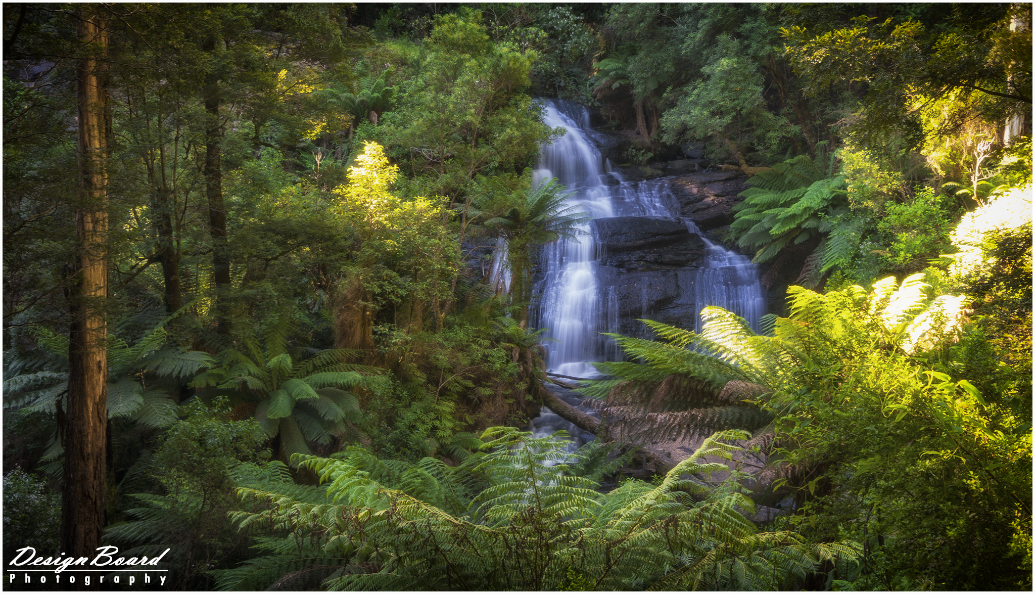
Another gem in within the Great Otway National Park, this is, arguably, one of the most beautiful waterfalls in the Great Otway National Park. The 3km (return) walk takes you through a beautiful forest filled with mountain ash and large myrtle beech trees as well as giant, thick ferns.
The walk to and from the falls is moderate-easy. The walk towards the falls is downhill and the return is uphill (duh!). The return journey is a bit steep and there are a number of steps on the way, which could get a bit slippery with rain.
To get to the falls, take the walking path from the Beauchamp Falls Campground located on the Beauchamp Falls Road. Once you turn off the Beech Forest-Mount Sabine Road, there’s about a 3km drive along an unsealed/gravel road, but nothing a normal sedan cannot handle.
Click here for Google Maps directions
Here’s some more details on the (return) walk to the falls.
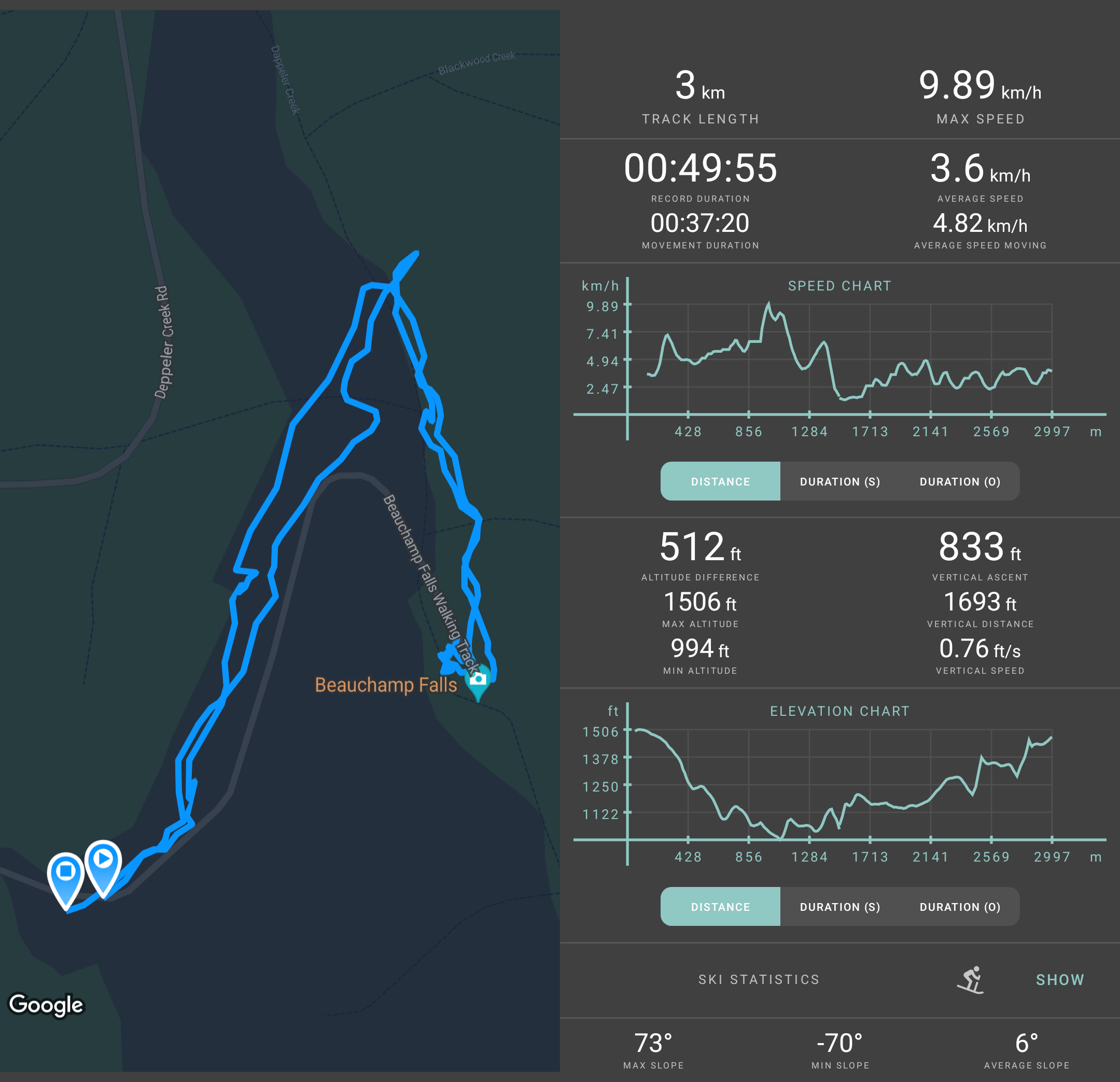
Walking details to Beauchap Falls by DesignBoard Photography
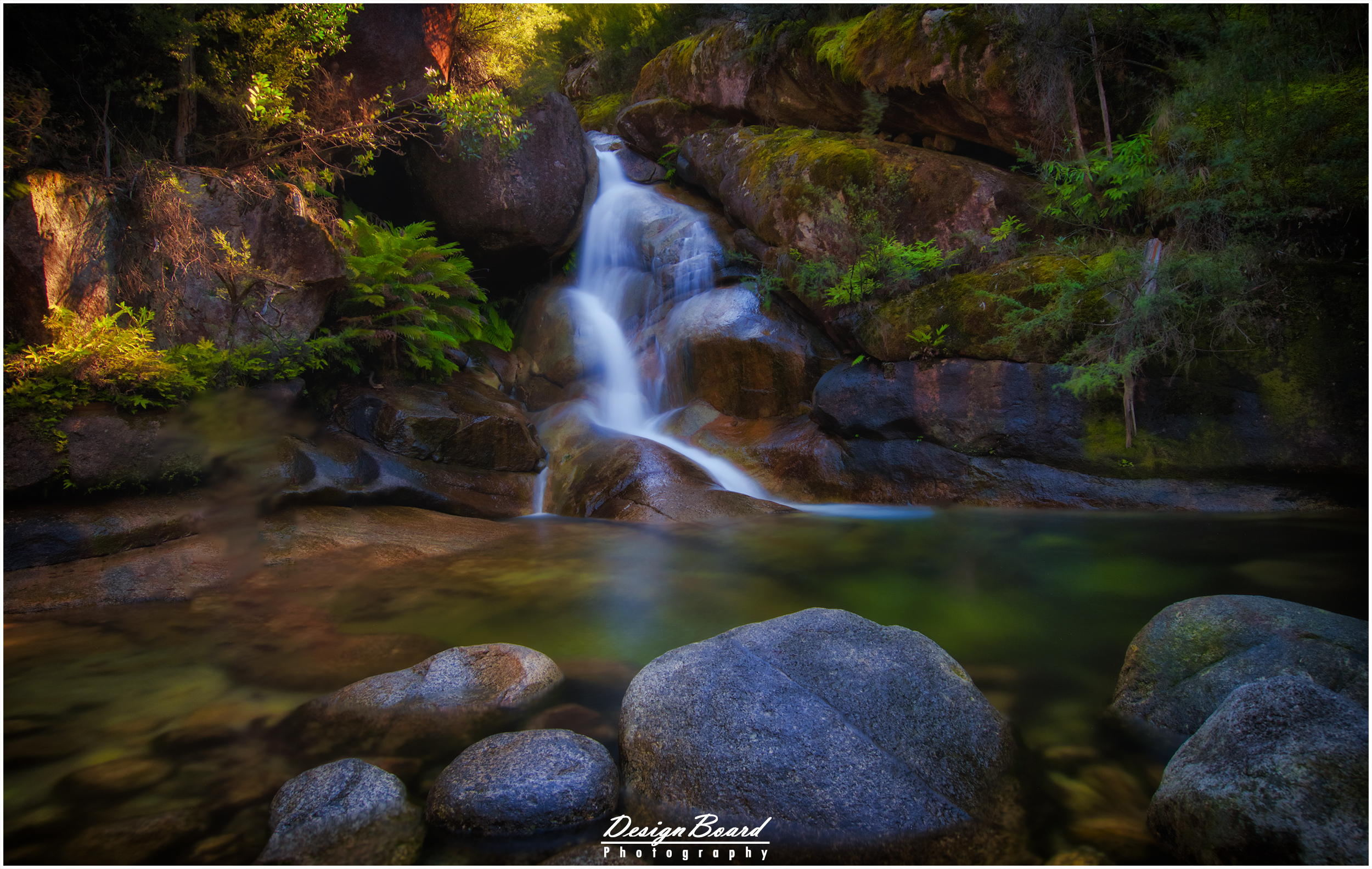
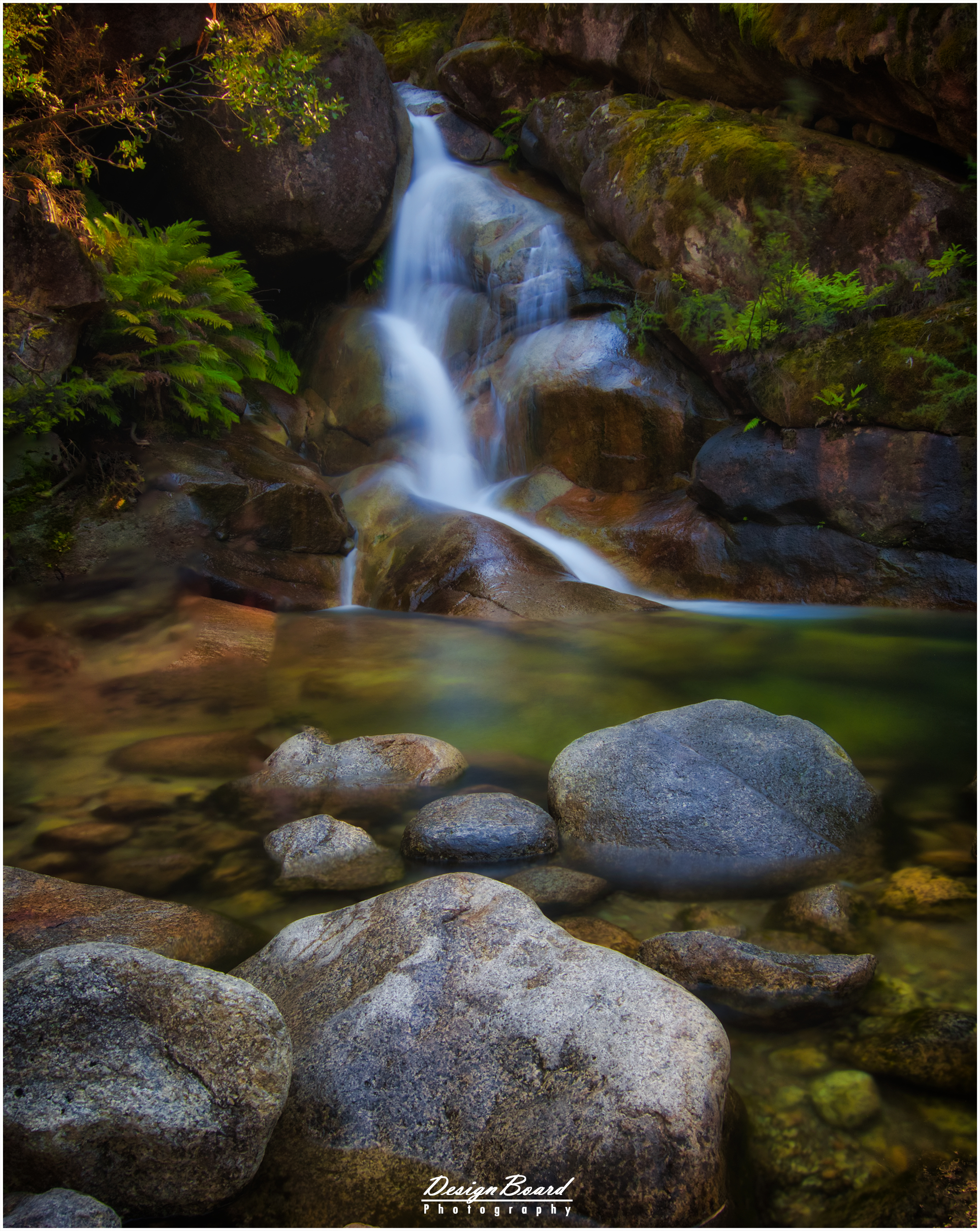
Apart from The Great Ocean Road, you can also check out Maits Rest Rainforest Walk and Erskine Falls.
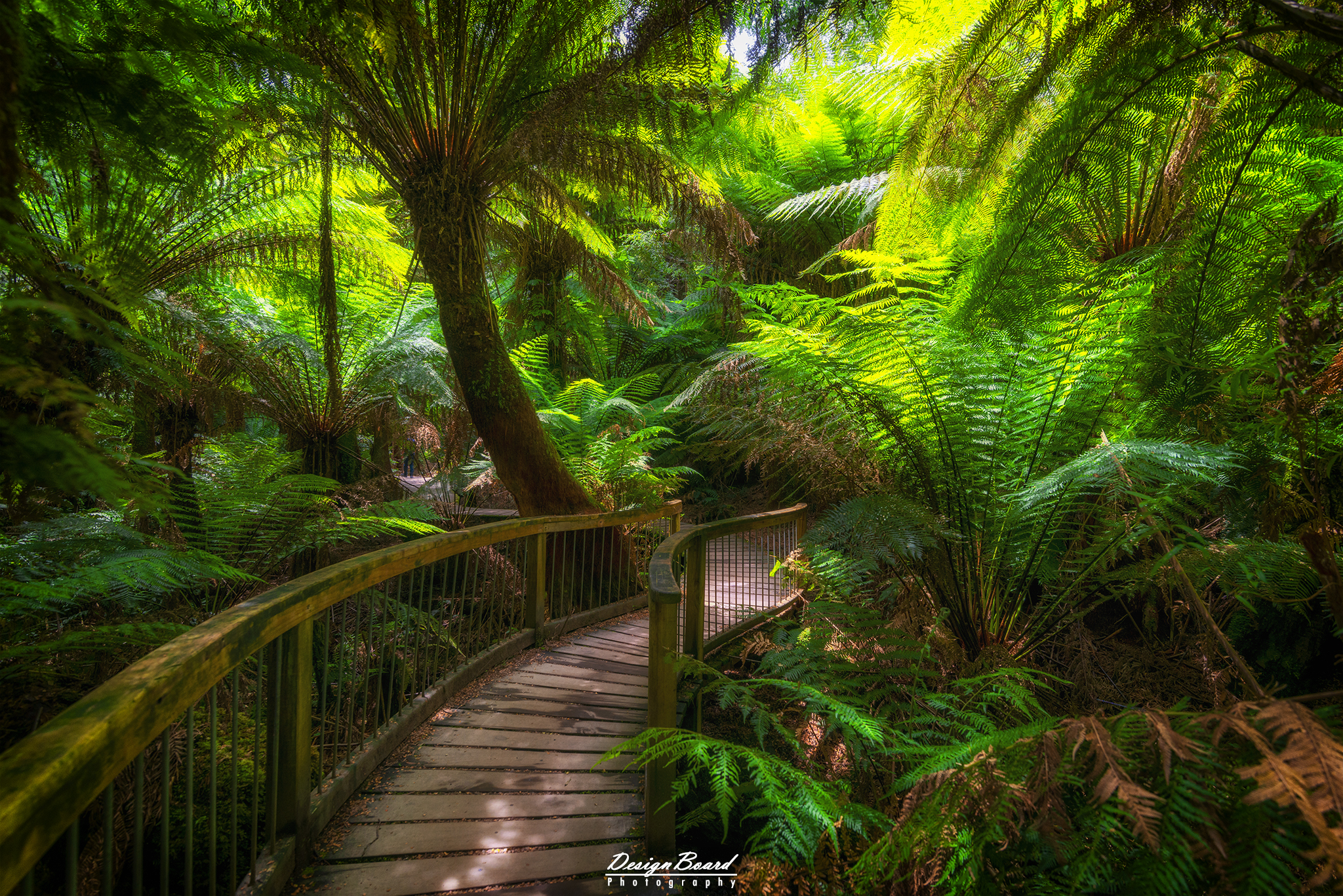
Maits Rest Rainforest Walk
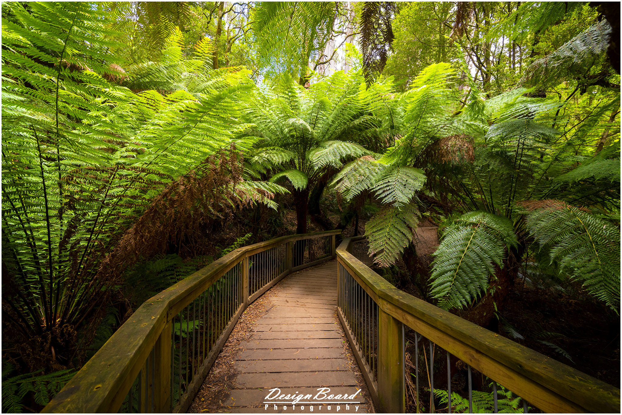
Maits Rest Rainforest Walk, Victoria, Australia – DesignBoard Photography